
|
The Nile
- Click the image above for a larger view
- Full-Res JPEG (1604 x 1745) (409.7 kB)
- Full-Res TIFF (1604 x 1745) (7.2 MB)
Caption:
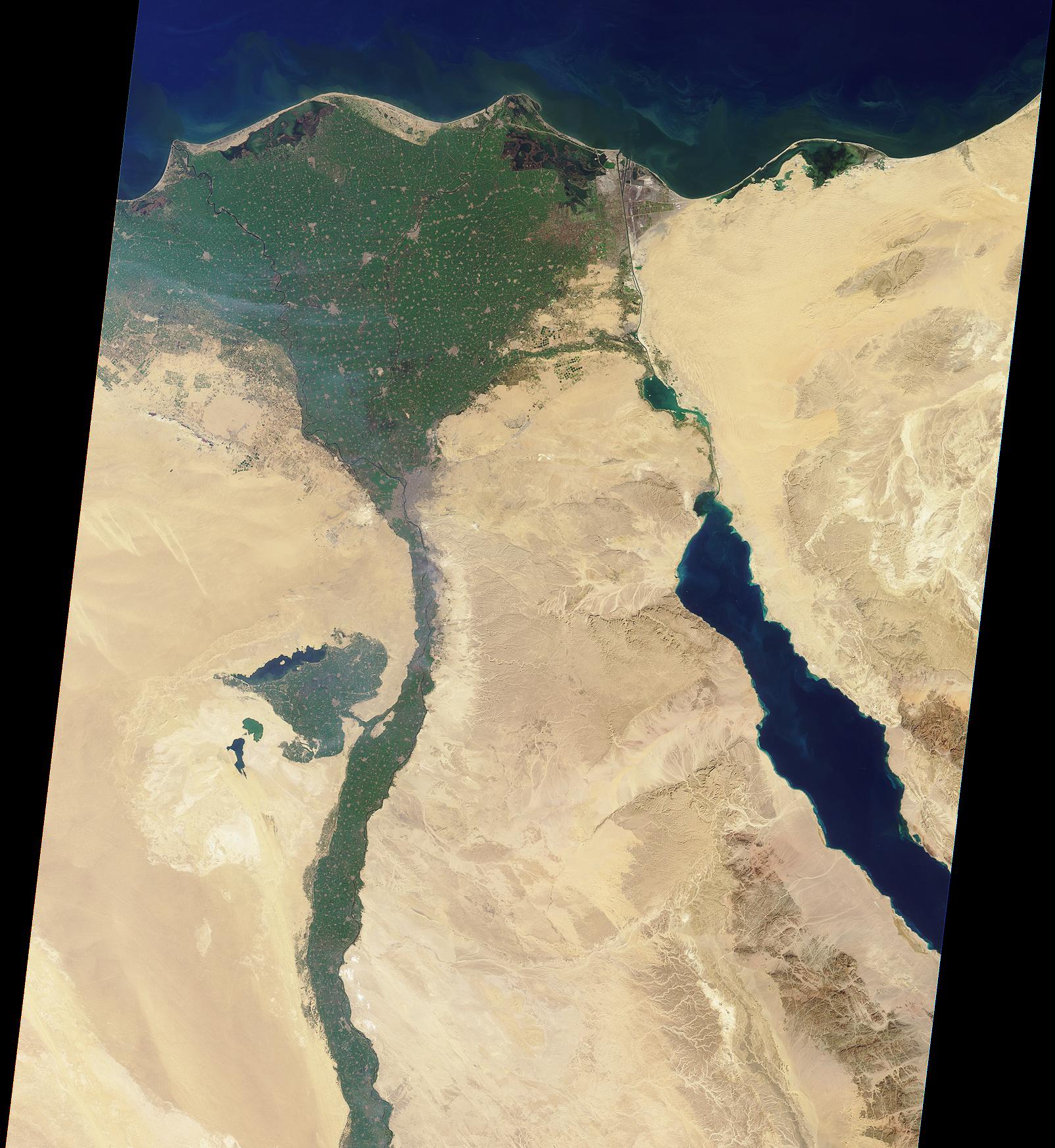
This image of the northern portion of the Nile River was captured by MISR's nadir camera on January 30, 2001 (Terra orbit 5956). The Nile is the longest river in the world, extending for about 6700 kilometers from its headwaters in the highlands of eastern Africa.
At the apex of the fertile Nile River Delta is the Egyptian capital city of Cairo. To the west are the Great Pyramids of Giza. North of here the Nile branches into two distributaries, the Rosetta to the west and the Damietta to the east.
Also visible in this image is the Suez Canal, a shipping waterway connecting Port Said on the Mediterranean Sea with the Gulf of Suez. The Gulf is an arm of the Red Sea, and is located on the righthand side of the picture.
Background Info:
MISR was built and is managed by NASA's Jet Propulsion Laboratory, Pasadena, CA, for NASA's Office of Earth Science, Washington, DC. The Terra satellite is managed by NASA's Goddard Space Flight Center, Greenbelt, MD. JPL is a division of the California Institute of Technology.
Cataloging Keywords:
| Name | Value | Additional Values |
|---|---|---|
| Target | Earth | 67P/Churyumov-Gerasimenko |
| System | Earth | |
| Target Type | Earth | Comet |
| Mission | Terra | Rosetta |
| Instrument Host | Terra | Rosetta |
| Host Type | Orbiter | |
| Instrument | Multi-Angle Imaging SpectroRadiometer (MISR) | |
| Detector | ||
| Extra Keywords | Color, Water | |
| Acquisition Date | ||
| Release Date | 2001-03-07 | |
| Date in Caption | 2001-01-30 | |
| Image Credit | NASA/GSFC/JPL, MISR Team | |
| Source | photojournal.jpl.nasa.gov/catalog/PIA02647 | |
| Identifier | PIA02647 | |