
|
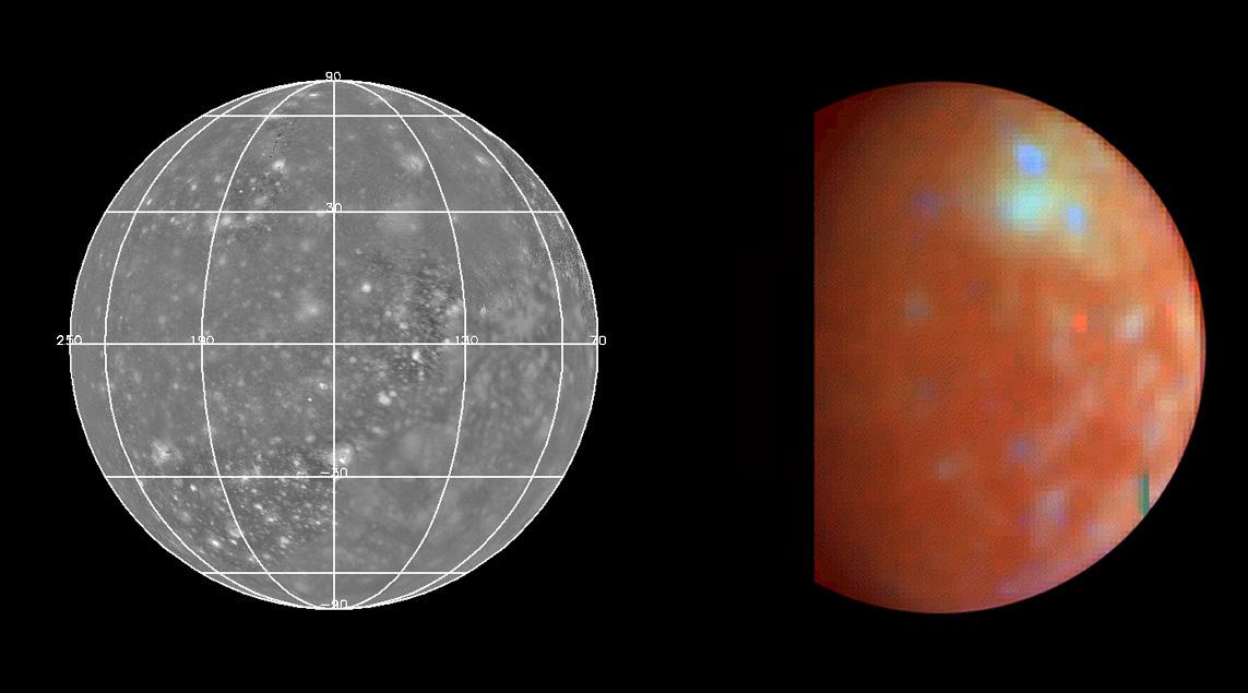
NIMS Callisto Global Mosaic
- Click the image above for a larger view
- Full-Res JPEG (1143 x 635) (63.8 kB)
- Full-Res TIFF (1143 x 635) (934.2 kB)
Caption:
The Near Infrared Mapping Spectrometer (NIMS) acquired this global mosaic (right) at a spatial resolution of 100 km during Galileo's third orbit on November 4, 1996, roughly 7.5 hours prior to Callisto closest approach.
The lighter bluish area in the upper latitudes is the Asgard multi-ring structure (the second largest surface feature on Callisto) with crater Burr to the north and Tornasuk to the east. The bluish color indicates regions with more exposed water ice while the reddish/rusty color indicates surface areas rich in non-ice minerals.
Spectra:
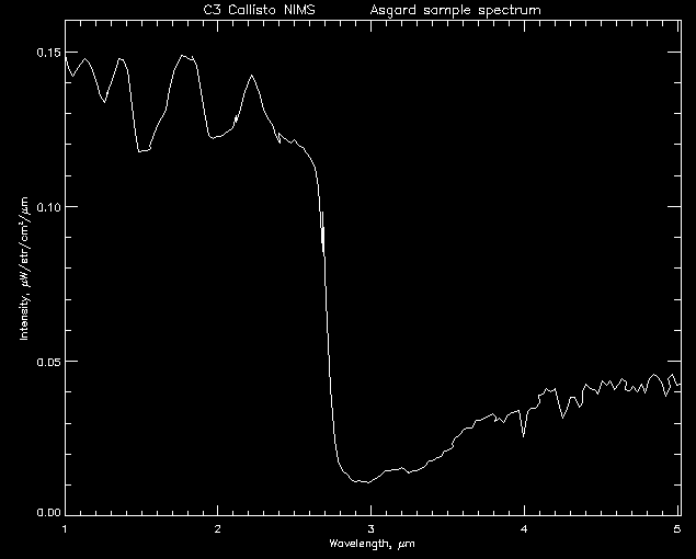
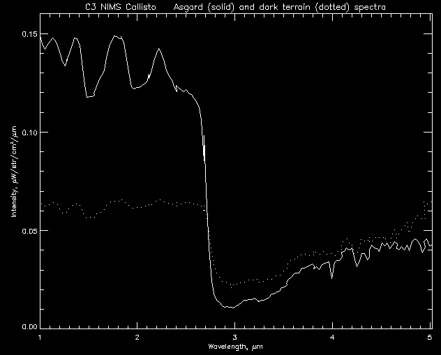
- Click on Asgard to view a sample spectrum of this region. This spectrum shows a higher abundance of ice between 1 and 2 microns.
- Click on the dark terrain to view sample spectra of Callisto's surface which shows more "rocky" material and less ice.
- Click here to compare the two spectra.
Background Info:
The Jet Propulsion Laboratory, Pasadena, CA manages the mission for NASA's Office of Space Science, Washington, DC.
This image and other images and data received from Galileo are posted on the World Wide Web, on the Galileo mission home page at URL http://www.jpl.nasa.gov/galileo/sepo .
Cataloging Keywords:
| Name | Value | Additional Values |
|---|---|---|
| Target | Ganymede | Callisto |
| System | Jupiter | |
| Target Type | Satellite | |
| Mission | Galileo | |
| Instrument Host | Galileo Orbiter | |
| Host Type | Orbiter | |
| Instrument | Near-Infrared Mapping Spectrometer (NIMS) | |
| Detector | ||
| Extra Keywords | Color, Crater, Infrared, Water | |
| Acquisition Date | ||
| Release Date | 1998-03-26 | |
| Date in Caption | 1996-11-04 | |
| Image Credit | NASA/JPL | |
| Source | photojournal.jpl.nasa.gov/catalog/PIA00844 | |
| Identifier | PIA00844 | |