skip to navigation
|
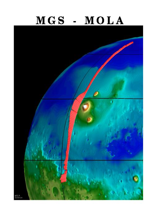
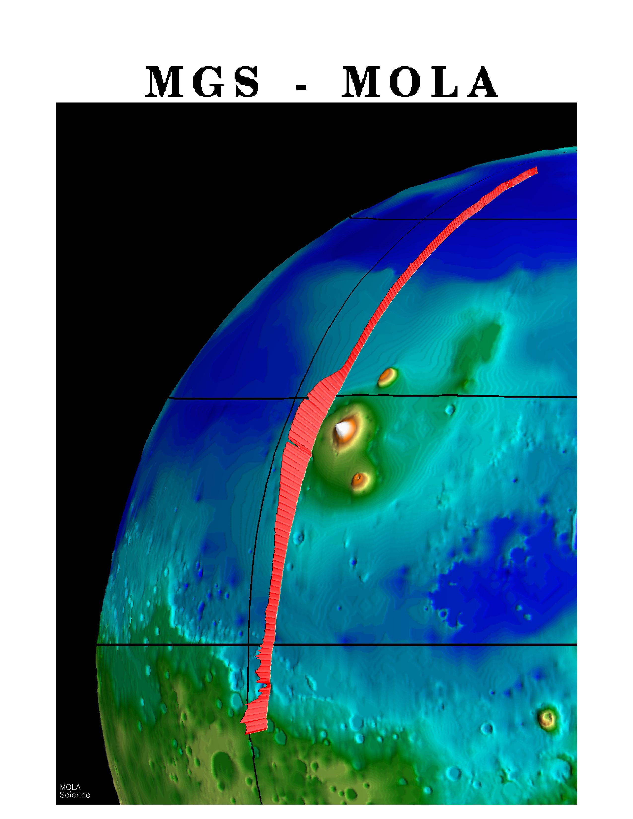
MGS Mars Orbiter Laser (MOLA) Surface Topography of Northern Hemisphere
- Click the image above for a larger view
- Full-Res JPEG (2550 x 3300) (439.4 kB)
- Full-Res TIFF (2550 x 3300) (8.5 MB)
Caption:
A "picket fence" rendition of surface topography in the northern hemisphere of Mars from the Mars Orbiter Laser Altimeter (MOLA). The profile was obtained during the Mars Global Surveyor Capture Orbit Calibration Pass on September 15, 1997. The profile runs from 73°N to 10°S latitude and passes through the topographically subdued northern plains, the western part of the Elysium volcanic province, which shows 3 miles (5 kilometers) of relief, and the chaotic "dichotomy" boundary between the northern plains and ancient southern highlands. The MOLA profile is approximately 3000 miles (5000 kilometers) long and has a resolution on the surface of 1000 feet (330 meters) and a vertical resolution of approximately 3 feet (1 meter).
Cataloging Keywords:
| Name | Value | Additional Values |
|---|---|---|
| Target | Mars | |
| System | ||
| Target Type | Planet | |
| Mission | Mars Global Surveyor (MGS) | |
| Instrument Host | Mars Global Surveyor | |
| Host Type | Orbiter | |
| Instrument | Mars Orbiter Laser Altimeter (MOLA) | |
| Detector | ||
| Extra Keywords | Color, Volcano | |
| Acquisition Date | ||
| Release Date | 1997-10-13 | |
| Date in Caption | 1997-09-15 | |
| Image Credit | NASA/JPL/GSFC | |
| Source | photojournal.jpl.nasa.gov/catalog/PIA00957 | |
| Identifier | PIA00957 | |