
|
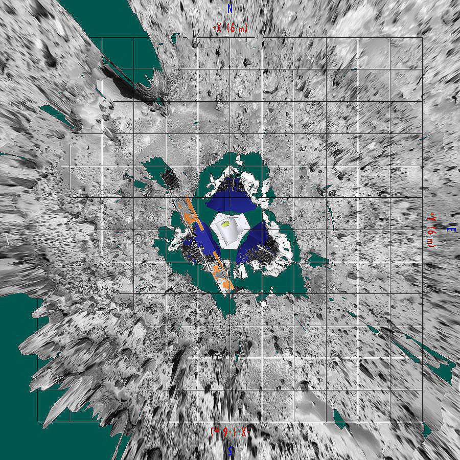
Overhead view of Pathfinder Landing Site
- Click the image above for a larger view
- Full-Res JPEG (900 x 900) (288.5 kB)
- Full-Res TIFF (900 x 900) (1.7 MB)
Caption:
This image, prepared by Pathfinder scientists at NASA/ Ames Research Center, is a view of the landing site from above. Seen in the lower right is Mermaid dune, with its long axis oriented northwest-southeast and its steeper side, the presumed slipface, toward the southwest. Dunes like Mermaid, the depositional tails and erosional moats associated with rocks in the area, and the fluted and polished surfaces on several boulders at the landing site all indicate an effective wind that blows from the northeast to the southwest.
Background Info:
Mars Pathfinder is the second in NASA's Discovery program of low-cost spacecraft with highly focused science goals. The Jet Propulsion Laboratory, Pasadena, CA, developed and manages the Mars Pathfinder mission for NASA's Office of Space Science, Washington, D.C. JPL is a division of the California Institute of Technology (Caltech).
Photojournal note: Sojourner spent 83 days of a planned seven-day mission exploring the Martian terrain, acquiring images, and taking chemical, atmospheric and other measurements. The final data transmission received from Pathfinder was at 10:23 UTC on September 27, 1997. Although mission managers tried to restore full communications during the following five months, the successful mission was terminated on March 10, 1998.
Cataloging Keywords:
| Name | Value | Additional Values |
|---|---|---|
| Target | Mars | |
| System | ||
| Target Type | Planet | |
| Mission | Mars Pathfinder (MPF) | |
| Instrument Host | Mars Pathfinder Lander | |
| Host Type | Lander | |
| Instrument | Imager for Mars Pathfinder (IMP) | |
| Detector | ||
| Extra Keywords | Atmosphere, Color, Dune | |
| Acquisition Date | ||
| Release Date | 1997-10-14 | |
| Date in Caption | ||
| Image Credit | NASA/JPL/Ames Research Center | |
| Source | photojournal.jpl.nasa.gov/catalog/PIA00973 | |
| Identifier | PIA00973 | |