Regional Topographic Views of Mars from MOLA
Caption:
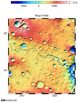
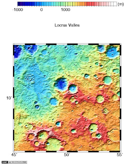
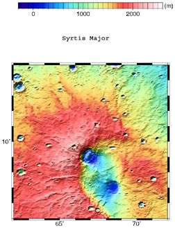
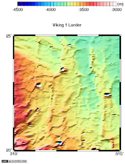
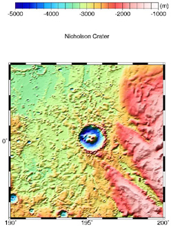
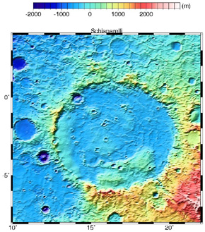
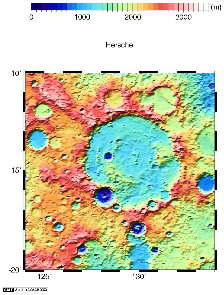
With one year of global mapping of the Mars Global Surveyor mission completed, the MOLA dataset has achieved excellent spatial and vertical resolution. The maps below (and above) have been produced from the altimetric observations collected during MOLA's first year of global mapping and provide a variety of regional topographic views of the Martian surface. The maps were compiled from a data base of 266.7 million laser altimetric measurements collected between March 1, 1999 and February 29, 2000. In each map the spatial resolution is approximately 1/16° by 1/32° (where 1° on Mars is about 59 km) and the vertical accuracy is approximately 1 meter. Note that the sizes of the regions vary.
Click on image for to see full resolution (Warning! these are large files)
Cataloging Keywords:
| Name |
Value |
Additional Values |
| Target |
Mars |
|
| System |
|
|
| Target Type |
Planet |
|
| Mission |
Mars Global Surveyor (MGS) |
Viking |
| Instrument Host |
Mars Global Surveyor |
|
| Host Type |
Orbiter |
|
| Instrument |
Mars Orbiter Laser Altimeter (MOLA) |
|
| Detector |
|
|
| Extra Keywords |
Color, Crater, Map |
| Acquisition Date |
|
| Release Date |
2000-09-08 |
| Date in Caption |
1999-03-01 |
2000-02-29 |
| Image Credit |
NASA/JPL/GSFC |
| Source |
photojournal.jpl.nasa.gov/catalog/PIA01049 |
| Identifier |
PIA01049 |
