|
Complex Geologic History of Triton
- Click the image above for a larger view
- Full-Res JPEG (1885 x 1903) (462.5 kB)
- Full-Res TIFF (1885 x 1903) (3.6 MB)
Caption:
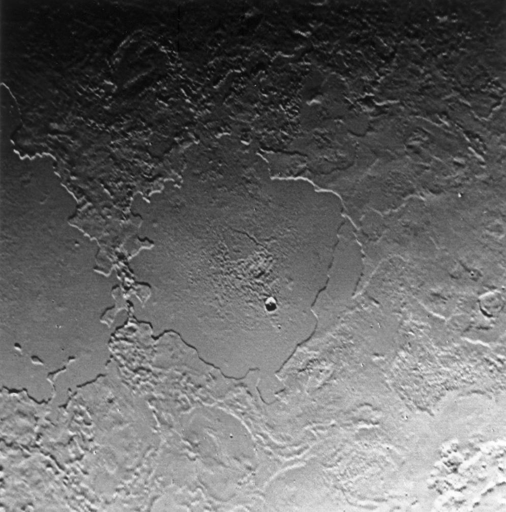
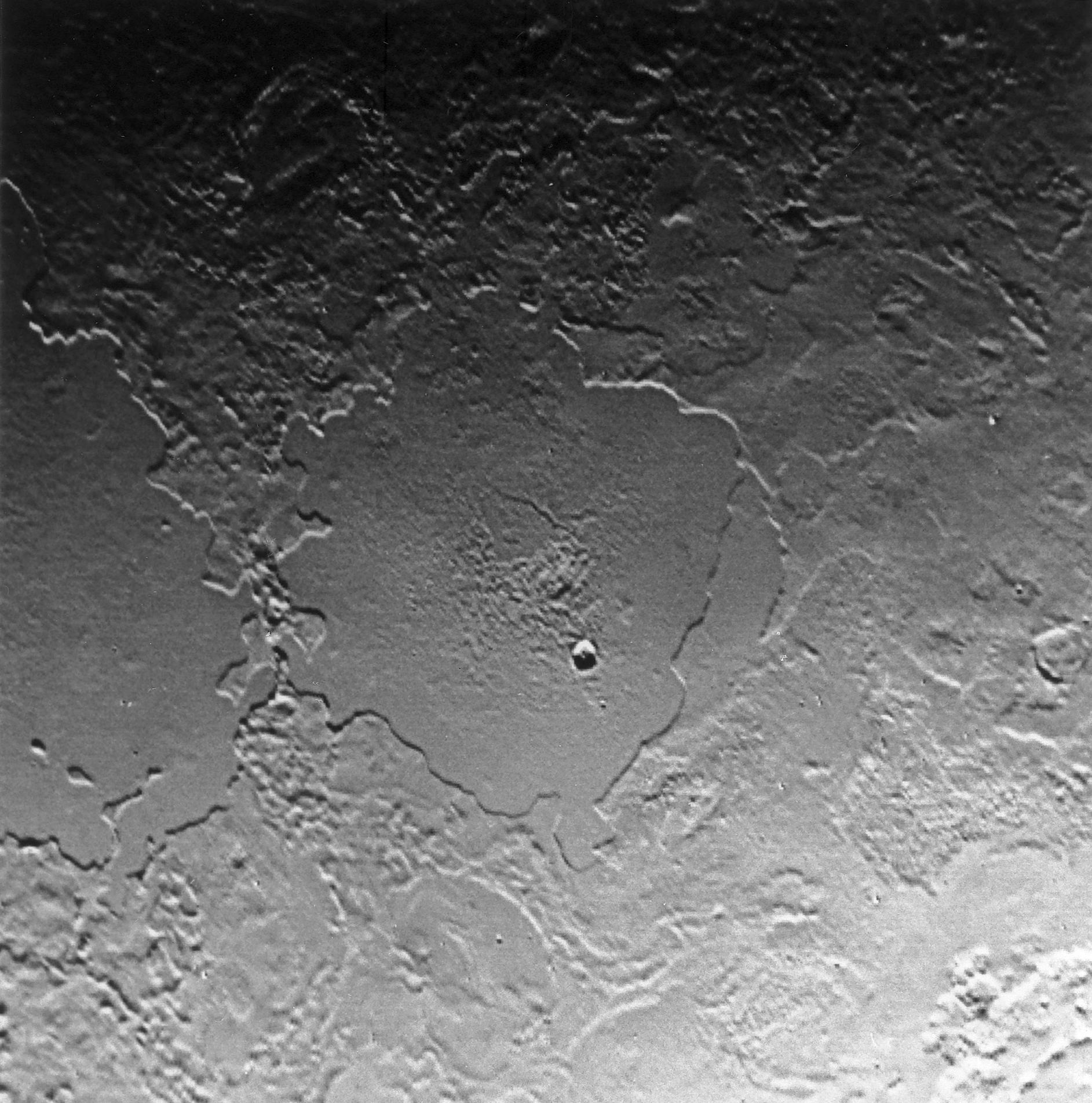
Part of the complex geologic history of icy Triton, Neptune's largest satellite, is shown in this Voyager 2 photo, which has a resolution of 900 meters (2,700 feet) per picture element. The photo was received as part of a Triton-mapping sequence between 3:30 and 5:30 a.m. (PDT). This view is about 500 kilometers (300 miles) across. It encompasses two depressions, possibly old impact basins, that have been extensively modified by flooding, melting, faulting, and collapse. Several episodes of filling and partial removal of material appear to have occurred. The rough area in the middle of the bottom depression probably marks the most recent eruption of material. Only a few impact craters dot the area, which shows the dominance of internally driven geologic processes on Triton.
Background Info:
JPL manages the Voyager project for NASA's Office of Space Science.
Cataloging Keywords:
| Name | Value | Additional Values |
|---|---|---|
| Target | Triton | |
| System | Neptune | |
| Target Type | Satellite | |
| Mission | Voyager | |
| Instrument Host | Voyager 2 | |
| Host Type | Flyby Spacecraft | |
| Instrument | ||
| Detector | ||
| Extra Keywords | Crater, Grayscale, Impact | |
| Acquisition Date | ||
| Release Date | 1999-05-08 | |
| Date in Caption | ||
| Image Credit | NASA/JPL | |
| Source | photojournal.jpl.nasa.gov/catalog/PIA01538 | |
| Identifier | PIA01538 | |