
|
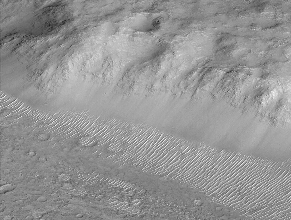
Layers of Cratered Highland Bedrock Exposed in Amenthes Slope
- Click the image above for a larger view
- Full-Res JPEG (1024 x 772) (129.8 kB)
- Full-Res TIFF (1024 x 772) (679.6 kB)
Caption:
One of the highlights of the Mars Global Surveyor Mars Orbiter Camera project thus far has been the realization that much of the upper crust--i.e., the bedrock--is layered. This dramatic view of a slope in the Amenthes Rupes region near the martian equator shows layered bedrock, smooth-surfaced debris at the slope base, and many small ripple-like dunes. The picture was taken during the second week of April 1999 and covers an area 3 kilometers (1.9 miles) wide. Illumination is from the lower right.
Background Info:
Malin Space Science Systems and the California Institute of Technology built the MOC using spare hardware from the Mars Observer mission. MSSS operates the camera from its facilities in San Diego, CA. The Jet Propulsion Laboratory's Mars Surveyor Operations Project operates the Mars Global Surveyor spacecraft with its industrial partner, Lockheed Martin Astronautics, from facilities in Pasadena, CA and Denver, CO.
Cataloging Keywords:
| Name | Value | Additional Values |
|---|---|---|
| Target | Mars | |
| System | ||
| Target Type | Planet | |
| Mission | Mars Global Surveyor (MGS) | |
| Instrument Host | Mars Global Surveyor | |
| Host Type | Orbiter | |
| Instrument | Mars Orbiter Camera (MOC) | |
| Detector | ||
| Extra Keywords | Crater, Dune, Dust, Grayscale | |
| Acquisition Date | ||
| Release Date | 2000-06-14 | |
| Date in Caption | ||
| Image Credit | NASA/JPL/MSSS | |
| Source | photojournal.jpl.nasa.gov/catalog/PIA02002 | |
| Identifier | PIA02002 | |