skip to navigation
|
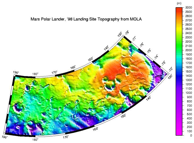
MPL LANDING SITE - DEM
- Click the image above for a larger view
- Full-Res JPEG (910 x 670) (111.2 kB)
- Full-Res TIFF (910 x 670) (172.2 kB)
Caption:
High resolution digital elevation model of the MPL landing site corridor based on observations through MGS Orbit Trim Maneuver-2 on June 10, 1999.
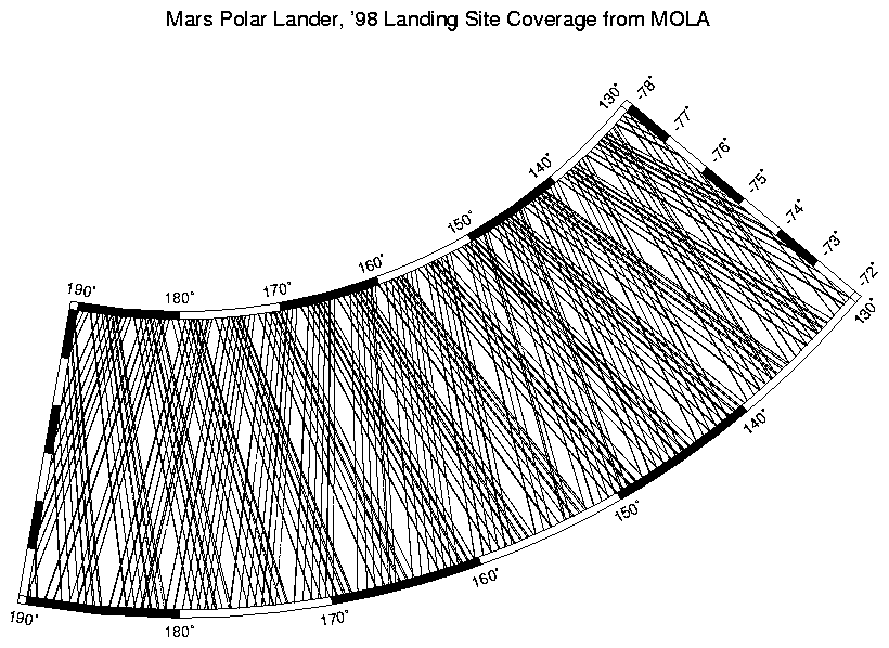
See also MOLA profile coverage (P50482) in the MPL landing site corridor. This plot shows the distribution of data that was used to make the above high-resolution digital elevation model.
Cataloging Keywords:
| Name | Value | Additional Values |
|---|---|---|
| Target | Mars | |
| System | ||
| Target Type | Planet | |
| Mission | Mars Global Surveyor (MGS) | |
| Instrument Host | Mars Global Surveyor | |
| Host Type | Orbiter | |
| Instrument | Mars Orbiter Laser Altimeter (MOLA) | |
| Detector | ||
| Extra Keywords | Color | |
| Acquisition Date | ||
| Release Date | 1999-07-06 | |
| Date in Caption | 1999-06-10 | |
| Image Credit | NASA/JPL/GSFC | |
| Source | photojournal.jpl.nasa.gov/catalog/PIA02089 | |
| Identifier | PIA02089 | |