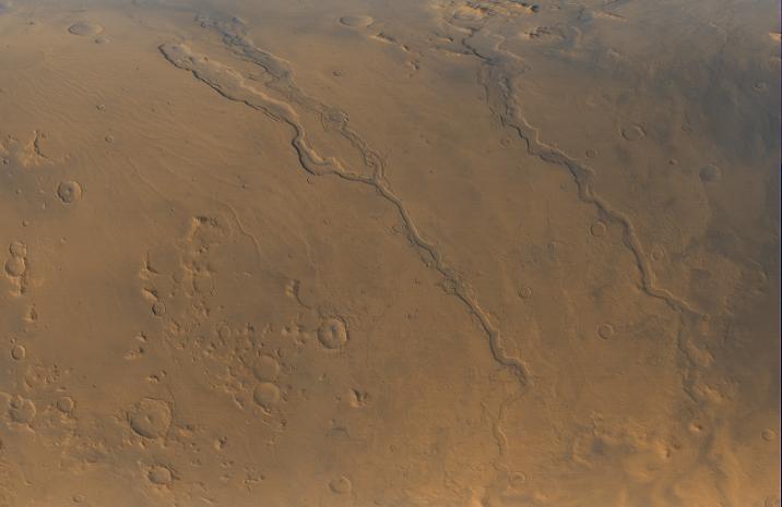
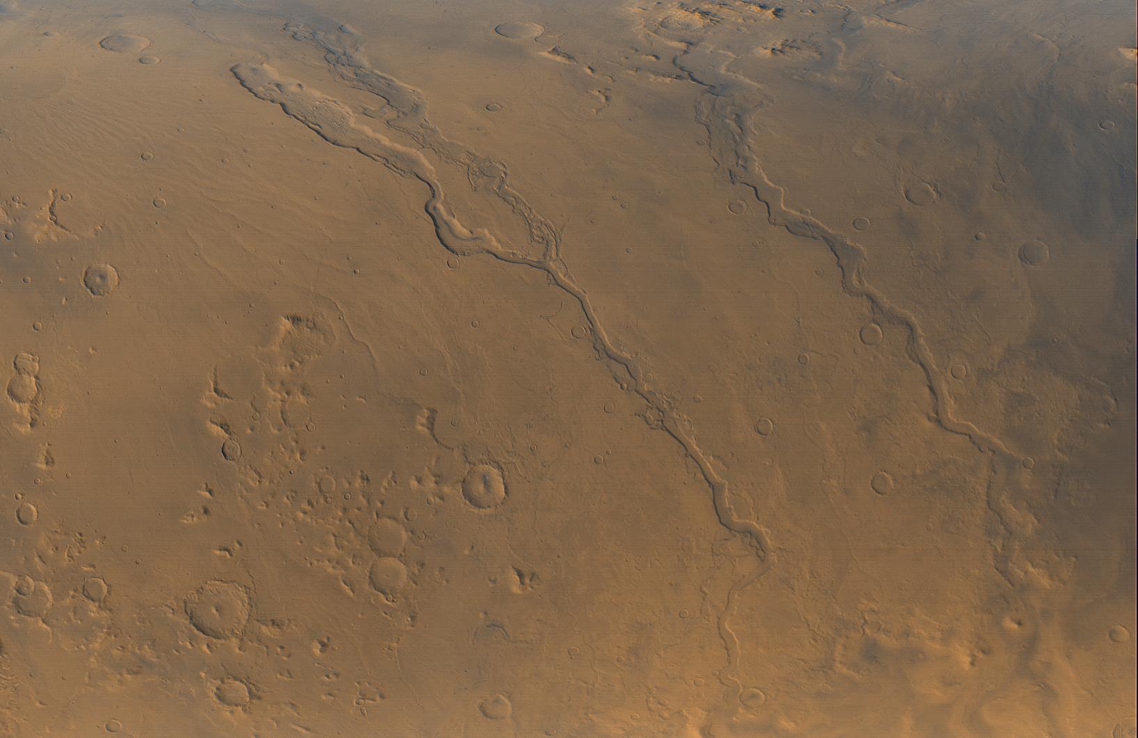
Looking Out Across Dao, Niger, and Harmakhis Valles
Caption:
The Mars Global Surveyor (MGS) Mars Orbiter Camera (MOC) opened its fourth year orbiting the red planet with this mid-autumn view of three major valley systems east of the Hellas plains. From left to right, the first major valley, Dao Vallis, runs diagonally from the upper left to just past the lower center of the image. Niger Vallis joins Dao Vallis just above the center of the frame. Harmakhis Vallis extends diagonally across the right half of the picture, toward the lower right. These valleys are believed by some to have been formed--at least in part--by large outbursts of liquid water some time far back in the martian past, though there is no way to know exactly how many hundreds of millions or billions of years ago this might have occurred. In each valley, water would have flowed toward the bottom of the image. Although their dimensions vary along their courses, the valleys are all roughly 1 km (0.6 miles) deep and range in width from about 40 km (25 miles) down to about 8 km (5 mi). Located around 40°S, 270°W, the picture covers an area approximately 800 km across and is illuminated by sunlight from the lower left. North is toward the left; the picture is a composite of red and blue wide angle images obtained by MOC on September 13, 2000.
Cataloging Keywords:
| Name |
Value |
Additional Values |
| Target |
Mars |
|
| System |
|
|
| Target Type |
Planet |
|
| Mission |
Mars Global Surveyor (MGS) |
|
| Instrument Host |
Mars Global Surveyor |
|
| Host Type |
Orbiter |
|
| Instrument |
Mars Orbiter Camera (MOC) |
|
| Detector |
|
|
| Extra Keywords |
Color, Water |
| Acquisition Date |
|
| Release Date |
2000-10-06 |
| Date in Caption |
2000-09-13 |
|
| Image Credit |
NASA/JPL/MSSS |
| Source |
photojournal.jpl.nasa.gov/catalog/PIA02810 |
| Identifier |
PIA02810 |