|
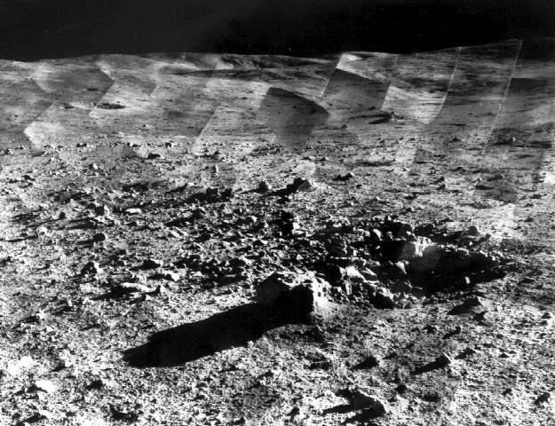
Photomosaic of Tycho Crater - Surveyor 7
- Click the image above for a larger view
- Full-Res JPEG (625 x 480) (99.6 kB)
- Full-Res TIFF (625 x 480) (234.2 kB)
Caption:
Photomosaic of lunar panorama near the Tycho crater taken by Surveyor 7. The hills on the center horizon are about eight miles away from the spacecraft.
Since the landing site survey for the Apollo missions had been successfully completed by the previous Surveyors, the landing site for Surveyor 7 was selected more for its scientific interest. Surveyor 7, in addition to taking thousands of images and gathering a wide variety of surface data, performed star surveys, took pictures of Earth, and tested laser-pointing techniques by detecting laser beams from Earth.
The primary objectives of the Surveyor program having already been met by the previous missions, Surveyor 7 was sent to perform a soft landing in a type of terrain different from the previous Surveyors. Other objectives were to obtain images of the landing site, manipulate the soil and analyze its composition, and obtain temperature and radar reflectivity data.
Surveyor 7 was launched on January 7, 1968 and landed on January 10, 1968.
Cataloging Keywords:
| Name | Value | Additional Values |
|---|---|---|
| Target | Moon | |
| System | Earth | |
| Target Type | Satellite | |
| Mission | Surveyor | |
| Instrument Host | Surveyor 7 | |
| Host Type | Lander | |
| Instrument | ||
| Detector | ||
| Extra Keywords | Crater, Grayscale, Radar | |
| Acquisition Date | ||
| Release Date | 2000-11-04 | |
| Date in Caption | 1968-01-07 | 1968-01-10 |
| Image Credit | NASA/JPL | |
| Source | photojournal.jpl.nasa.gov/catalog/PIA02977 | |
| Identifier | PIA02977 | |