|
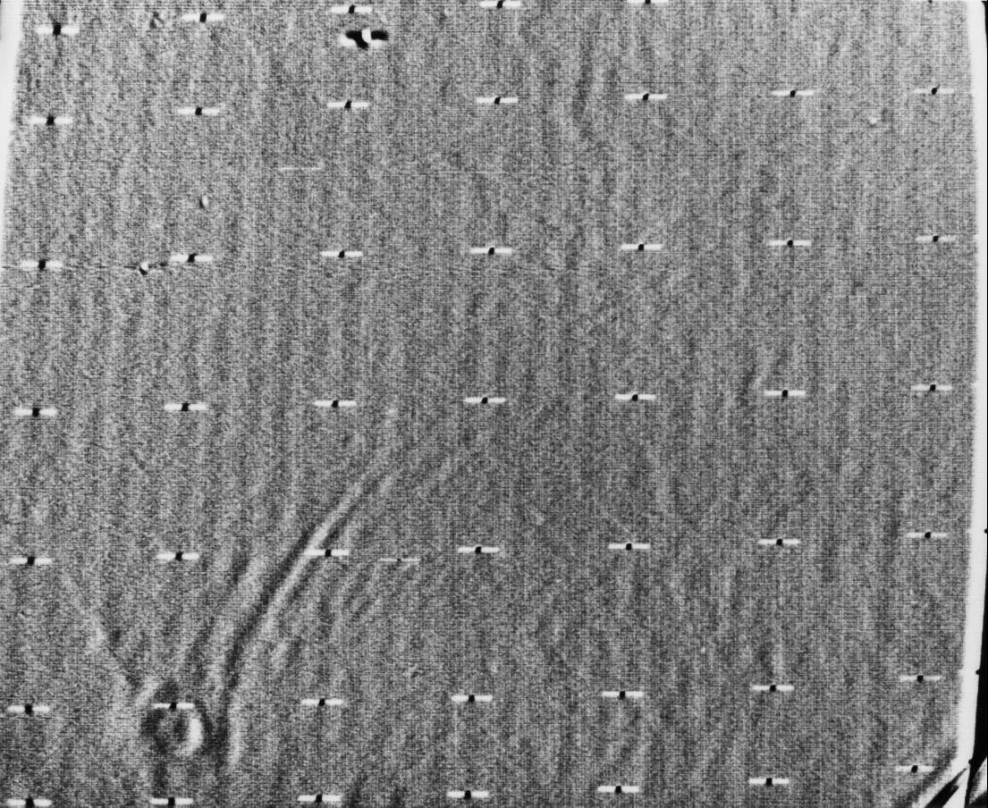
Mariner 9 View of Arsia Silva
- Click the image above for a larger view
- Full-Res JPEG (5925 x 4847) (4.4 MB)
- Full-Res TIFF (5925 x 4847) (29.4 MB)
Caption:
Mariner 9 took this picture of Mars during the closing hours of its approach to the planet on November 13, 1971. The picture has been computer-enhanced with electronic high-pass filtering. The crater-like object at the lower left is about 124 miles (200 kilometers) across and is the same dark spot seen earlier in more distant views. It can be identified on a Mars map as Arsia Silva. The streaks pointing north--more than 1000 kilometers long--are either atmospheric turbulence patterns or dunes formed downwind of the crater. If they are dunes, they are as extensive as the largest in the Sahara in North Africa and those in Peru, South America. The picture was taken from a distance of 65,000 miles about eight hours before Mariner 9 went into orbit around Mars. It was transmitted back to Earth at 10:00 p.m. during the first orbit.
Mariner 9 was the first spacecraft to orbit another planet. The spacecraft was designed to continue the atmospheric studies begun by Mariners 6 and 7, and to map over 70% of the Martian surface from the lowest altitude (1500 kilometers [900 miles]) and at the highest resolutions (1 kilometer per pixel to 100 meters per pixel) of any previous Mars mission.
Background Info:
Mariner 9 was launched on May 30, 1971 and arrived on November 14, 1971.
Cataloging Keywords:
| Name | Value | Additional Values |
|---|---|---|
| Target | Mars | |
| System | ||
| Target Type | Planet | |
| Mission | Mariner | |
| Instrument Host | Mariner 9 | |
| Host Type | Flyby Spacecraft | |
| Instrument | ||
| Detector | ||
| Extra Keywords | Atmosphere, Crater, Dune, Grayscale, Map, Storm | |
| Acquisition Date | ||
| Release Date | 2000-11-22 | |
| Date in Caption | 1971-11-13 | |
| Image Credit | NASA/JPL | |
| Source | photojournal.jpl.nasa.gov/catalog/PIA02997 | |
| Identifier | PIA02997 | |