skip to navigation
|
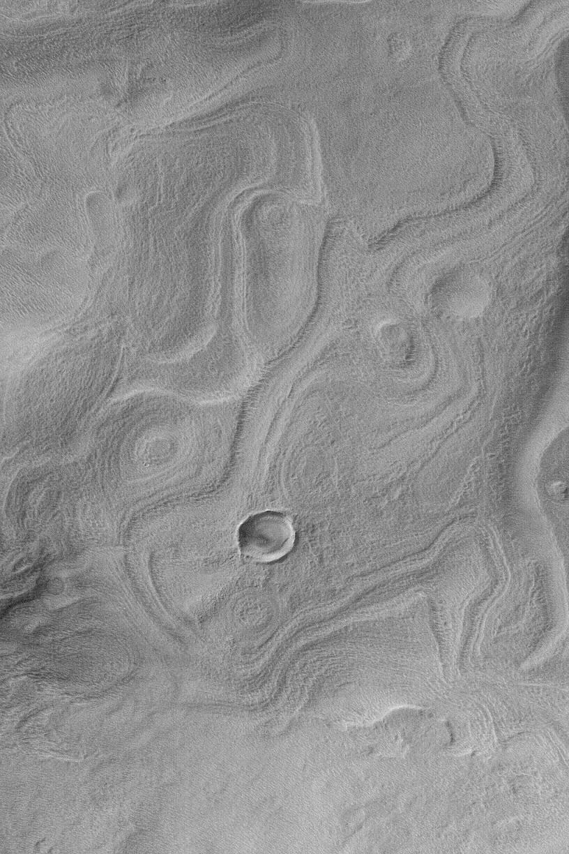
Banded Terrain in East Hellas
- Click the image above for a larger view
- Full-Res JPEG (1020 x 1530) (436.7 kB)
- Full-Res TIFF (1020 x 1530) (1.6 MB)
Caption:
MGS MOC Release No. MOC2-460, 22 August 2003
This Mars Global Surveyor (MGS) Mars Orbiter Camera (MOC) narrow angle camera image shows banded terrain in easternmost Hellas Planitia, between the distal ends of Dao and Harmakhis valleys. These bands probably indicate the location of eroded, layered bedrock that has been covered by a mantling deposit that, itself, became eroded to form the very small pits and bumps that pervade the region. This picture is located near 41.1°S, 275.0°W. Sunlight illuminates the scene from the left/upper left.
Cataloging Keywords:
| Name | Value | Additional Values |
|---|---|---|
| Target | Mars | |
| System | ||
| Target Type | Planet | |
| Mission | Mars Global Surveyor (MGS) | |
| Instrument Host | Mars Global Surveyor | |
| Host Type | Orbiter | |
| Instrument | Mars Orbiter Camera (MOC) | |
| Detector | ||
| Extra Keywords | Grayscale | |
| Acquisition Date | ||
| Release Date | 2003-08-27 | |
| Date in Caption | 2003-08-22 | |
| Image Credit | NASA/JPL/Malin Space Science Systems | |
| Source | photojournal.jpl.nasa.gov/catalog/PIA04694 | |
| Identifier | PIA04694 | |