skip to navigation
|
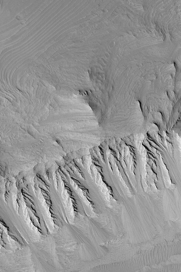
Layers in East Candor
- Click the image above for a larger view
- Full-Res JPEG (628 x 942) (92.0 kB)
- Full-Res TIFF (628 x 942) (559.7 kB)
Caption:
MGS MOC Release No. MOC2-475, 6 September 2003
Eroded, layered sedimentary rock exposures are common in the chasms of the Valles Marineris system. This Mars Global Surveyor (MGS) Mars Orbiter Camera (MOC) image shows some of the layers in eastern Candor Chasma. Faulting has created the steep slope that runs left to right across the lower half of the image. About two-thirds of the way down this slope occurs a distinct change from a spur-and-gully slope morphology to a flatter topography overlain by piles of talus that have come down the slopes. This abrupt change might indicate the location of a fault. The picture is located near 7.2°S, 69.0°W and covers an area 3 km (1.9 mi) across. The scene is illuminated by sunlight from the left.
Cataloging Keywords:
| Name | Value | Additional Values |
|---|---|---|
| Target | Mars | |
| System | ||
| Target Type | Planet | |
| Mission | Mars Global Surveyor (MGS) | Mariner |
| Instrument Host | Mars Global Surveyor | |
| Host Type | Orbiter | Flyby Spacecraft |
| Instrument | Mars Orbiter Camera (MOC) | |
| Detector | ||
| Extra Keywords | Grayscale | |
| Acquisition Date | ||
| Release Date | 2003-09-08 | |
| Date in Caption | 2003-09-06 | |
| Image Credit | NASA/JPL/Malin Space Science Systems | |
| Source | photojournal.jpl.nasa.gov/catalog/PIA04732 | |
| Identifier | PIA04732 | |