skip to navigation

|
‘You Are Here’
- Click the image above for a larger view
- Full-Res JPEG (1200 x 900) (44.9 kB)
- Full-Res TIFF (1200 x 900) (671.3 kB)
Caption:
 Click on image for larger view
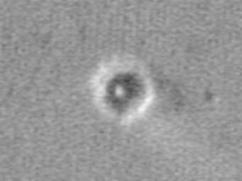
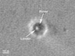
This map shows the Mars Exploration Rover Opportunity and its lander on the surface of Mars. The robotic geologist landed inside a small crater at Meridiani Planum on Jan. 24, 2004, PST. The white spot is the lander, and the small black spot northeast of it is believed to be the rover (see inset). The image was taken by the camera onboard the Mars Global Surveyor orbiter.
Cataloging Keywords:
| Name | Value | Additional Values |
|---|---|---|
| Target | Mars | |
| System | ||
| Target Type | Planet | |
| Mission | Mars Global Surveyor (MGS) | Mars Exploration Rover (MER) |
| Instrument Host | Mars Global Surveyor | Opportunity (MER-B) |
| Host Type | Orbiter | Rover |
| Instrument | Mars Orbiter Camera (MOC) | |
| Detector | ||
| Extra Keywords | Crater, Grayscale, Map | |
| Acquisition Date | ||
| Release Date | 2004-02-09 | |
| Date in Caption | 2004-01-24 | |
| Image Credit | NASA/JPL/MSSS | |
| Source | photojournal.jpl.nasa.gov/catalog/PIA05230 | |
| Identifier | PIA05230 | |
