skip to navigation

|
Mind of Its Own
- Click the image above for a larger view
 Movie Download Options
Caption:
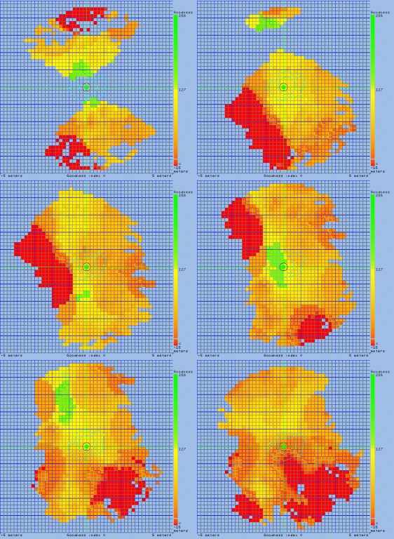
This animation shows the path the Mars Exploration Rover Spirit traveled during its 24-meter (78.7-foot) autonomous drive across the bumpy terrain at Gusev Crater, Mars, on the 39th day, or sol, of its mission. The colored data are from the rover's hazard-avoidance camera and have been reconstructed to show the topography of the land. Red areas indicate extremely hazardous terrain, and green patches denote safe, smooth ground. At the end of its drive, Spirit decided it was safer to back up then go forward. The rover is now positioned directly in front of its target, a rock dubbed Stone Council.
Cataloging Keywords:
| Name | Value | Additional Values |
|---|---|---|
| Target | Mars | |
| System | ||
| Target Type | Planet | |
| Mission | Mars Exploration Rover (MER) | |
| Instrument Host | Spirit (MER-A) | |
| Host Type | Rover | |
| Instrument | Hazard Camera (Hazcam) | |
| Detector | ||
| Extra Keywords | Color, Crater, Movie | |
| Acquisition Date | ||
| Release Date | 2004-02-12 | |
| Date in Caption | ||
| Image Credit | NASA/JPL | |
| Source | photojournal.jpl.nasa.gov/catalog/PIA05268 | |
| Identifier | PIA05268 | |
