Fretted Terrain
Caption:
20 October 2004
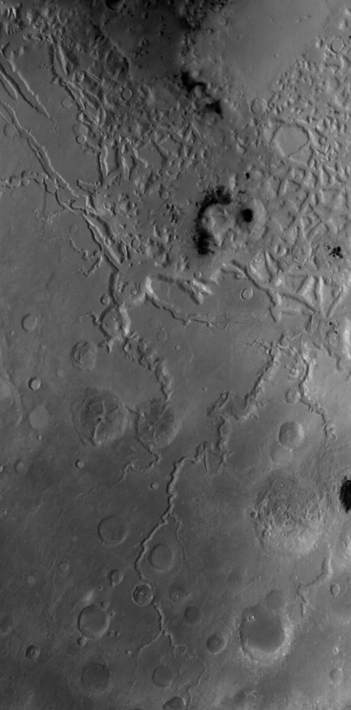
This red wide angle Mars Global Surveyor (MGS) Mars Orbiter Camera (MOC) image shows a portion of the fretted terrain north of eastern Arabia Terra. As described earlier this month in "
Craters in Fretted Terrain
," the fretted terrains of Mars are the broken-up, blocky areas where the heavily cratered martian highlands transition to the lightly-cratered, lower elevation, northern plains. The landforms in the top half of the picture shown here comprise a portion of the fretted terrain. This picture has a resolution of about 243 meters (266 yards) per pixel and covers an area about 248 kilometers (154 miles) wide. The long valley that runs diagonal from lower center toward right center in the bottom half of the picture is Auqakuh Vallis. This image is located near 32°N, 299°W, and is illuminated by sunlight from the left/lower left. Another view of landforms in the fretted terrain was featured yesterday in "
Fretted Terrain Craters
."
Cataloging Keywords:
| Name |
Value |
Additional Values |
| Target |
Mars |
|
| System |
|
|
| Target Type |
Planet |
|
| Mission |
Mars Global Surveyor (MGS) |
|
| Instrument Host |
Mars Global Surveyor |
|
| Host Type |
Orbiter |
|
| Instrument |
Mars Orbiter Camera (MOC) |
|
| Detector |
|
|
| Extra Keywords |
Crater, Grayscale |
| Acquisition Date |
|
| Release Date |
2004-10-20 |
| Date in Caption |
2004-10-20 |
|
| Image Credit |
NASA/JPL/Malin Space Science Systems |
| Source |
photojournal.jpl.nasa.gov/catalog/PIA06956 |
| Identifier |
PIA06956 |