|
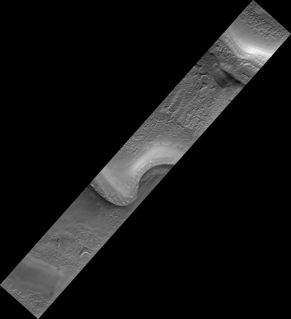
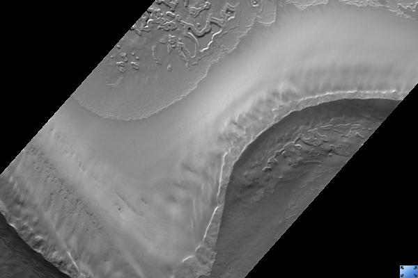
Monitoring South Polar Cap Swiss-Cheese Terrain Change
- Click the image above for a larger view
- Full-Res JPEG (2048 x 2241) (199.1 kB)
- Full-Res TIFF (2048 x 2241) (4.6 MB)
Caption:
Click on image for larger version
This HiRISE image ( PSP_002804_0930 ) is taken in one of the troughs that are typical within the stack of Martian south polar layered deposits.
Viewed at low resolution, sequences of layers of different albedos, or brightnesses, and/or textures can be seen. At full resolution, the different tones and textures can be seen to be due to different shapes and sizes of polygonal fractures, surface knobiness, and surface cover and concentration of frost, often within polygonal fractures.
Faint criss-crossing troughs and dimples can be discerned on even the smoothest surfaces. Perhaps the most notable features in the image are the distinct round to heart-shaped to blob-shaped depressions scattered throughout the smooth areas, dubbed "swiss-cheese terrain."
The smooth material is solid carbon dioxide ice representing the uppermost layer of the south polar residual cap. The retention of carbon dioxide ice throughout the year by the southern polar cap is one characteristic that distinguishes it significantly from Mars' north polar cap. The swiss-cheese depressions are areas in which sublimation of the carbon dioxide ice was initiated at a particular location and spread laterally from that point, creating rounded depressions typically several to 10 meters deep.
In HiRISE images, it is evident that this carbon dioxide-rich material is actually comprised of several individual horizontal layers. In this particular location, several images had been acquired over the previous decade by the Mars Orbiter Camera (MOC) at slightly lower resolutions. In a series of those MOC images, the swiss-cheese depressions were seen to enlarge radially, or grow over a time period of several years.
Part of the HiRISE imaging campaign includes continued monitoring of these features (at higher resolution) to understand their growth rates and patterns. In turn, we can better comprehend the role of carbon dioxide -- the main component of the Mars atmosphere -- in the current Mars climate regime.
Observation Toolbox
Acquisition date:
3 March 2007
Local Mars time:
7:42 PM
Degrees latitude (centered):
-87.0°
Degrees longitude (East):
281.8°
Range to target site:
247.8 km (154.9 miles)
Original image scale range:
49.6 cm/pixel (with 2 x 2 binning) so objects ~149 cm across are resolved
Map-projected scale:
50 cm/pixel and north is up
Map-projection:
POLAR STEREOGRAPHIC
Emission angle:
1.6°
Phase angle:
87.0°
Solar incidence angle:
86°, with the Sun about 4° above the horizon
Solar longitude:
193.3°, Northern Summer
Background Info:
NASA's Jet Propulsion Laboratory, a division of the California Institute of Technology in Pasadena, manages the Mars Reconnaissance Orbiter for NASA's Science Mission Directorate, Washington. Lockheed Martin Space Systems, Denver, is the prime contractor for the project and built the spacecraft. The High Resolution Imaging Science Experiment is operated by the University of Arizona, Tucson, and the instrument was built by Ball Aerospace and Technology Corp., Boulder, Colo.
Cataloging Keywords:
| Name | Value | Additional Values |
|---|---|---|
| Target | Mars | |
| System | ||
| Target Type | Planet | |
| Mission | Mars Reconnaissance Orbiter (MRO) | Mars Global Surveyor (MGS) |
| Instrument Host | Mars Reconnaissance Orbiter | Mars Global Surveyor |
| Host Type | Orbiter | |
| Instrument | High Resolution Imaging Science Experiment (HiRISE) | Mars Orbiter Camera (MOC) |
| Detector | ||
| Extra Keywords | Atmosphere, Grayscale, Map | |
| Acquisition Date | ||
| Release Date | 2007-03-14 | |
| Date in Caption | 2007-03-03 | |
| Image Credit | NASA/JPL/Univ. of Arizona | |
| Source | photojournal.jpl.nasa.gov/catalog/PIA09625 | |
| Identifier | PIA09625 | |