
|
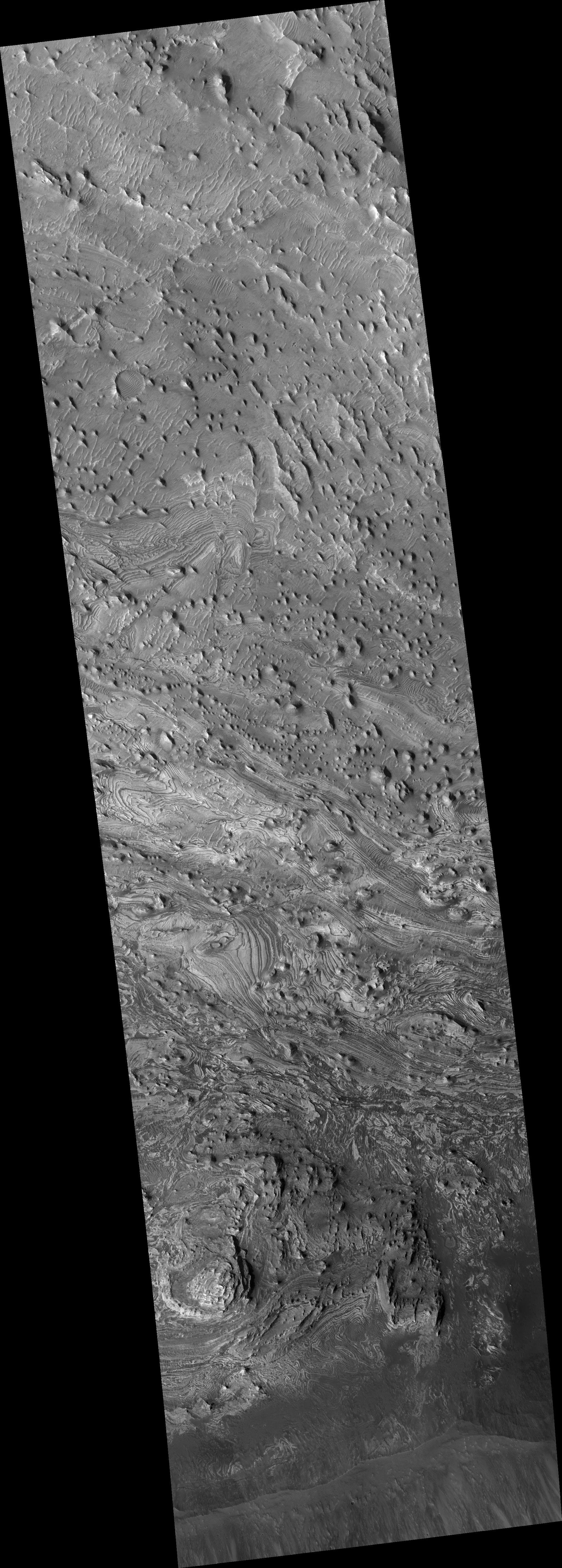
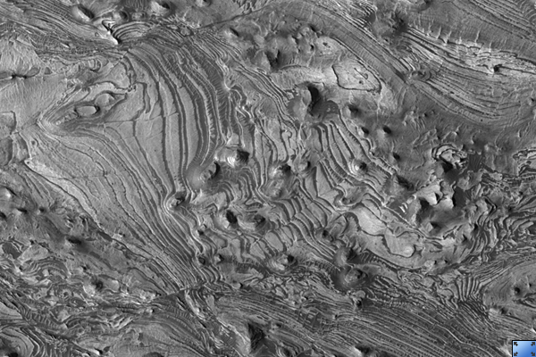
Faults and Folds in Western Candor Chasma
- Click the image above for a larger view
- Full-Res JPEG (2048 x 5709) (1.3 MB)
- Full-Res TIFF (2048 x 5709) (11.7 MB)
Caption:
Click on image for larger version
This HiRISE image ( PSP_003540_1735 ) shows various interesting structures along the floor of Candor Chasma, a major canyon of Valles Marineris.
The rocks along the floor of the chasma consist of multiple layers of light-toned material, possibly windblown or water-lain sediment. These layers have been shifted along faults and also folded, giving the layers an apparent wavy appearance as they are exposed at the surface through erosion.
Some waviness in the layers may also have formed as these sediments were laid down, for example, in dunes or large ripples. Detailed mapping of these faults and folds may help reveal the origin of these layered deposits and if water played any role in their formation.
Observation Toolbox
Acquisition date:
4 April 2007
Local Mars time:
3:33 PM
Degrees latitude (centered):
-6.4°
Degrees longitude (East):
283.2°
Range to target site:
263.6 km (164.7 miles)
Original image scale range:
26.4 cm/pixel (with 1 x 1 binning) so objects ~79 cm across are resolved
Map-projected scale:
25 cm/pixel and north is up
Map-projection:
EQUIRECTANGULAR
Emission angle:
7.3°
Phase angle:
46.0°
Solar incidence angle:
53°, with the Sun about 37° above the horizon
Solar longitude:
228.2°, Northern Autumn
Background Info:
NASA's Jet Propulsion Laboratory, a division of the California Institute of Technology in Pasadena, manages the Mars Reconnaissance Orbiter for NASA's Science Mission Directorate, Washington. Lockheed Martin Space Systems, Denver, is the prime contractor for the project and built the spacecraft. The High Resolution Imaging Science Experiment is operated by the University of Arizona, Tucson, and the instrument was built by Ball Aerospace and Technology Corp., Boulder, Colo.
Cataloging Keywords:
| Name | Value | Additional Values |
|---|---|---|
| Target | Mars | |
| System | ||
| Target Type | Planet | |
| Mission | Mars Reconnaissance Orbiter (MRO) | Mariner |
| Instrument Host | Mars Reconnaissance Orbiter | |
| Host Type | Orbiter | Flyby Spacecraft |
| Instrument | High Resolution Imaging Science Experiment (HiRISE) | |
| Detector | ||
| Extra Keywords | Dune, Grayscale, Infrared, Map, Water | |
| Acquisition Date | ||
| Release Date | 2007-05-16 | |
| Date in Caption | 2007-04-04 | |
| Image Credit | NASA/JPL/Univ. of Arizona | |
| Source | photojournal.jpl.nasa.gov/catalog/PIA09682 | |
| Identifier | PIA09682 | |