|
Fans of Lava Flows on the Flanks of Olympus Mons
- Click the image above for a larger view
- Full-Res JPEG (2048 x 4782) (1.2 MB)
- Full-Res TIFF (2048 x 4782) (9.8 MB)
Caption:

Click on image for larger version
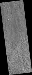
Olympus Mons, the largest volcano in the Solar System is covered by lava flows. Most of these lava flows carried the liquid lava in open streams which geologists call channels. In some places these channels break down and the lava spreads across a broad area, like a fan. In the center of this HiRISE image ( PSP_002909_2000 ), you can see the transition from well-confined lava channels into broad fans as the lava flowed down to the north.
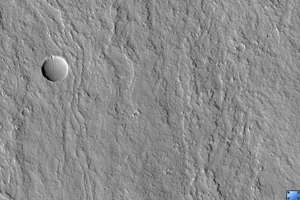
When viewed at full-resolution, the HiRISE image shows a fuzzy pitted surface. This is caused by a thick layer of very small particles that are being moved around by the wind. It is not clear at this point in time whether these particles are predominantly dust deposited from the global dust storms or if they are mostly volcanic ash.
Observation Toolbox
Acquisition date:
3 March 2007
Local Mars time:
3:38 PM
Degrees latitude (centered):
19.7°
Degrees longitude (East):
226.1°
Range to target site:
263.0 km (164.4 miles)
Original image scale range:
26.3 cm/pixel (with 1 x 1 binning) so objects ~79 cm across are resolved
Map-projected scale:
25 cm/pixel and north is up
Map-projection:
EQUIRECTANGULAR
Emission angle:
0.2°
Phase angle:
60.3°
Solar incidence angle:
60°, with the Sun about 30° above the horizon
Solar longitude:
198.1°, Northern Autumn
Background Info:
NASA's Jet Propulsion Laboratory, a division of the California Institute of Technology in Pasadena, manages the Mars Reconnaissance Orbiter for NASA's Science Mission Directorate, Washington. Lockheed Martin Space Systems, Denver, is the prime contractor for the project and built the spacecraft. The High Resolution Imaging Science Experiment is operated by the University of Arizona, Tucson, and the instrument was built by Ball Aerospace and Technology Corp., Boulder, Colo.
Cataloging Keywords:
| Name | Value | Additional Values |
|---|---|---|
| Target | Mars | |
| System | ||
| Target Type | Planet | |
| Mission | Mars Reconnaissance Orbiter (MRO) | |
| Instrument Host | Mars Reconnaissance Orbiter | |
| Host Type | Orbiter | |
| Instrument | High Resolution Imaging Science Experiment (HiRISE) | |
| Detector | ||
| Extra Keywords | Atmosphere, Dust, Grayscale, Infrared, Map, Mountain, Storm, Volcano | |
| Acquisition Date | ||
| Release Date | 2007-05-30 | |
| Date in Caption | 2007-03-03 | |
| Image Credit | NASA/JPL/Univ. of Arizona | |
| Source | photojournal.jpl.nasa.gov/catalog/PIA09716 | |
| Identifier | PIA09716 | |
