skip to navigation
|
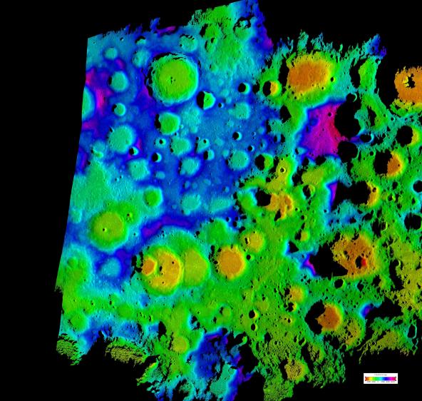
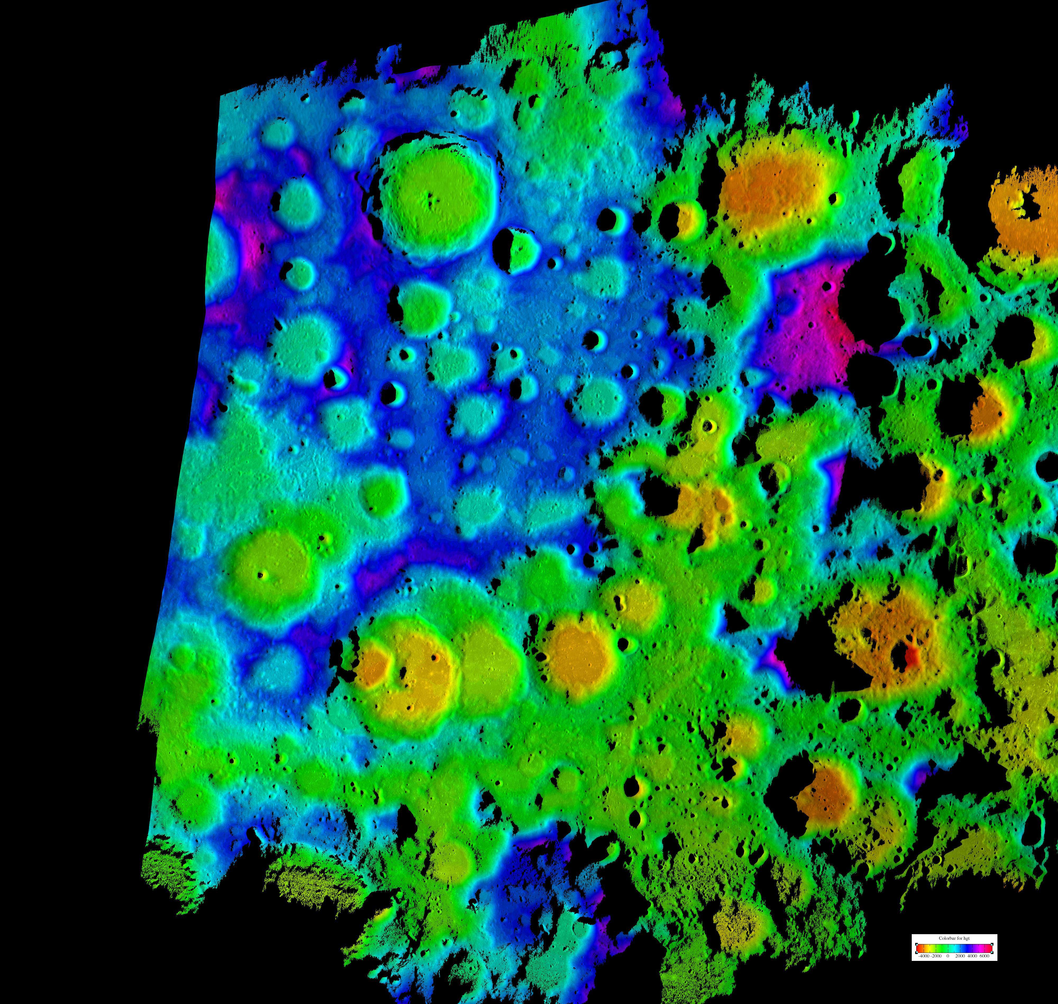
Moon’s Rugged South Polar Region Composite
- Click the image above for a larger view
- Full-Res JPEG (4000 x 3796) (1.9 MB)
- Full-Res TIFF (4000 x 3796) (45.5 MB)
Caption:

Figure 1
This composite image depicts the moon's rugged south polar region in two lights. The black and white image in figure 1 is a computer generated view of the pole from radar reflectance data. The color image is a topographic map of that same area. The color image is the highest resolution topography map to date of the moon's south pole. It was generated by scientists at NASA's Jet Propulsion Laboratory, Pasadena, Calif., using data collected using the Deep Space Network's Goldstone Solar System Radar located in California's Mojave Desert. The new map provides contiguous topographic detail over a region approximately 500 kilometers by 400 kilometers (311 miles by 249 miles).
Cataloging Keywords:
| Name | Value | Additional Values |
|---|---|---|
| Target | Moon | |
| System | Earth | |
| Target Type | Satellite | |
| Mission | Deep Space Network (DSN) | |
| Instrument Host | Goldstone Deep Space Communications Complex (GDSCC) | |
| Host Type | Ground-Based Observatory | |
| Instrument | Goldstone Solar System Radar | |
| Detector | ||
| Extra Keywords | Color, Map, Radar, Radio | |
| Acquisition Date | ||
| Release Date | 2009-06-18 | |
| Date in Caption | ||
| Image Credit | NASA/JPL | |
| Source | photojournal.jpl.nasa.gov/catalog/PIA12077 | |
| Identifier | PIA12077 | |