Polygons, Crater Layers, and Defrosting Dunes
Caption:
|
|
|
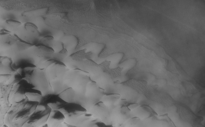
Figure 1
|
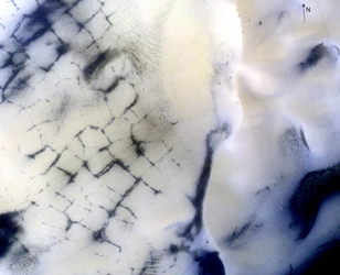
Figure 2
|
|
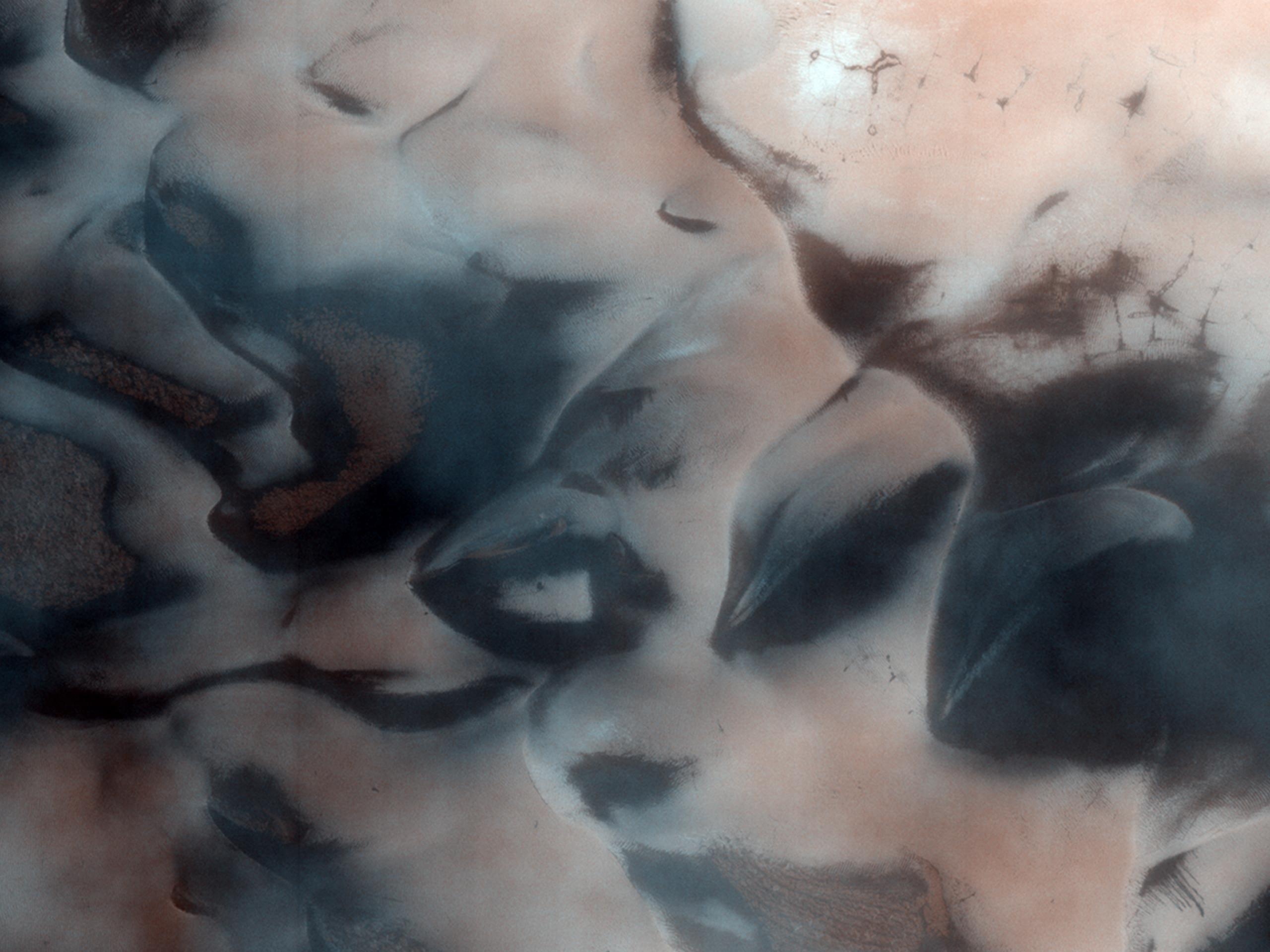
The north polar region of Mars is surrounded by a large sea of dark sand dunes that become covered by seasonal carbon dioxide frost. As the northern hemisphere begins to warm in the spring, the frozen carbon dioxide changes from a solid to a gas. The wind blows from an east-northeasterly direction and leaves dark streaks behind (exposed basalt) from the evaporating carbon dioxide. This image displays defrosting sand dunes in an unnamed crater.
The High Resolution Imaging Science Experiment, which took this image, is the most powerful telescopic camera ever sent to another planet.
Background Info:
NASA's Jet Propulsion Laboratory, a division of the California Institute of Technology in Pasadena, manages the Mars Reconnaissance Orbiter for NASA's Science Mission Directorate, Washington. Lockheed Martin Space Systems, Denver, is the prime contractor for the project and built the spacecraft. The High Resolution Imaging Science Experiment is operated by the University of Arizona, Tucson, and the instrument was built by Ball Aerospace & Technologies Corp., Boulder, Colo.
Cataloging Keywords:
| Name |
Value |
Additional Values |
| Target |
Mars |
|
| System |
|
|
| Target Type |
Planet |
|
| Mission |
Mars Reconnaissance Orbiter (MRO) |
|
| Instrument Host |
Mars Reconnaissance Orbiter |
|
| Host Type |
Orbiter |
|
| Instrument |
High Resolution Imaging Science Experiment (HiRISE) |
|
| Detector |
|
|
| Extra Keywords |
Color, Crater, Dune |
| Acquisition Date |
|
| Release Date |
2008-05-14 |
| Date in Caption |
|
|
| Image Credit |
NASA/JPL/University of Arizona |
| Source |
photojournal.jpl.nasa.gov/catalog/PIA12112 |
| Identifier |
PIA12112 |


