|
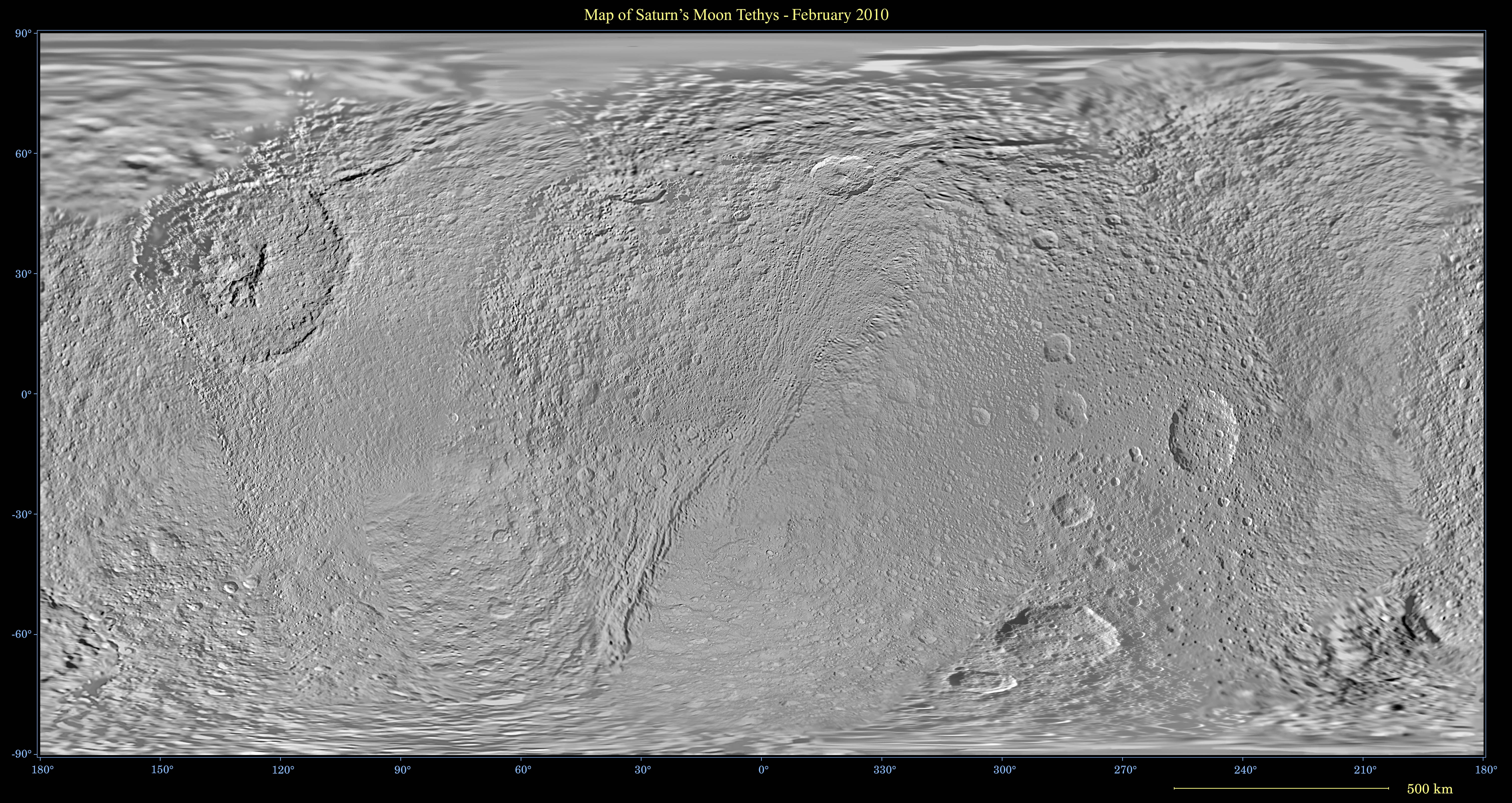
Map of Tethys - February 2010
- Click the image above for a larger view
- Full-Res JPEG (2880 x 1440) (884.0 kB)
- Full-Res TIFF (2880 x 1440) (4.2 MB)
Caption:
Click on the image for larger version
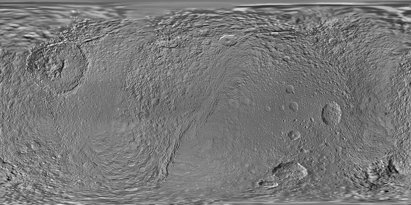
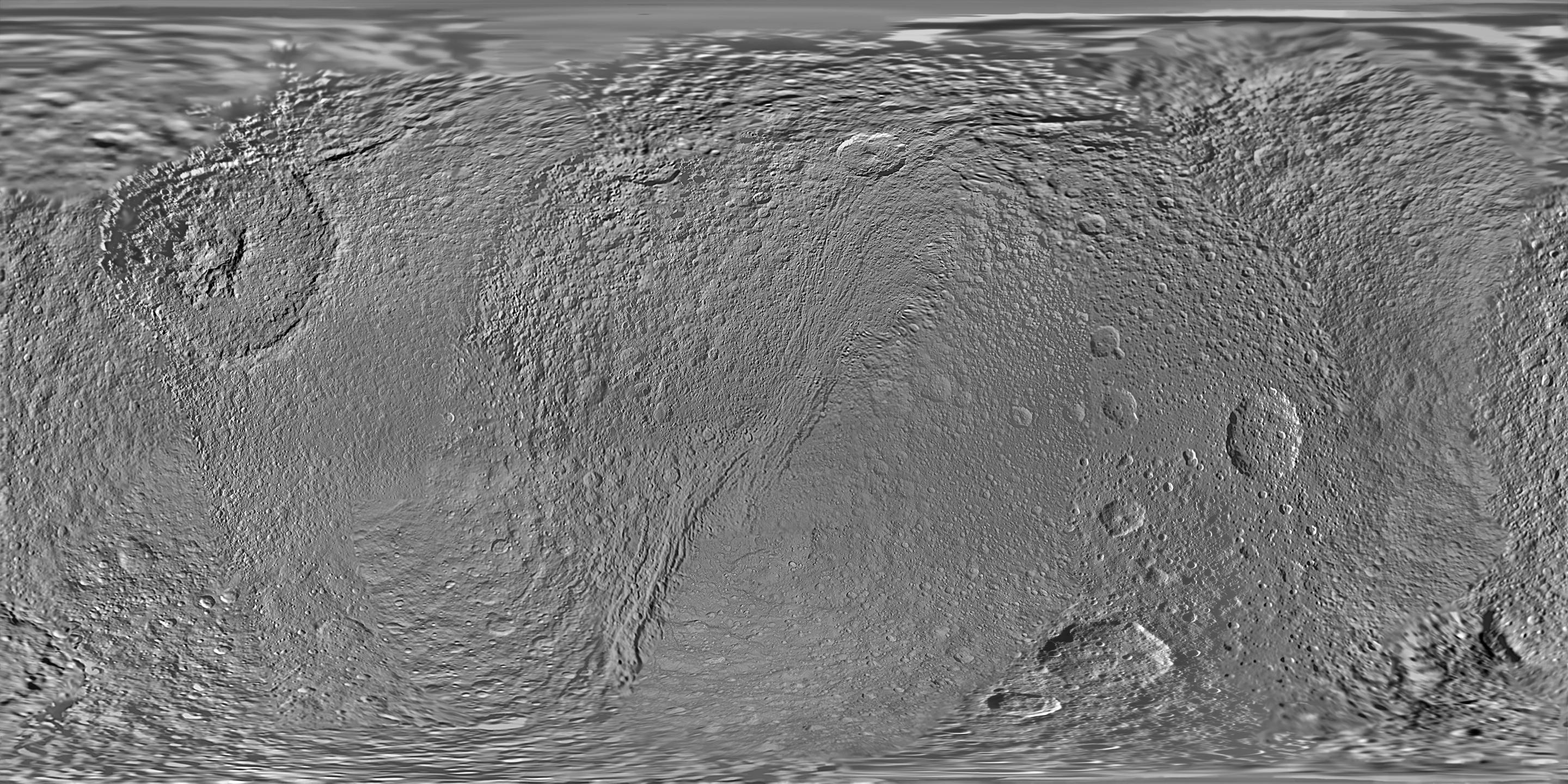
This global map of Saturn's moon Tethys was created using images taken during Cassini spacecraft flybys.
The map is an equidistant (simple cylindrical) projection and has a scale of 293 meters (960 feet) per pixel at the equator in the full size version. The mean radius of Tethys used for projection of this map is 536.3 kilometers (333.2 miles). The resolution of the map is 32 pixels per degree.
This map is an update to the version released in June 2008. See PIA08416 . Unlike the 2008 and earlier iterations, this new map does not use Voyager images to fill in gaps in Cassini's coverage. Only Cassini images are used here.
Background Info:
The Cassini-Huygens mission is a cooperative project of NASA, the European Space Agency and the Italian Space Agency. The Jet Propulsion Laboratory, a division of the California Institute of Technology in Pasadena, manages the mission for NASA's Science Mission Directorate, Washington, D.C. The Cassini orbiter and its two onboard cameras were designed, developed and assembled at JPL. The imaging operations center is based at the Space Science Institute in Boulder, Colo.
For more information about the Cassini-Huygens mission visit http://www.nasa.gov/cassini and http://saturn.jpl.nasa.gov . The Cassini imaging team homepage is at http://ciclops.org .
Cataloging Keywords:
| Name | Value | Additional Values |
|---|---|---|
| Target | Tethys | |
| System | Saturn | |
| Target Type | Satellite | |
| Mission | Cassini-Huygens | Voyager |
| Instrument Host | Cassini Orbiter | |
| Host Type | Orbiter | Flyby Spacecraft |
| Instrument | Imaging Science Subsystem (ISS) | |
| Detector | ||
| Extra Keywords | Grayscale, Map | |
| Acquisition Date | ||
| Release Date | 2010-03-03 | |
| Date in Caption | ||
| Image Credit | NASA/JPL/Space Science Institute | |
| Source | photojournal.jpl.nasa.gov/catalog/PIA12560 | |
| Identifier | PIA12560 | |