|
The Mimas Atlas
- Click the image above for a larger view
- Full-Res JPEG (2669 x 2126) (525.6 kB)
- Full-Res TIFF (2669 x 2126) (5.7 MB)
Caption:
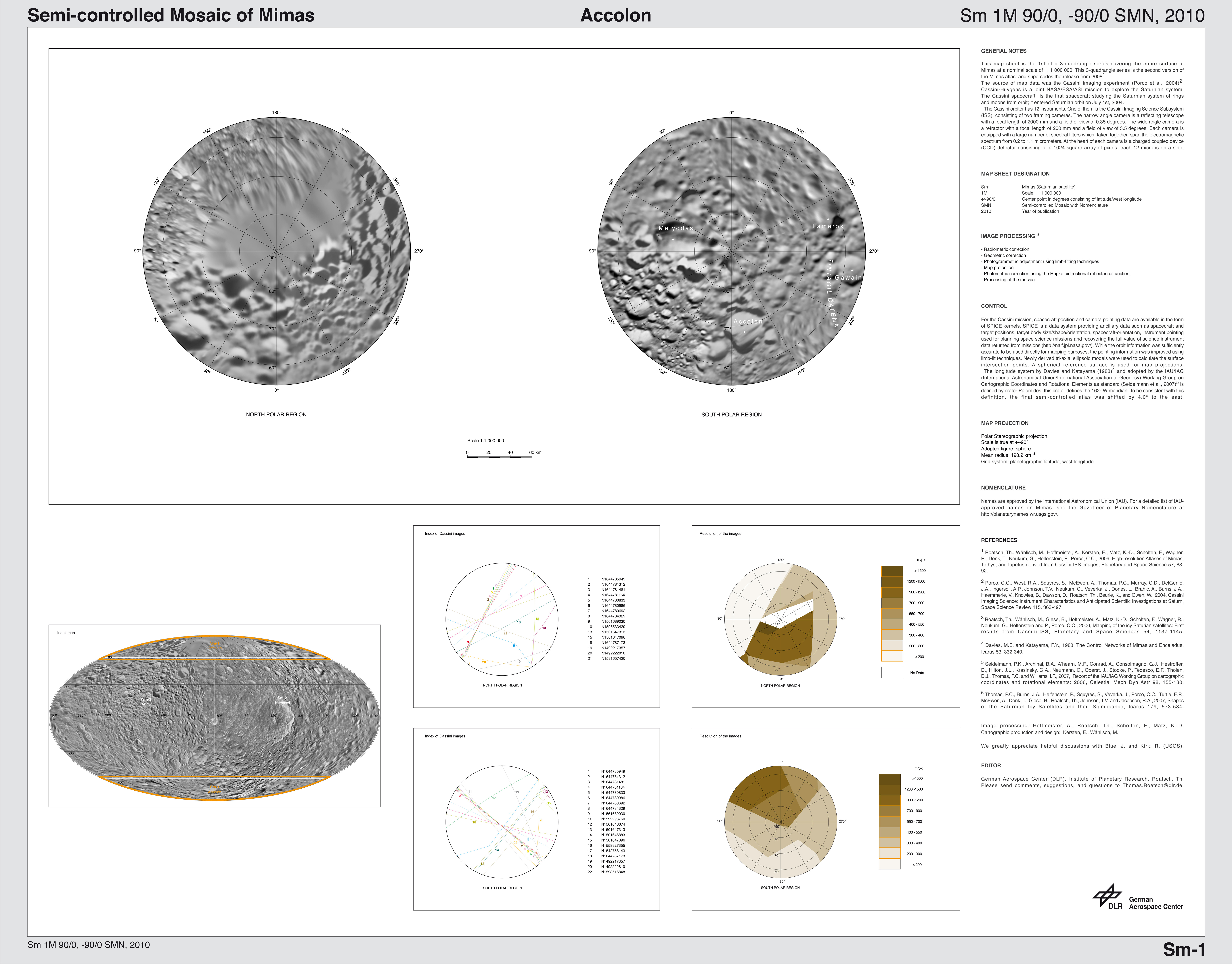
Accolon
|

Click on an individual image for larger view
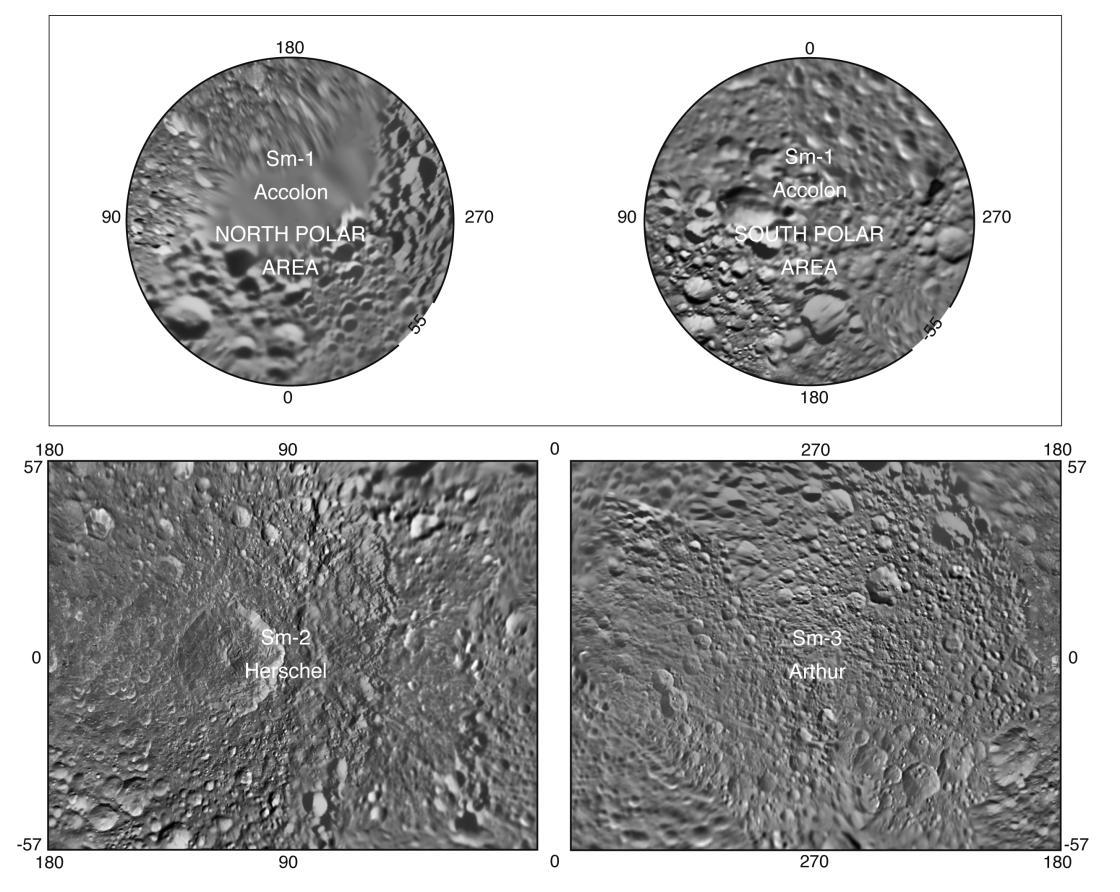
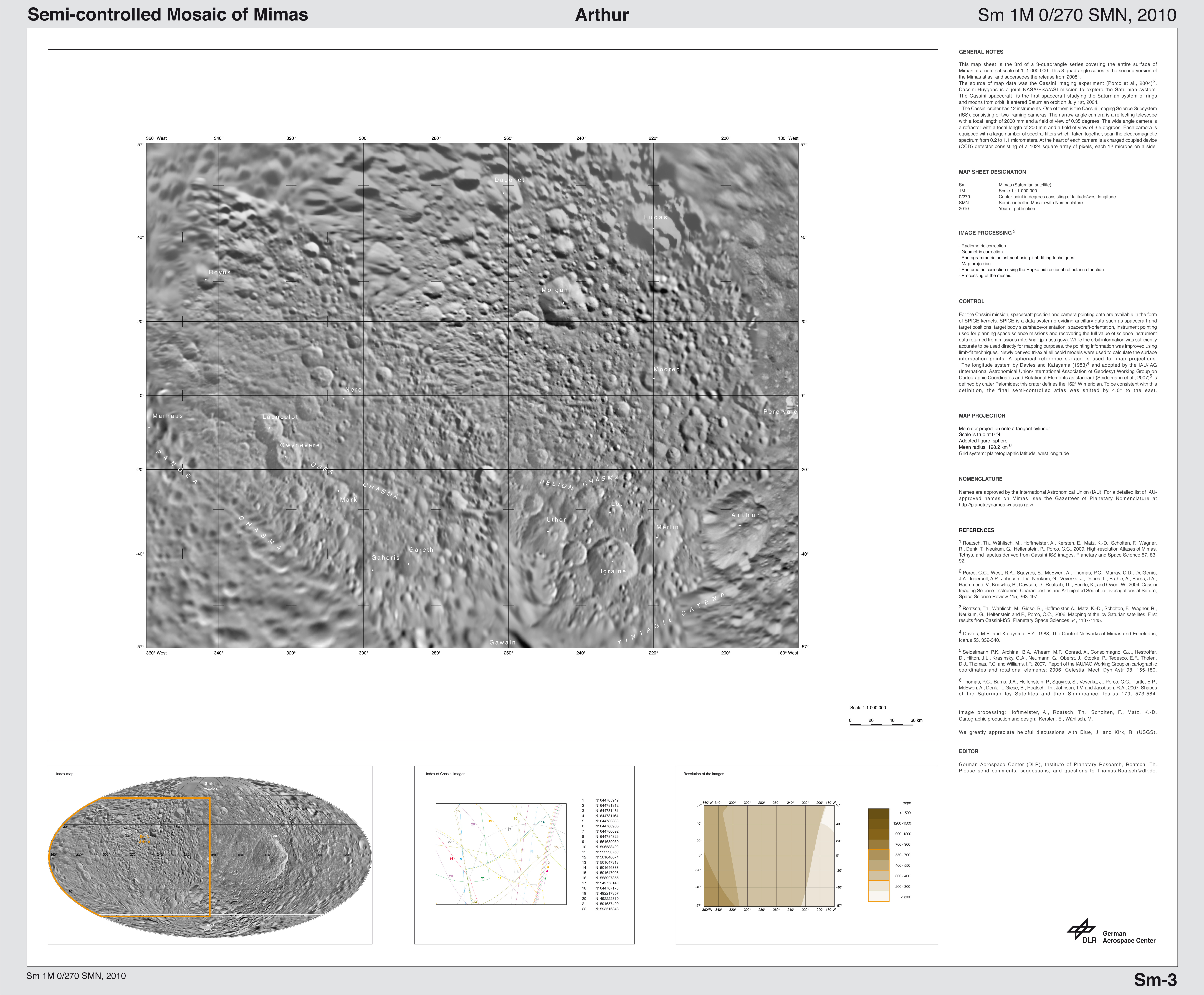
Presented here is a complete set of cartographic map sheets from a high-resolution atlas of Saturn's moon Mimas. The atlas is a product of the imaging team working with NASA's Cassini spacecraft.
Mimas, as imaged by NASA's Voyager spacecraft in the early 1980s, has a very large, distinguishing crater that makes it look like the "Death Star." As shown in this map, that crater is named Herschel.
The map sheets form a three-quadrangle series covering the entire surface of Mimas at a nominal scale of 1:1,500,000. The map data were acquired by the Cassini imaging cameras. The mean radius of Mimas used for projection of the maps is 198.2 kilometers (123.2 miles). Image scale is 216.2 meters (709 feet) per pixel. The resolution of the map is 16 pixels per degree.
Names for features have been approved by the International Astronomical Union (IAU).
This atlas is an update to the version released in October 2008 (see PIA11117 ).
Background Info:
The Cassini-Huygens mission is a cooperative project of NASA, the European Space Agency and the Italian Space Agency. The Jet Propulsion Laboratory, a division of the California Institute of Technology in Pasadena, manages the mission for NASA's Science Mission Directorate, Washington, D.C. The Cassini orbiter and its two onboard cameras were designed, developed and assembled at JPL. The imaging operations center is based at the Space Science Institute in Boulder, Colo.
For more information about the Cassini-Huygens mission visit http://saturn.jpl.nasa.gov/ . The Cassini imaging team homepage is at http://ciclops.org .
Cataloging Keywords:
| Name | Value | Additional Values |
|---|---|---|
| Target | Mimas | |
| System | Saturn | |
| Target Type | Satellite | |
| Mission | Cassini-Huygens | Voyager |
| Instrument Host | Cassini Orbiter | |
| Host Type | Orbiter | Flyby Spacecraft |
| Instrument | Imaging Science Subsystem (ISS) | |
| Detector | ||
| Extra Keywords | Crater, Grayscale, Map | |
| Acquisition Date | ||
| Release Date | 2010-07-28 | |
| Date in Caption | ||
| Image Credit | NASA/JPL/Space Science Institute | |
| Source | photojournal.jpl.nasa.gov/catalog/PIA12793 | |
| Identifier | PIA12793 | |