|
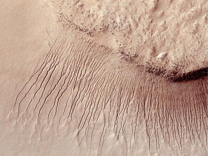
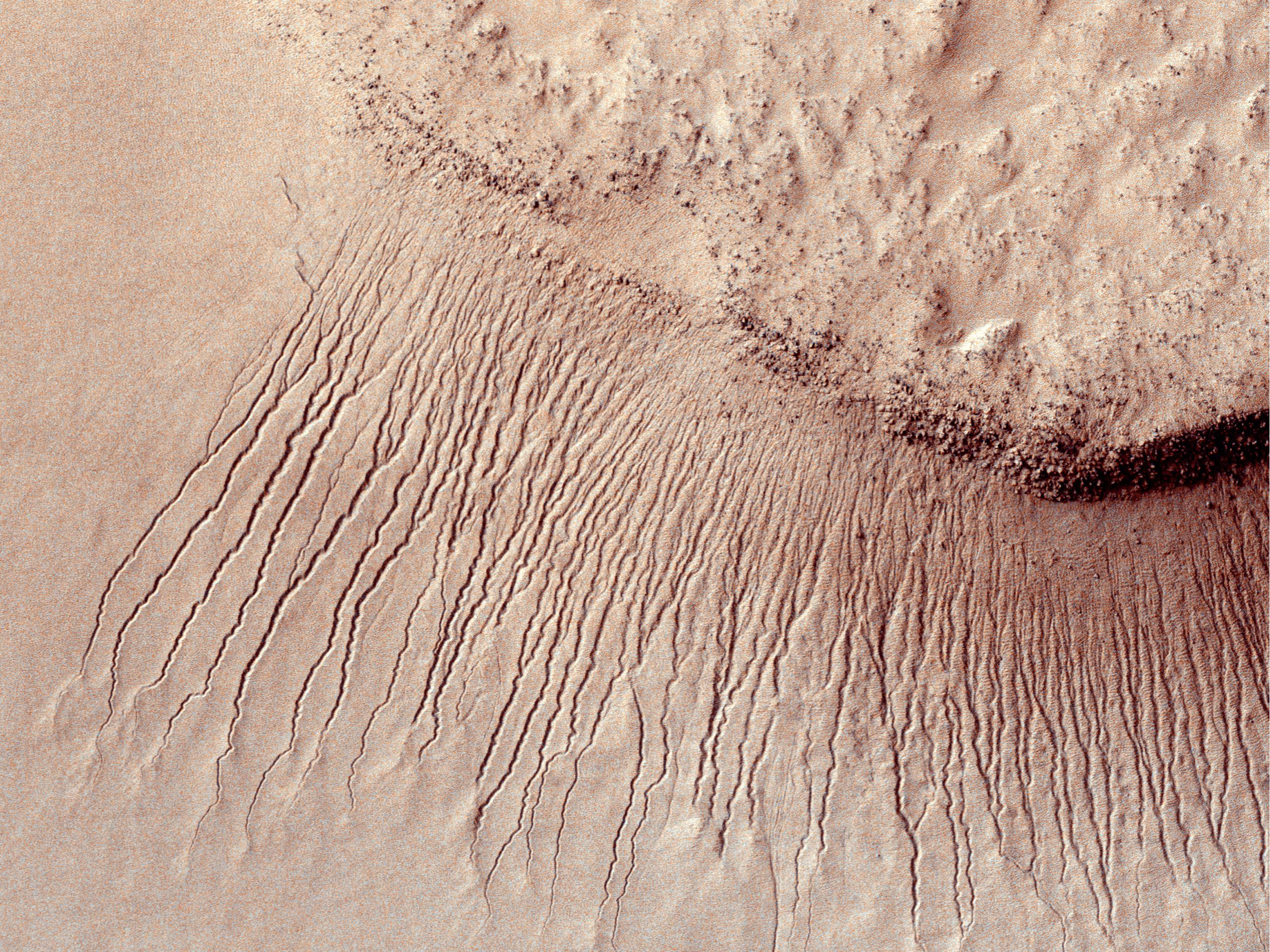
True Gullies on Mars
- Click the image above for a larger view
- Full-Res JPEG (2560 x 1920) (1.3 MB)
- Full-Res TIFF (2560 x 1920) (14.8 MB)
Caption:
Images like this from the High Resolution Imaging Science Experiment (HiRISE) camera on NASA's Mars Reconnaissance Orbiter show portions of the Martian surface in unprecedented detail. This one shows many channels from 1 meter to 10 meters (approximately 3 feet to 33 feet) wide on a scarp in the Hellas impact basin. On Earth we would call these gullies. Some larger channels on Mars that are sometimes called gullies are big enough to be called ravines on Earth.
This view is an excerpt from a HiRISE observation taken on Jan. 14, 2011, nearly five years after the March 10, 2006, arrival of the Mars Reconnaissance Orbiter at Mars. North is up. The image was taken at 3:44 p.m. local Mars time. The observation is centered at 48.4 degrees south latitude, 73.5 degree east longitude.
Background Info:
NASA's Jet Propulsion Laboratory, a division of the California Institute of Technology in Pasadena, manages the Mars Reconnaissance Orbiter for NASA's Science Mission Directorate, Washington. Lockheed Martin Space Systems, Denver, built the spacecraft. The High Resolution Imaging Science Experiment is operated by the University of Arizona, Tucson, and the instrument was built by Ball Aerospace & Technologies Corp., Boulder, Colo.
Cataloging Keywords:
| Name | Value | Additional Values |
|---|---|---|
| Target | Mars | |
| System | ||
| Target Type | Planet | |
| Mission | Mars Reconnaissance Orbiter (MRO) | |
| Instrument Host | Mars Reconnaissance Orbiter | |
| Host Type | Orbiter | |
| Instrument | High Resolution Imaging Science Experiment (HiRISE) | |
| Detector | ||
| Extra Keywords | Color, Impact | |
| Acquisition Date | ||
| Release Date | 2011-03-09 | |
| Date in Caption | 2006-03-10 | 2011-01-14 |
| Image Credit | NASA/JPL-Caltech/University of Arizona | |
| Source | photojournal.jpl.nasa.gov/catalog/PIA13802 | |
| Identifier | PIA13802 | |