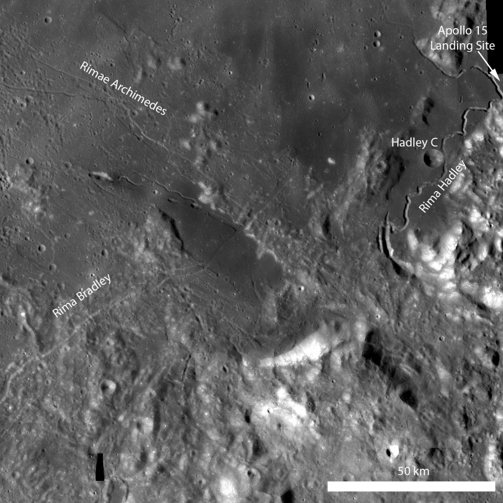
Rima Bradley
Caption:
Rima Bradley is a northeast/southwest-trending linear rille located between Mare Imbrium and Palus Putredinis (very close to the Apollo 15 landing site). Rima Bradley probably formed as a result of tectonic stresses in the Imbrium basin. LROC WAC monochrome mosaic, illumination from left.

|
|
Click on image for larger version
|
|
|
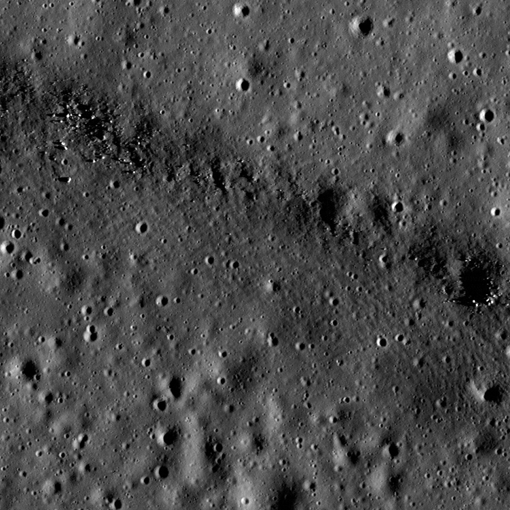
Rima Bradley primarily traverses across highland terrain, but in this portion of an LROC NAC image the rille crosses a mare pond (center of the opening image). Image is 700 meters across, illumination is from the right
|
|
This region is geologically complex, featuring sinuous rilles, mare volcanism, highland mountain ranges, and of course impact craters.
Background Info:
NASA's Goddard Space Flight Center built and manages the mission for the Exploration Systems Mission Directorate at NASA Headquarters in Washington. The Lunar Reconnaissance Orbiter Camera was designed to acquire data for landing site certification and to conduct polar illumination studies and global mapping. Operated by Arizona State University, LROC consists of a pair of narrow-angle cameras (NAC) and a single wide-angle camera (WAC). The mission is expected to return over 70 terabytes of image data.
Cataloging Keywords:
| Name |
Value |
Additional Values |
| Target |
Moon |
|
| System |
Earth |
|
| Target Type |
Satellite |
|
| Mission |
Lunar Reconnaissance Orbiter (LRO) |
|
| Instrument Host |
Lunar Reconnaissance Orbiter |
|
| Host Type |
Orbiter |
|
| Instrument |
Lunar Reconnaissance Orbiter Camera (NAC) |
Lunar Reconnaissance Orbiter Camera (WAC) |
| Detector |
|
Narrow Angle Camera (NAC), Wide Angle Camera (WAC) |
| Extra Keywords |
Crater, Grayscale, Impact, Mountain, Volcano |
| Acquisition Date |
|
| Release Date |
2011-02-11 |
| Date in Caption |
|
|
| Image Credit |
NASA/GSFC/Arizona State University |
| Source |
photojournal.jpl.nasa.gov/catalog/PIA14006 |
| Identifier |
PIA14006 |