|
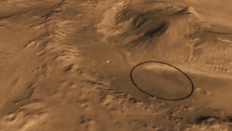
Oblique view of Gale Crater from the Northwest
- Click the image above for a larger view
- Full-Res JPEG (1920 x 1080) (141.6 kB)
- Full-Res TIFF (1920 x 1080) (6.2 MB)
Caption:
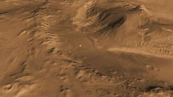
Unannotated image
Click on the image for larger view
This computer-generated view based on multiple orbital observations shows Mars' Gale crater as if seen from an aircraft northwest of the crater.
NASA has selected Gale as the landing site for the Mars Science Laboratory mission. The mission's rover will be placed on the ground in a northern portion of Gale crater in August 2012.
Gale crater is 96 miles (154 kilometers) in diameter and holds a layered mountain rising about 3 miles (5 kilometers) above the crater floor. The ellipse superimposed on this image indicates the intended landing area, 12.4 miles (20 kilometers) by 15.5 miles (25 kilometers). The portion of the crater within the landing area has an alluvial fan likely formed by water-carried sediments. The lower layers of the nearby mountain -- within driving distance for Curiosity -- contain minerals indicating a wet history. The intended landing site is at 4.5 degrees south latitude, 137.4 degrees east longitude.
This view was created using visible-light imaging by the Thermal Emission Imaging System camera on NASA's Mars Odyssey orbiter and three-dimensional information from the Mars Orbiter Laser Altimeter, which flew on NASA's Mars Global Surveyor orbiter. Color information is generalized from color imaging of portions of the scene by the High Resolution Imaging Science Experiment camera on NASA's Mars Reconnaissance Orbiter. The vertical dimension is not exaggerated.
Background Info:
The Mars Science Laboratory spacecraft is being prepared for launch during the period Nov. 25 to Dec. 18, 2011. In a prime mission lasting one Martian year -- nearly two Earth years -- after landing, researchers will use the rover's tools to study whether the landing region has had environmental conditions favorable for supporting microbial life and for preserving clues about whether life existed.
NASA's Jet Propulsion Laboratory, a division of the California Institute of Technology in Pasadena, manages the Mars Science Laboratory Project for NASA's Science Mission Directorate in Washington.
Arizona State University, Tempe, operates the Thermal Emission Imaging System. The Mars Orbiter Laser Altimeter was operated by NASA Goddard Space Flight Center, Greenbelt, Md. The University of Arizona, Tucson, operates the High Resolution Science Imaging Experiment. JPL manages Mars Odyssey and Mars Reconnaissance Orbiter for NASA's Science Mission Directorate.
Cataloging Keywords:
| Name | Value | Additional Values |
|---|---|---|
| Target | Mars | |
| System | ||
| Target Type | Planet | |
| Mission | Mars Science Laboratory (MSL) | 2001 Mars Odyssey, Mars Global Surveyor (MGS), Mars Reconnaissance Orbiter (MRO) |
| Instrument Host | Curiosity Rover | Mars Odyssey, Mars Global Surveyor, Mars Reconnaissance Orbiter |
| Host Type | Rover | Orbiter |
| Instrument | Mars Orbiter Laser Altimeter (MOLA) | Thermal Emission Imaging System (THEMIS) |
| Detector | ||
| Extra Keywords | Color, Crater, Mountain, Thermal, Water | |
| Acquisition Date | ||
| Release Date | 2011-07-22 | |
| Date in Caption | ||
| Image Credit | NASA/JPL-Caltech/ASU/UA | |
| Source | photojournal.jpl.nasa.gov/catalog/PIA14292 | |
| Identifier | PIA14292 | |