|
Curiosity’s Travels Through Sol 56
- Click the image above for a larger view
- Full-Res JPEG (3600 x 2700) (1.9 MB)
- Full-Res TIFF (3600 x 2700) (29.2 MB)
Caption:
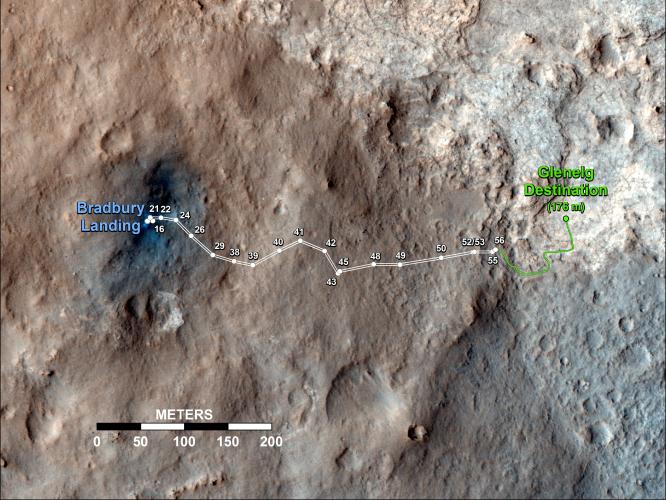
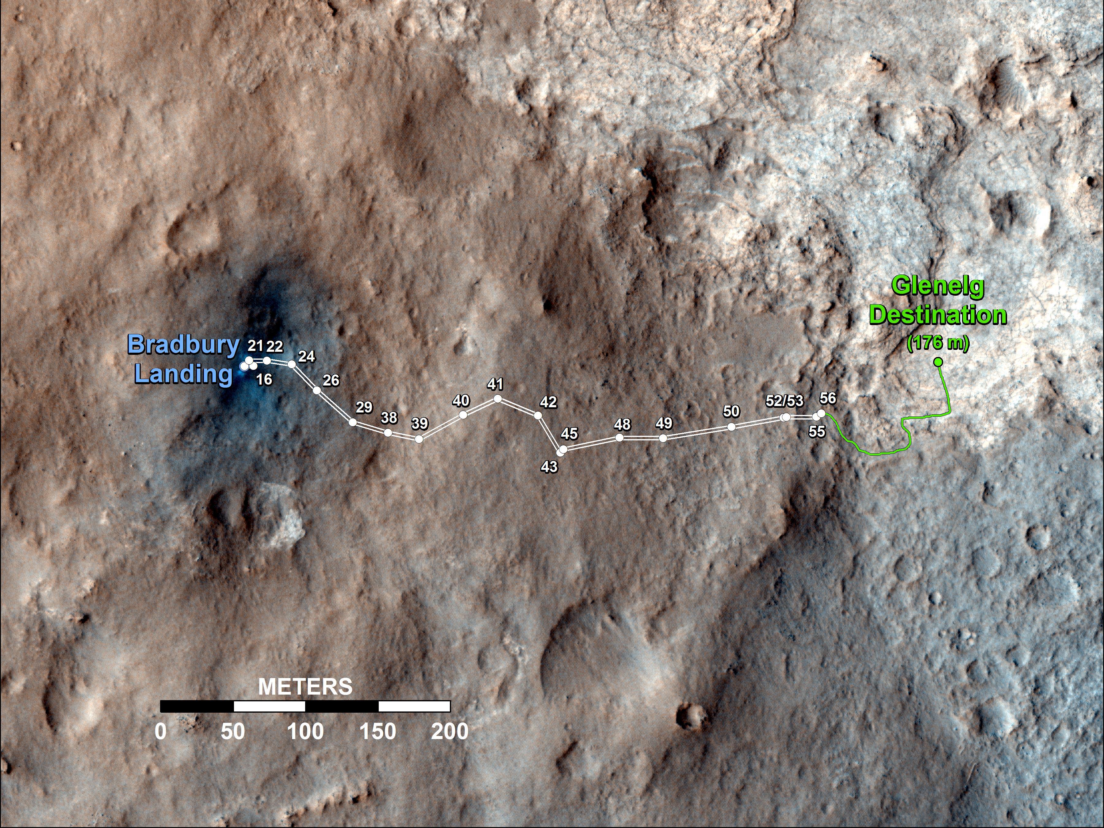
This map shows the route driven by NASA's Mars rover Curiosity through the 56th Martian day, or sol, of the rover's mission on Mars (Oct. 2, 2012).
The route starts where the rover touched down, a site subsequently named Bradbury Landing. The white line extending toward the right (eastward) from Bradbury Landing is the rover's path so far, and the green line shows its planned future route. Numbering of the dots along the line indicate the sol number of each drive. North is up. The scale bar is 200 meters (656 feet). By Sol 56, Curiosity had driven at total distance of about 1,590 feet (484 meters).
The Glenelg area farther east is the mission's first major science destination, selected as likely to offer a good target for Curiosity's first analysis of powder collected by drilling into a rock.
The image used for the map is from an observation of the landing site by the High Resolution Imaging Science Experiment (HiRISE) instrument on NASA's Mars Reconnaissance Orbiter.
Background Info:
JPL manages the Mars Science Laboratory/Curiosity for NASA's Science Mission Directorate in Washington. The rover was designed, developed and assembled at JPL, a division of the California Institute of Technology in Pasadena.
For more about NASA's Curiosity mission, visit: http://www.jpl.nasa.gov/msl , http://www.nasa.gov/mars , and http://marsprogram.jpl.nasa.gov/msl .
Cataloging Keywords:
| Name | Value | Additional Values |
|---|---|---|
| Target | Mars | |
| System | ||
| Target Type | Planet | |
| Mission | Mars Science Laboratory (MSL) | Mars Reconnaissance Orbiter (MRO) |
| Instrument Host | Curiosity Rover | Mars Reconnaissance Orbiter |
| Host Type | Rover | Orbiter |
| Instrument | High Resolution Imaging Science Experiment (HiRISE) | |
| Detector | ||
| Extra Keywords | Color, Map | |
| Acquisition Date | ||
| Release Date | 2012-10-04 | |
| Date in Caption | 2012-10-02 | |
| Image Credit | NASA/JPL-Caltech/Univ. of Arizona | |
| Source | photojournal.jpl.nasa.gov/catalog/PIA16200 | |
| Identifier | PIA16200 | |