|
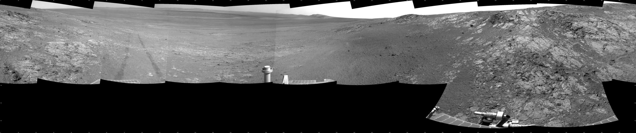
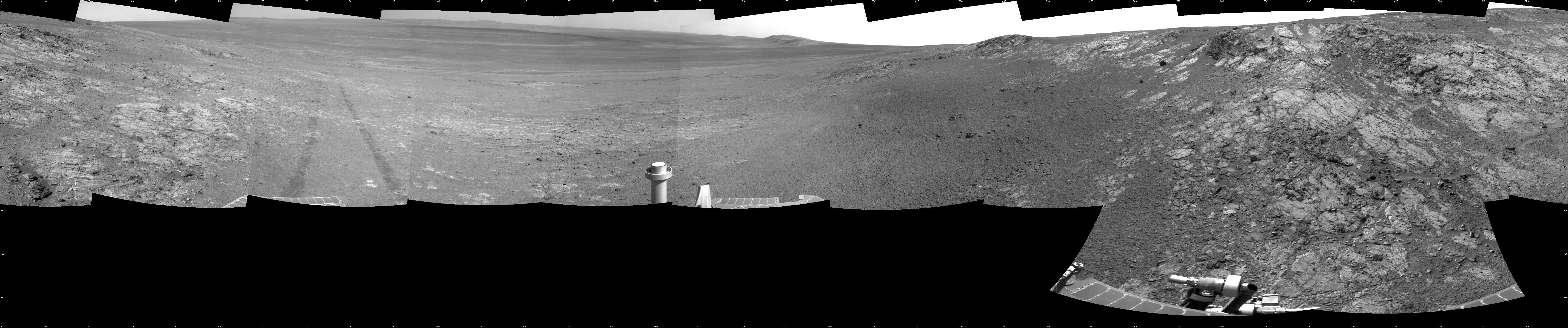
Opportunity’s Surroundings on Sol 3105, on ‘Matijevic Hill’
- Click the image above for a larger view
- Full-Res JPEG (7688 x 1610) (1.5 MB)
- Full-Res TIFF (7688 x 1610) (12.4 MB)
Caption:
This full-circle panorama shows the terrain around the NASA Mars Exploration Rover Opportunity during the 3,105th Martian day, or sol, of the rover's work on Mars (Oct. 18, 2012). It was assembled from images taken by the rover's navigation camera. South is at the center. North is on both ends.
Opportunity had driven about 61 feet (18.5 meters) westward earlier on Sol 3105 to reach this location, which is on the northern portion of "Matijevic Hill" on the "Cape York" segment of the western rim of Endeavour Crater. The wheel tracks created by the drive are visible. For scale, the distance between the two parallel tracks is about 3.3 feet (1 meter).
The basin of Endeavour Crater is in the left half of the image. Opportunity has been working on the western rim of Endeavour since mid-2011.
The panorama is presented as a cylindrical projection.
Cataloging Keywords:
| Name | Value | Additional Values |
|---|---|---|
| Target | Mars | |
| System | ||
| Target Type | Planet | |
| Mission | Mars Exploration Rover (MER) | |
| Instrument Host | Opportunity (MER-B) | |
| Host Type | Rover | |
| Instrument | Navigation Camera (Navcam) | |
| Detector | ||
| Extra Keywords | Crater, Grayscale | |
| Acquisition Date | ||
| Release Date | 2012-12-19 | |
| Date in Caption | 2012-10-18 | |
| Image Credit | NASA/JPL-Caltech | |
| Source | photojournal.jpl.nasa.gov/catalog/PIA16558 | |
| Identifier | PIA16558 | |