
|
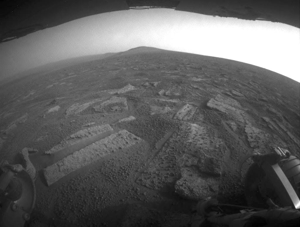
Opportunity’s View in ‘Botany Bay’ Toward ‘Solander Point’
- Click the image above for a larger view
- Full-Res JPEG (1024 x 774) (81.9 kB)
- Full-Res TIFF (1024 x 774) (793.6 kB)
Caption:
This view shows the terrain that NASA's Mars Exploration Rover Opportunity is crossing in a flat area called "Botany Bay" on the way toward "Solander Point," which is visible on the horizon.
The rover used its rear hazard-identification camera to record this southward view at the end of a southward drive covering about 387 feet (118 meters) during the 3,355th Martian day of Opportunity's work on Mars (July 2, 2013). Rover planners have been driving Opportunity in reverse to mitigate wear on wheel actuators. For scale, the distance between the two rear wheels visible in the foreground is about 3.3 feet (1 meter). The underside of Opportunity's deck appears at the top of the image.
The surface Opportunity is driving upon while crossing Botany Bay has a mosaic pavement of fractured, light-toned bedrock. A mixture of darker-toned basaltic soil and small spherules nicknamed "blueberries" fills cracks between the bedrock pieces and thinly covers some of the bedrock.
Background Info:
NASA's Jet Propulsion Laboratory, a division of the California Institute of Technology in Pasadena, manages the Mars Exploration Rover Project for NASA's Science Mission Directorate, Washington.
For more information about Opportunity, visit http://www.nasa.gov/rovers and http://marsrovers.jpl.nasa.gov .
Cataloging Keywords:
| Name | Value | Additional Values |
|---|---|---|
| Target | Mars | |
| System | ||
| Target Type | Planet | |
| Mission | Mars Exploration Rover (MER) | |
| Instrument Host | Opportunity (MER-B) | |
| Host Type | Rover | |
| Instrument | Hazard Camera (Hazcam) | |
| Detector | ||
| Extra Keywords | Grayscale | |
| Acquisition Date | ||
| Release Date | 2013-07-02 | |
| Date in Caption | 2013-07-02 | |
| Image Credit | NASA/JPL-Caltech | |
| Source | photojournal.jpl.nasa.gov/catalog/PIA17271 | |
| Identifier | PIA17271 | |