|
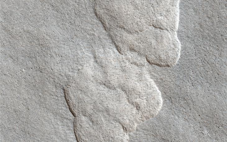
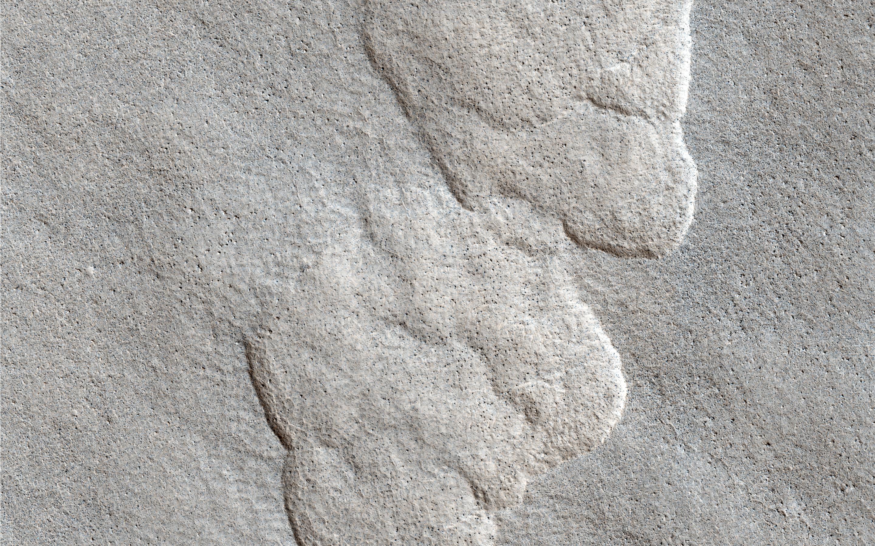
Aligned Scallops
- Click the image above for a larger view
- Full-Res JPEG (2880 x 1800) (1.5 MB)
- Full-Res TIFF (2880 x 1800) (15.6 MB)
Caption:
This observation shows what we call "scalloped terrain," that appears here to merge in a linear depression.
How do these scallops form? Possibly from the collapse of the terrain due to sublimation (when a solid transforms directly into a gaseous state) of subsurface ice. There is also a large number of rocks on the surface.
HiRISE resolution can help us examine the surface much more closely to see if there are any differences between the surrounding plains and the floor of these scalloped depressions.
Background Info:
HiRISE is one of six instruments on NASA's Mars Reconnaissance Orbiter. The University of Arizona, Tucson, operates the orbiter's HiRISE camera, which was built by Ball Aerospace & Technologies Corp., Boulder, Colo. NASA's Jet Propulsion Laboratory, a division of the California Institute of Technology in Pasadena, manages the Mars Reconnaissance Orbiter Project for the NASA Science Mission Directorate, Washington.
Cataloging Keywords:
| Name | Value | Additional Values |
|---|---|---|
| Target | Mars | |
| System | ||
| Target Type | Planet | |
| Mission | Mars Reconnaissance Orbiter (MRO) | |
| Instrument Host | Mars Reconnaissance Orbiter | |
| Host Type | Orbiter | |
| Instrument | High Resolution Imaging Science Experiment (HiRISE) | |
| Detector | ||
| Extra Keywords | Color | |
| Acquisition Date | ||
| Release Date | 2013-10-02 | |
| Date in Caption | ||
| Image Credit | NASA/JPL-Caltech/Univ. of Arizona | |
| Source | photojournal.jpl.nasa.gov/catalog/PIA17572 | |
| Identifier | PIA17572 | |