
|
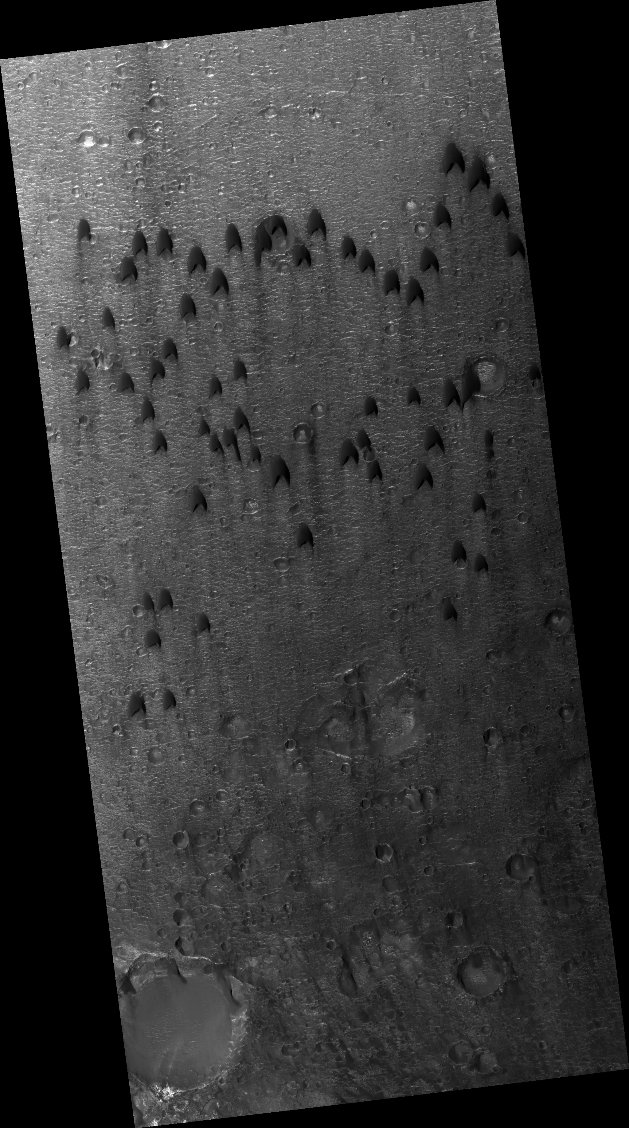
Dunes Flying in Formation
- Click the image above for a larger view
- Full-Res JPEG (2880 x 1800) (797.8 kB)
- Full-Res TIFF (2880 x 1800) (15.6 MB)
Caption:
Map Projected Browse Image
Click on the image for larger version
Migratory birds and military aircraft -- like during World War II -- often fly in a V-shaped formation. The "V" formation greatly boosts the efficiency and range of flying birds, because all except the first fly in the upward motion of air -- called upwash -- from the wingtip vortices of the bird ahead.
In this image of a dune field in a large crater near Mawrth Vallis, some of the dunes appear to be in formation . For dune fields, the spacing of individual dunes is a function of sand supply, wind speed, and topography.
Background Info:
HiRISE is one of six instruments on NASA's Mars Reconnaissance Orbiter. The University of Arizona, Tucson, operates the orbiter's HiRISE camera, which was built by Ball Aerospace & Technologies Corp., Boulder, Colo. NASA's Jet Propulsion Laboratory, a division of the California Institute of Technology in Pasadena, manages the Mars Reconnaissance Orbiter Project for the NASA Science Mission Directorate, Washington.
Cataloging Keywords:
| Name | Value | Additional Values |
|---|---|---|
| Target | Mars | |
| System | ||
| Target Type | Planet | |
| Mission | Mars Reconnaissance Orbiter (MRO) | |
| Instrument Host | Mars Reconnaissance Orbiter | |
| Host Type | Orbiter | |
| Instrument | High Resolution Imaging Science Experiment (HiRISE) | |
| Detector | ||
| Extra Keywords | Color, Crater, Dune, Map | |
| Acquisition Date | ||
| Release Date | 2014-02-13 | |
| Date in Caption | ||
| Image Credit | NASA/JPL-Caltech/Univ. of Arizona | |
| Source | photojournal.jpl.nasa.gov/catalog/PIA17981 | |
| Identifier | PIA17981 | |