|
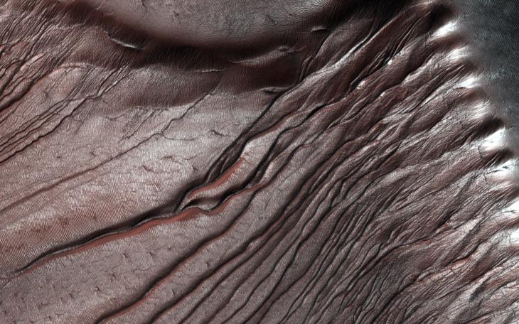
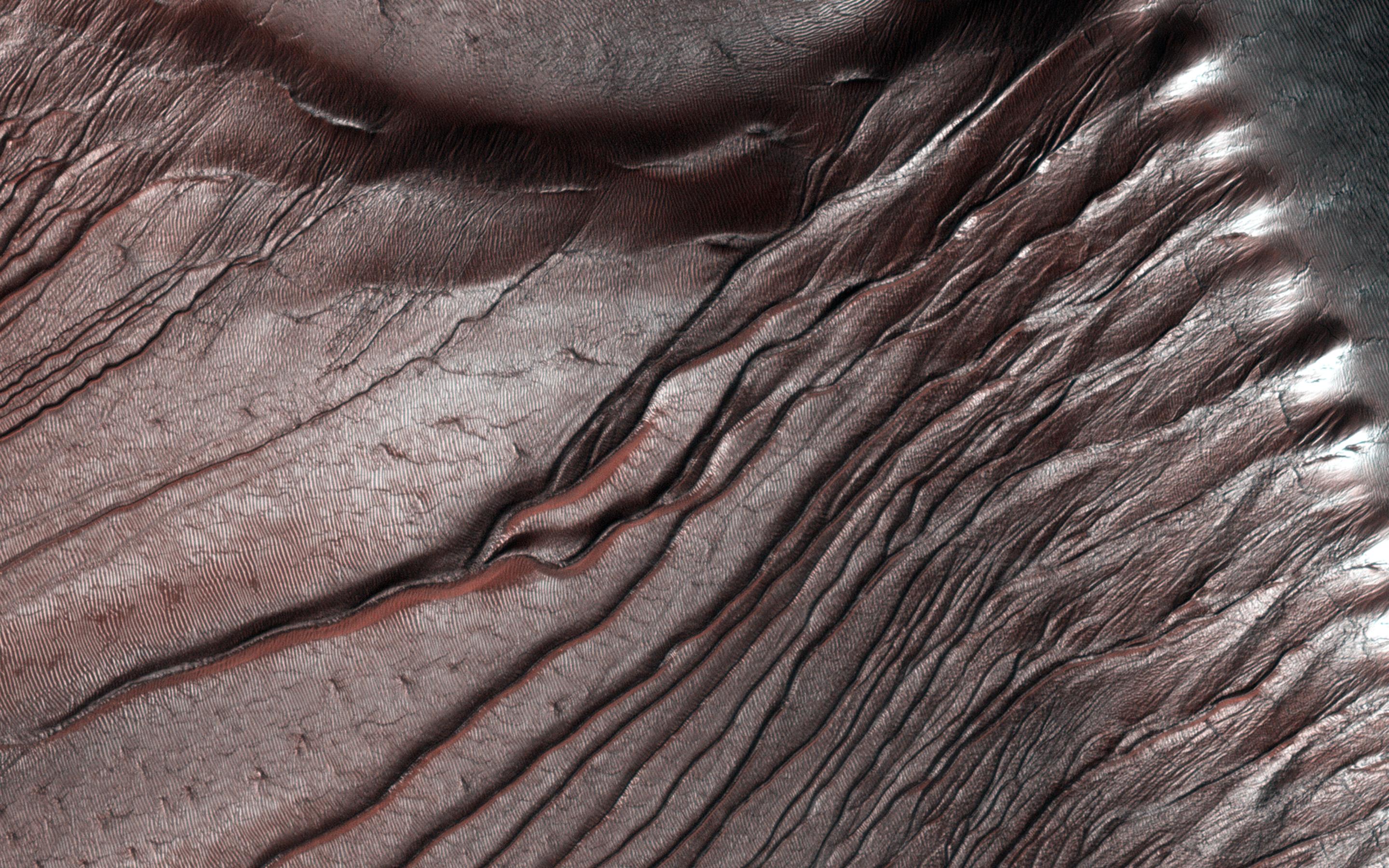
Fall Frost Accumulation on Russell Crater Dunes
- Click the image above for a larger view
- Full-Res JPEG (2880 x 1800) (962.1 kB)
- Full-Res TIFF (2880 x 1800) (15.6 MB)
Caption:
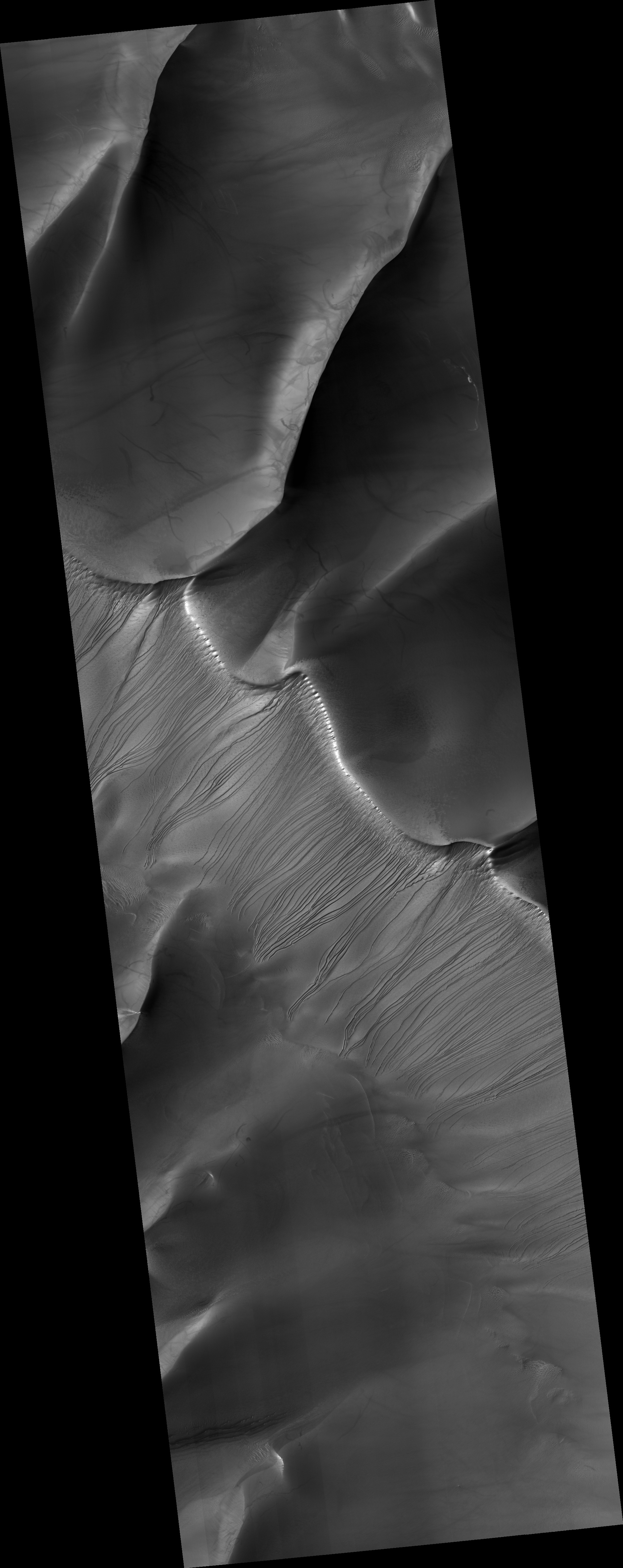
Map Projected Browse Image
Click on the image for larger version
Russell Crater dunes are a favorite target for HiRISE images not only because of their incredible beauty, but for how we can measure the accumulation of frost year after year in the fall, and its disappearance in the spring.
The frost is, of course, carbon dioxide ice that often sublimates (going directly from a solid to a gas) during the Martian spring. HiRISE takes images of the same areas on Mars in order to study seasonal changes like this. In an area like Russell Crater -- a very ancient impact crater about 140 kilometers in diameter -- we can follow changes in the terrain by comparing images taken at different times. This helps give us a better understanding of active processes on the Red Planet.
Background Info:
HiRISE is one of six instruments on NASA's Mars Reconnaissance Orbiter. The University of Arizona, Tucson, operates the orbiter's HiRISE camera, which was built by Ball Aerospace & Technologies Corp., Boulder, Colo. NASA's Jet Propulsion Laboratory, a division of the California Institute of Technology in Pasadena, manages the Mars Reconnaissance Orbiter Project for the NASA Science Mission Directorate, Washington.
Cataloging Keywords:
| Name | Value | Additional Values |
|---|---|---|
| Target | Mars | |
| System | ||
| Target Type | Planet | |
| Mission | Mars Reconnaissance Orbiter (MRO) | |
| Instrument Host | Mars Reconnaissance Orbiter | |
| Host Type | Orbiter | |
| Instrument | High Resolution Imaging Science Experiment (HiRISE) | |
| Detector | ||
| Extra Keywords | Color, Crater, Dune, Impact, Map | |
| Acquisition Date | ||
| Release Date | 2014-02-05 | |
| Date in Caption | ||
| Image Credit | NASA/JPL-Caltech/Univ. of Arizona | |
| Source | photojournal.jpl.nasa.gov/catalog/PIA17986 | |
| Identifier | PIA17986 | |