|
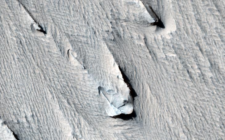
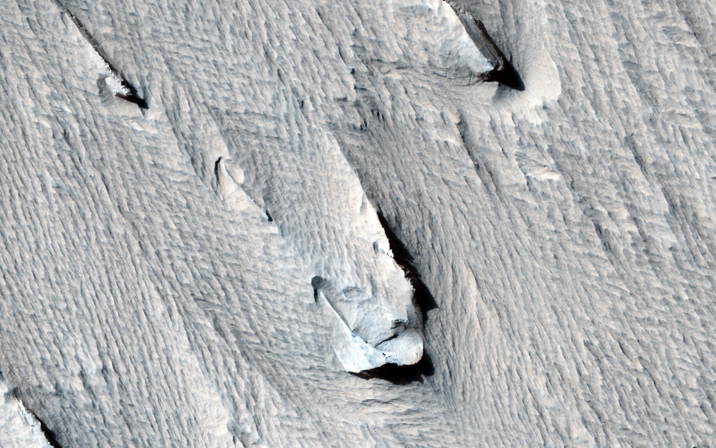
Yardangs Forming Near Gordii Dorsum
- Click the image above for a larger view
- Full-Res JPEG (2880 x 1800) (734.8 kB)
- Full-Res TIFF (2880 x 1800) (15.6 MB)
Caption:
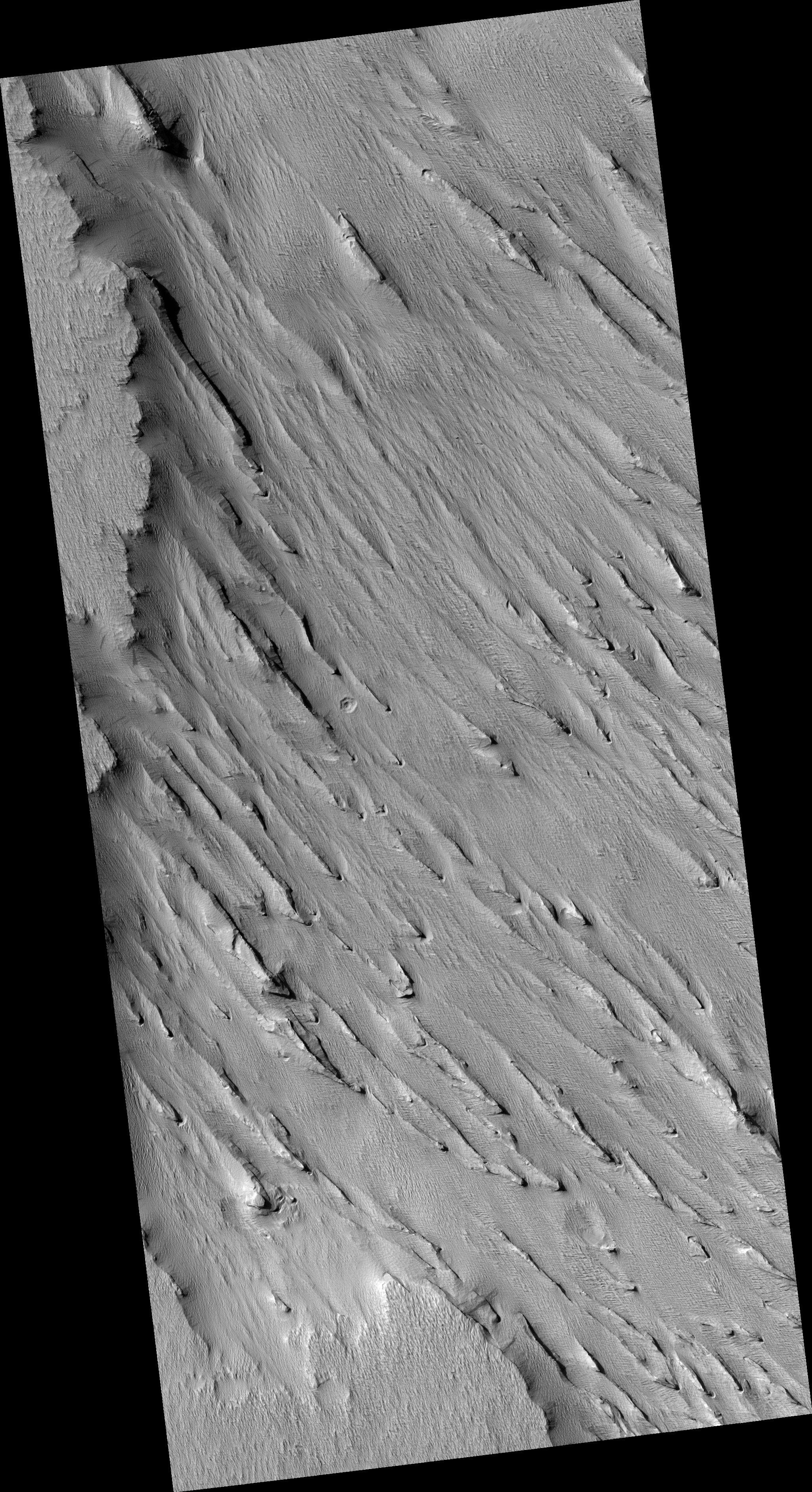
Map Projected Browse Image
Click on the image for larger version
The purpose of this observation is to determine how these formations, called "yardangs" are forming within a layer of bedrock.
Yardangs are streamlined hills that are carved by wind erosion from bedrock. The rock must be sufficiently erodible for wind to either deflate (pick up) poorly-consolidated pieces or scrape the surface by blowing sand. HiRISE resolution allows us to view yardangs and the component layers more closely, and to get a better understanding of the material.
"Yardang" is a word of Turkish origin, meaning "steep bank." When viewed from above, yardangs can look like the hull of a boat.
Background Info:
HiRISE is one of six instruments on NASA's Mars Reconnaissance Orbiter. The University of Arizona, Tucson, operates the orbiter's HiRISE camera, which was built by Ball Aerospace & Technologies Corp., Boulder, Colo. NASA's Jet Propulsion Laboratory, a division of the California Institute of Technology in Pasadena, manages the Mars Reconnaissance Orbiter Project for the NASA Science Mission Directorate, Washington.
Cataloging Keywords:
| Name | Value | Additional Values |
|---|---|---|
| Target | Mars | |
| System | ||
| Target Type | Planet | |
| Mission | Mars Reconnaissance Orbiter (MRO) | |
| Instrument Host | Mars Reconnaissance Orbiter | |
| Host Type | Orbiter | |
| Instrument | High Resolution Imaging Science Experiment (HiRISE) | |
| Detector | ||
| Extra Keywords | Color, Map | |
| Acquisition Date | ||
| Release Date | 2014-04-30 | |
| Date in Caption | ||
| Image Credit | NASA/JPL-Caltech/Univ. of Arizona | |
| Source | photojournal.jpl.nasa.gov/catalog/PIA18241 | |
| Identifier | PIA18241 | |