
|
More Polar Dunes
- Click the image above for a larger view
- Full-Res JPEG (1182 x 2905) (249.2 kB)
- Full-Res TIFF (1182 x 2905) (3.4 MB)
Caption:
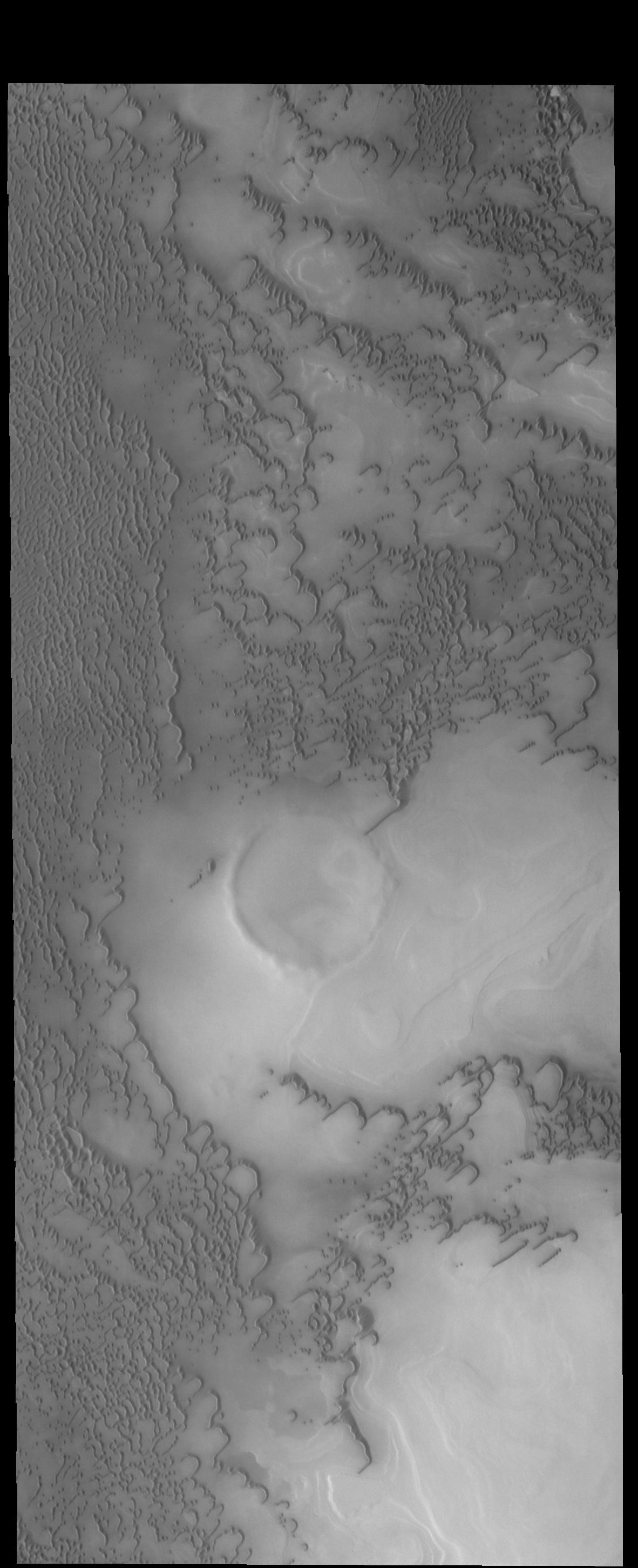
Context image
Like yesterday's image, this VIS image shows more north polar dunes. If you compare multiple dune images, you will see that the dunes can take different forms and cover different amounts of the plains. The differences are caused by many factors including the amount of available sand, the force and direction of the winds, and the topography of the underlying plains.
Orbit Number: 54806 Latitude: 77.9098 Longitude: 109.282 Instrument: VIS Captured: 2014-04-22 13:16
Background Info:
Please see the THEMIS Data Citation Note for details on crediting THEMIS images.
NASA's Jet Propulsion Laboratory manages the 2001 Mars Odyssey mission for NASA's Science Mission Directorate, Washington, D.C. The Thermal Emission Imaging System (THEMIS) was developed by Arizona State University, Tempe, in collaboration with Raytheon Santa Barbara Remote Sensing. The THEMIS investigation is led by Dr. Philip Christensen at Arizona State University. Lockheed Martin Astronautics, Denver, is the prime contractor for the Odyssey project, and developed and built the orbiter. Mission operations are conducted jointly from Lockheed Martin and from JPL, a division of the California Institute of Technology in Pasadena.
Cataloging Keywords:
| Name | Value | Additional Values |
|---|---|---|
| Target | Mars | |
| System | ||
| Target Type | Planet | |
| Mission | 2001 Mars Odyssey | |
| Instrument Host | Mars Odyssey | |
| Host Type | Orbiter | |
| Instrument | Thermal Emission Imaging System (THEMIS) | |
| Detector | ||
| Extra Keywords | Dune, Grayscale, Thermal | |
| Acquisition Date | ||
| Release Date | 2014-07-11 | |
| Date in Caption | 2014-04-22 | |
| Image Credit | NASA/JPL-Caltech/ASU | |
| Source | photojournal.jpl.nasa.gov/catalog/PIA18505 | |
| Identifier | PIA18505 | |