|
Mantled Terrain in the Southern Mid-Latitudes
- Click the image above for a larger view
- Full-Res JPEG (2880 x 1800) (874.7 kB)
- Full-Res TIFF (2880 x 1800) (15.6 MB)
Caption:
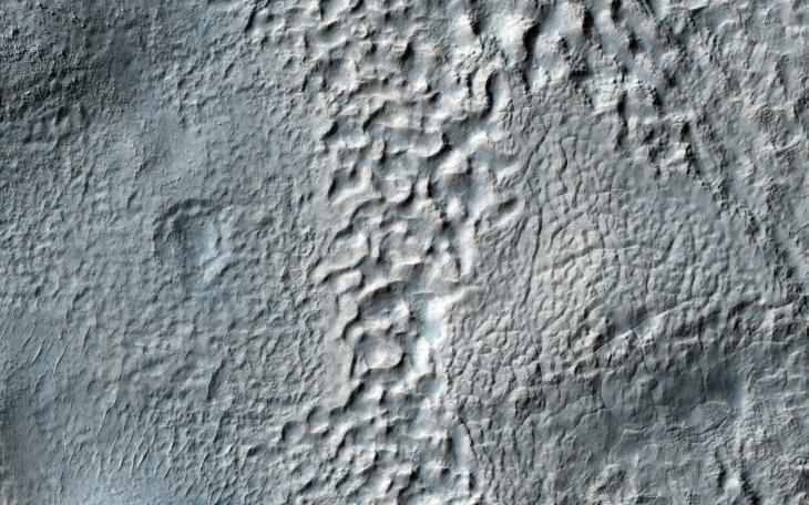
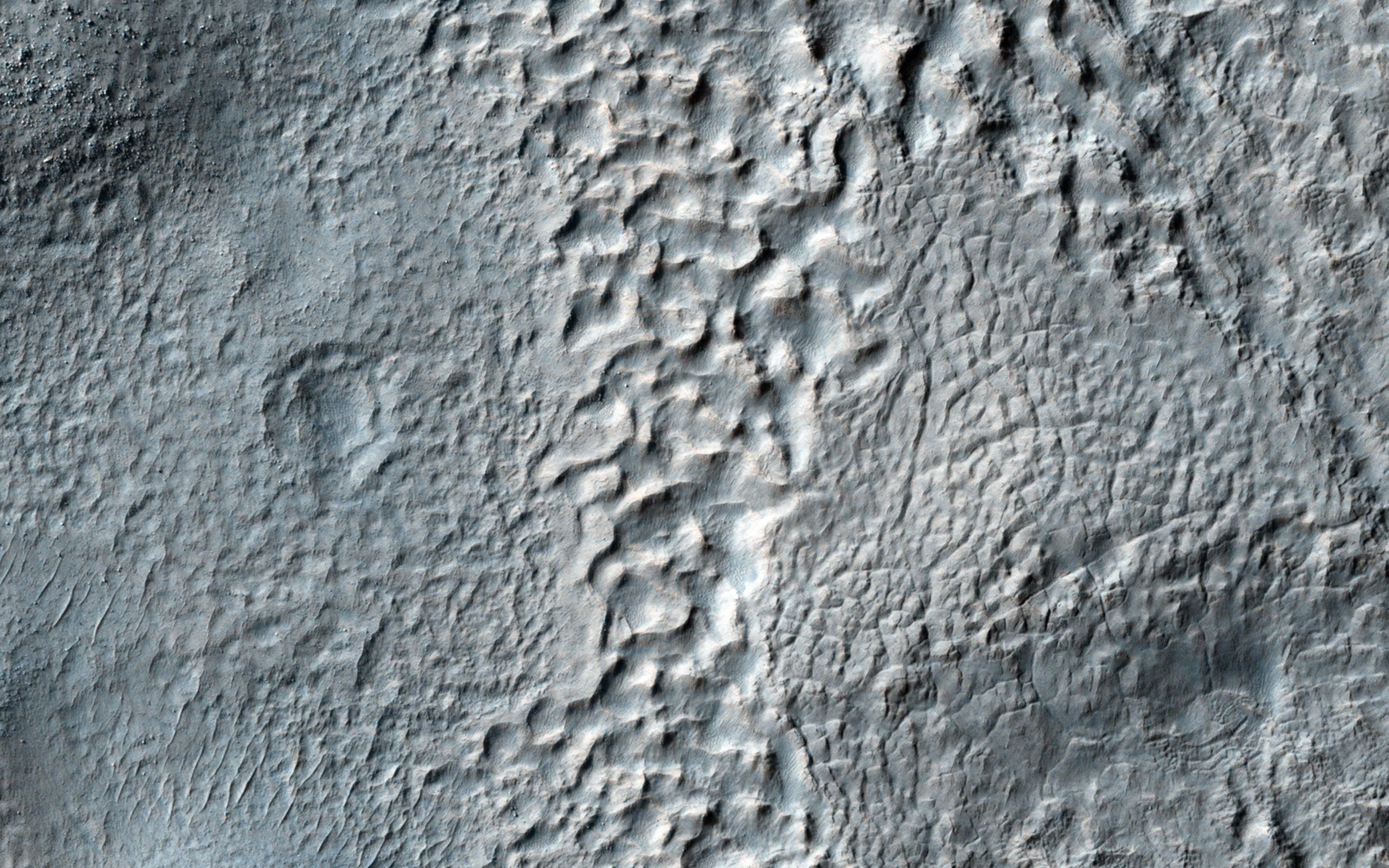
Map Projected Browse Image
Click on the image for larger version
The mid-latitudes of Mars (approximately 30 to 60 degrees, north and south) are covered in ice-rich mantling deposits in varying states of degradation.
This mantle is thought to be deposited as snow during periods when the angle of the tilt of Mars' rotational axis-called obliquity-is much higher, which last happened around 10 million years ago.
This HiRISE image shows terrain typical of these mantling deposits in the Southern Hemisphere, east of Reull Vallis. The pitted texture suggests that ice is sublimating out from the deposits as the region is warmed under current lower obliquity conditions.
Background Info:
HiRISE is one of six instruments on NASA's Mars Reconnaissance Orbiter. The University of Arizona, Tucson, operates HiRISE, which was built by Ball Aerospace & Technologies Corp., Boulder, Colorado. NASA's Jet Propulsion Laboratory, a division of the California Institute of Technology in Pasadena, manages the Mars Reconnaissance Orbiter Project for NASA's Science Mission Directorate, Washington.
Cataloging Keywords:
| Name | Value | Additional Values |
|---|---|---|
| Target | Mars | |
| System | ||
| Target Type | Planet | |
| Mission | Mars Reconnaissance Orbiter (MRO) | |
| Instrument Host | Mars Reconnaissance Orbiter | |
| Host Type | Orbiter | |
| Instrument | High Resolution Imaging Science Experiment (HiRISE) | |
| Detector | ||
| Extra Keywords | Color, Map, Rotation | |
| Acquisition Date | ||
| Release Date | 2014-08-27 | |
| Date in Caption | ||
| Image Credit | NASA/JPL-Caltech/Univ. of Arizona | |
| Source | photojournal.jpl.nasa.gov/catalog/PIA18775 | |
| Identifier | PIA18775 | |