
|
Wind Erosion
- Click the image above for a larger view
- Full-Res JPEG (1368 x 2639) (451.6 kB)
- Full-Res TIFF (1368 x 2639) (3.6 MB)
Caption:
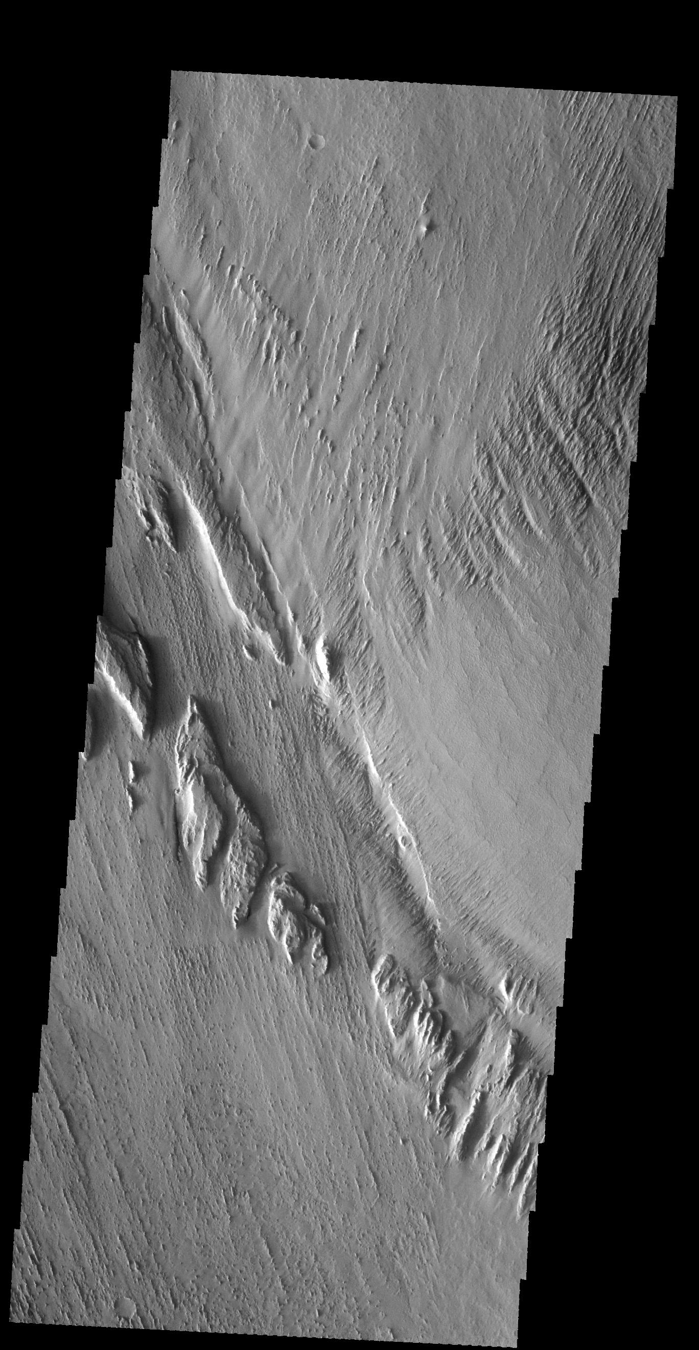
Context image
Long term winds have etched the surface in Memnonia Sulci. Partial cemented surface materials are easily eroded by the wind, forming linear ridges called yardangs. The multiple direction of yardangs in this VIS image indicate that there were at least two different wind directions in this area.
Orbit Number: 59217 Latitude: -8.33112 Longitude: 186.506 Instrument: VIS Captured: 2015-04-20 15:12
Background Info:
Please see the THEMIS Data Citation Note for details on crediting THEMIS images.
NASA's Jet Propulsion Laboratory manages the 2001 Mars Odyssey mission for NASA's Science Mission Directorate, Washington, D.C. The Thermal Emission Imaging System (THEMIS) was developed by Arizona State University, Tempe, in collaboration with Raytheon Santa Barbara Remote Sensing. The THEMIS investigation is led by Dr. Philip Christensen at Arizona State University. Lockheed Martin Astronautics, Denver, is the prime contractor for the Odyssey project, and developed and built the orbiter. Mission operations are conducted jointly from Lockheed Martin and from JPL, a division of the California Institute of Technology in Pasadena.
Cataloging Keywords:
| Name | Value | Additional Values |
|---|---|---|
| Target | Mars | |
| System | ||
| Target Type | Planet | |
| Mission | 2001 Mars Odyssey | |
| Instrument Host | Mars Odyssey | |
| Host Type | Orbiter | |
| Instrument | Thermal Emission Imaging System (THEMIS) | |
| Detector | ||
| Extra Keywords | Grayscale, Thermal | |
| Acquisition Date | ||
| Release Date | 2015-07-02 | |
| Date in Caption | 2015-04-20 | |
| Image Credit | NASA/JPL-Caltech/ASU | |
| Source | photojournal.jpl.nasa.gov/catalog/PIA19502 | |
| Identifier | PIA19502 | |