|
Water Ice on Pluto
- Click the image above for a larger view
- Full-Res JPEG (2707 x 1072) (427.7 kB)
- Full-Res TIFF (2707 x 1072) (3.9 MB)
Caption:
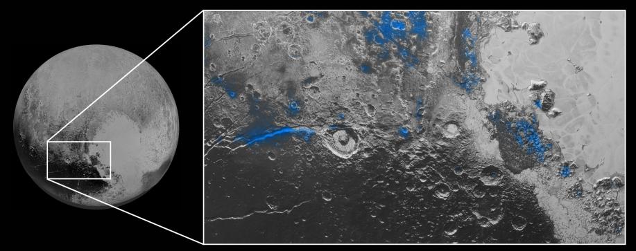
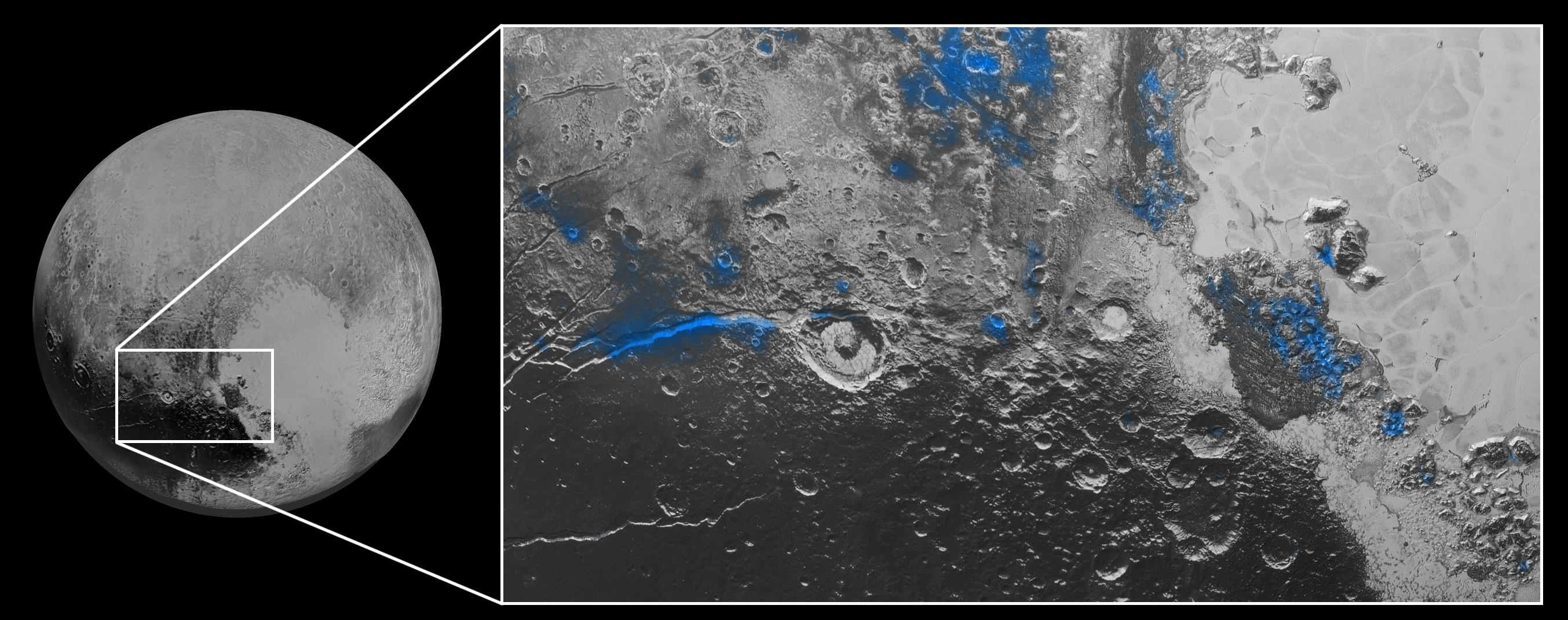
Regions with exposed water ice are highlighted in blue in this composite image from New Horizons' Ralph instrument, combining visible imagery from the Multispectral Visible Imaging Camera (MVIC) with infrared spectroscopy from the Linear Etalon Imaging Spectral Array (LEISA). The strongest signatures of water ice occur along Virgil Fossa, just west of Elliot crater on the left side of the inset image, and also in Viking Terra near the top of the frame. A major outcrop also occurs in Baré Montes towards the right of the image, along with numerous much smaller outcrops, mostly associated with impact craters and valleys between mountains. The scene is approximately 280 miles (450 kilometers) across. Note that all surface feature names are informal.
Background Info:
The Johns Hopkins University Applied Physics Laboratory in Laurel, Maryland, designed, built, and operates the New Horizons spacecraft, and manages the mission for NASA's Science Mission Directorate. The Southwest Research Institute, based in San Antonio, leads the science team, payload operations and encounter science planning. New Horizons is part of the New Frontiers Program managed by NASA's Marshall Space Flight Center in Huntsville, Alabama.
Cataloging Keywords:
| Name | Value | Additional Values |
|---|---|---|
| Target | Pluto | Mars |
| System | Pluto | Kuiper Belt |
| Target Type | Dwarf Planet | KBO, Planet |
| Mission | New Horizons | Viking |
| Instrument Host | New Horizons | |
| Host Type | Flyby Spacecraft | |
| Instrument | Linear Etalon Imaging Spectral Array (LEISA) | Multispectral Visible Imaging Camera (MVIC) |
| Detector | ||
| Extra Keywords | Color, Crater, Impact, Infrared, Mountain, Water | |
| Acquisition Date | ||
| Release Date | 2015-10-08 | |
| Date in Caption | ||
| Image Credit | NASA/Johns Hopkins University Applied Physics Laboratory/Southwest Research Institute | |
| Source | photojournal.jpl.nasa.gov/catalog/PIA19963 | |
| Identifier | PIA19963 | |