|
For a Decade Orbiting Mars: One Recent View
- Click the image above for a larger view
- Full-Res JPEG (1280 x 960) (200.3 kB)
- Full-Res TIFF (1280 x 960) (3.7 MB)
Caption:
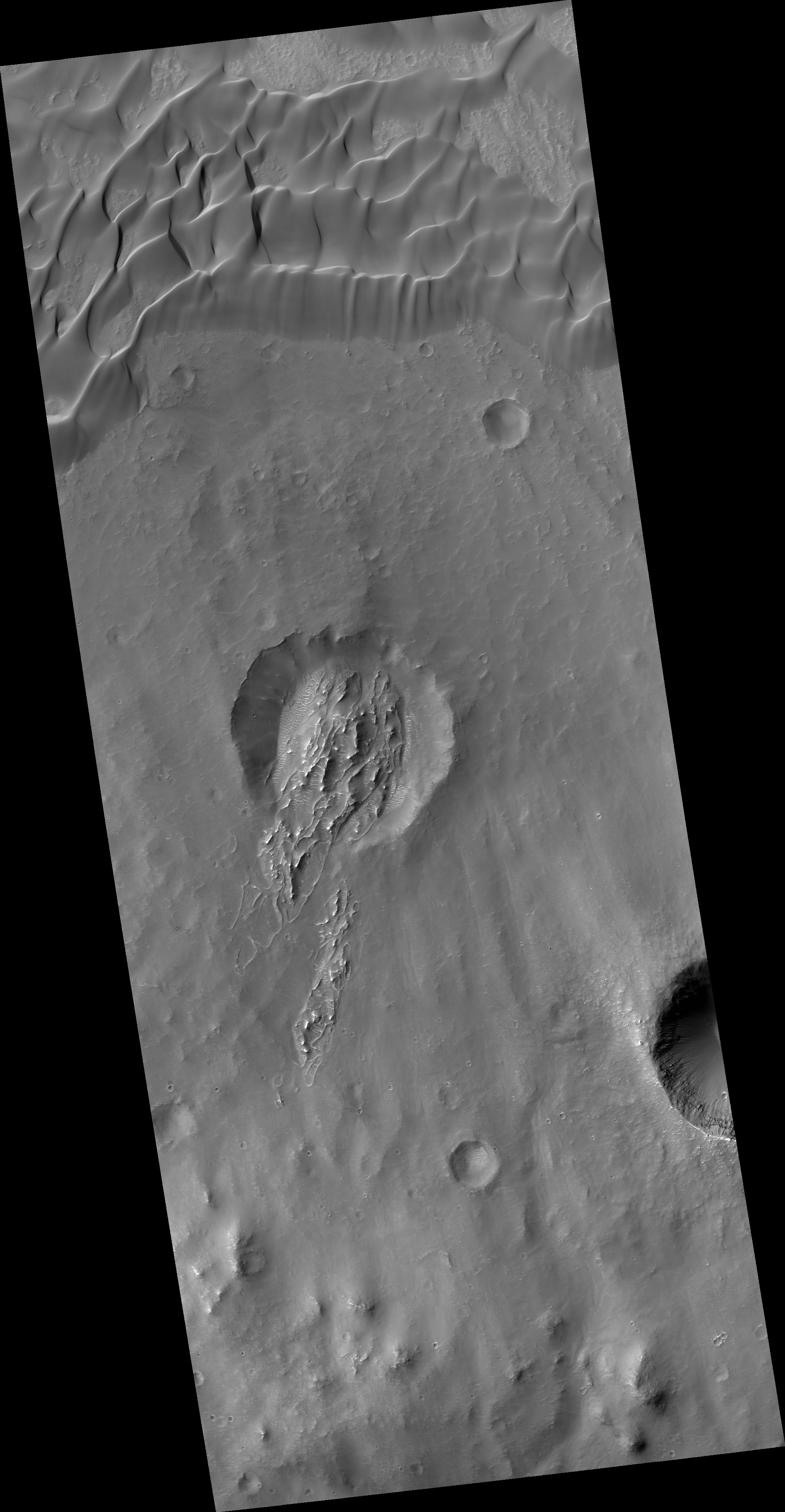
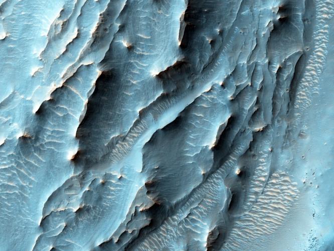
Map Projected Browse Image
Click on the image for larger version
NASA's Mars Reconnaissance Orbiter, nearing the 10th anniversary of its arrival at Mars, used its High Resolution Imaging Science Experiment (HiRISE) camera to obtain this view of an area with unusual texture on the southern floor of Gale Crater.
This area shown hosts many distinctive landforms in a different part of Gale Crater from where NASA's Curiosity rover is working. This view spans about half a mile or one kilometer across, with north toward the top. It shows about half of the floor area of a small crater lying within Gale Crater, which is 96 miles (154 kilometers) in diameter. An enigmatic deposit appears to have flowed into the small crater from the south.
The location of the site in this image is 6.2 degrees south latitude, 137.7 degrees east latitude. The image is an excerpt from HiRISE observation ESP_043961_1740, taken on Dec. 12, 2015. Other image products from this observation are available at http://hirise.lpl.arizona.edu/ESP_043961_1740 .
Background Info:
HiRISE is one of six instruments on the Mars Reconnaissance Orbiter. The University of Arizona, Tucson, operates HiRISE, which was built by Ball Aerospace & Technologies Corp., Boulder, Colorado. NASA's Jet Propulsion Laboratory, a division of the California Institute of Technology in Pasadena, manages the Mars Reconnaissance Orbiter Project for NASA's Science Mission Directorate, Washington. Lockheed Martin Space Systems, Denver, built the orbiter and collaborates with JPL to operate it.
Cataloging Keywords:
| Name | Value | Additional Values |
|---|---|---|
| Target | Mars | |
| System | ||
| Target Type | Planet | |
| Mission | Mars Reconnaissance Orbiter (MRO) | Mars Science Laboratory (MSL) |
| Instrument Host | Mars Reconnaissance Orbiter | Curiosity Rover |
| Host Type | Orbiter | Rover |
| Instrument | High Resolution Imaging Science Experiment (HiRISE) | |
| Detector | ||
| Extra Keywords | Color, Crater, Map | |
| Acquisition Date | ||
| Release Date | 2016-03-09 | |
| Date in Caption | 2015-12-12 | |
| Image Credit | NASA/JPL-Caltech/Univ. of Arizona | |
| Source | photojournal.jpl.nasa.gov/catalog/PIA20167 | |
| Identifier | PIA20167 | |