|
Looking for Ice
- Click the image above for a larger view
- Full-Res JPEG (2880 x 1800) (1.8 MB)
- Full-Res TIFF (2880 x 1800) (15.6 MB)
Caption:
Map Projected Browse Image
Click on the image for larger version
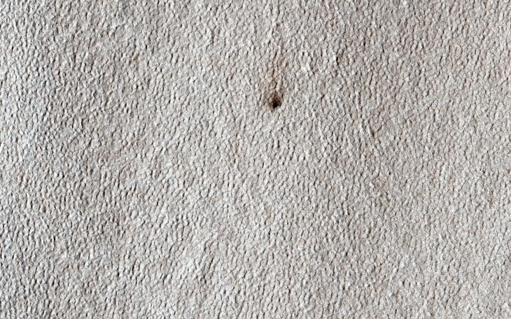
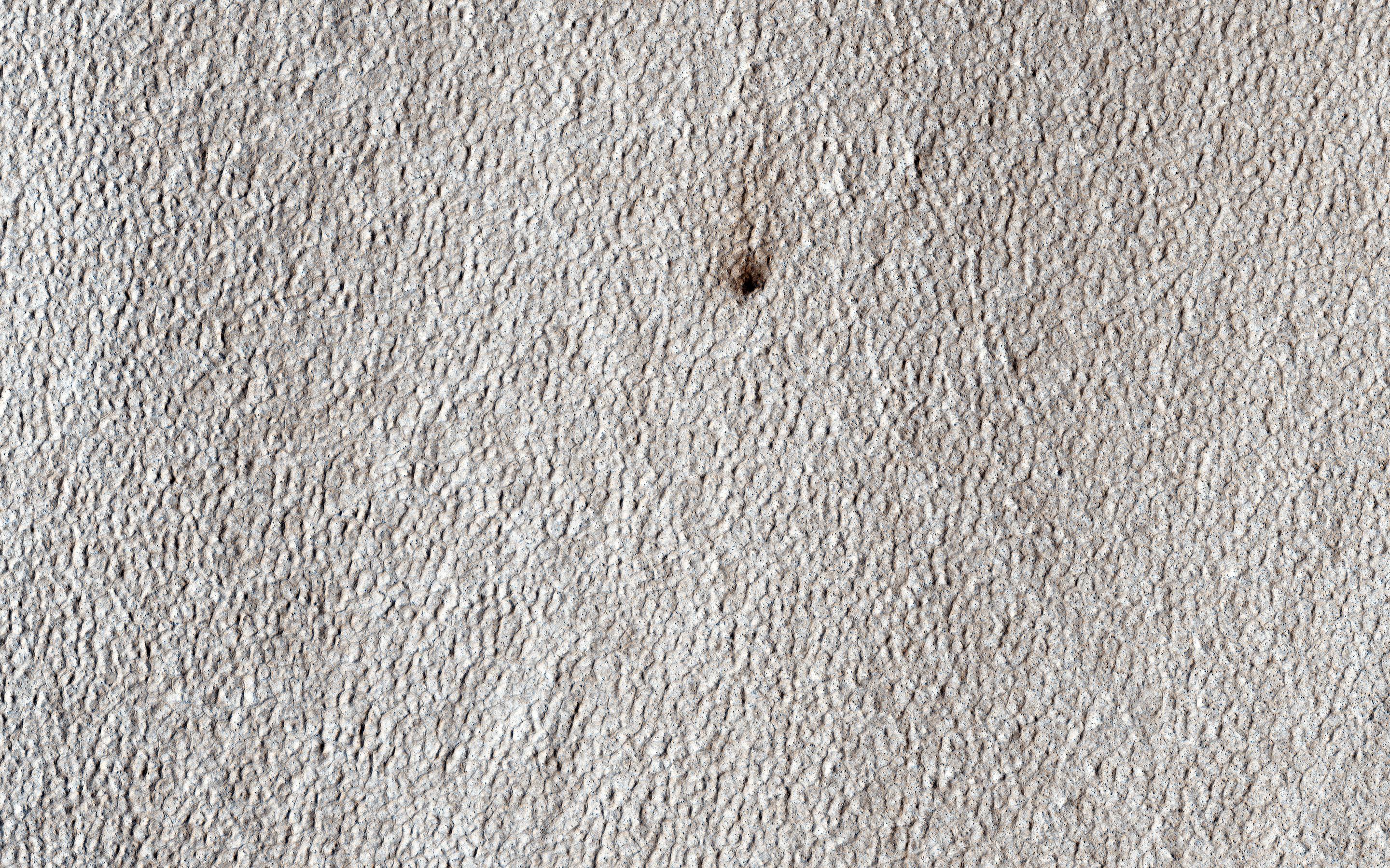
One of MRO's ongoing campaigns is a search for new impact craters. At high latitudes, such craters often expose ice, which appears bright in HiRISE enhanced-color images. This image was targeted to look at a candidate new crater on a lobate apron. Such aprons are often ice-rich, but the crater shows no bright material that would indicate ice.
Why not? The most likely reason is that the crater simply didn't dig deeply enough. This crater is barely visible with HiRISE , and probably only excavated down to 10 centimeters or so. At this latitude, ice is often much deeper, first appearing tens of centimeters (a foot or more) below the surface. Near the poles, colder temperatures cause ice to be shallower, as NASA's Phoenix mission discovered in 2008.
Background Info:
The University of Arizona, Tucson, operates HiRISE, which was built by Ball Aerospace & Technologies Corp., Boulder, Colo. NASA's Jet Propulsion Laboratory, a division of the California Institute of Technology in Pasadena, manages the Mars Reconnaissance Orbiter Project for NASA's Science Mission Directorate, Washington.
Cataloging Keywords:
| Name | Value | Additional Values |
|---|---|---|
| Target | Mars | |
| System | ||
| Target Type | Planet | |
| Mission | Mars Reconnaissance Orbiter (MRO) | Phoenix |
| Instrument Host | Mars Reconnaissance Orbiter | Phoenix Lander |
| Host Type | Orbiter | Lander |
| Instrument | High Resolution Imaging Science Experiment (HiRISE) | |
| Detector | ||
| Extra Keywords | Color, Crater, Impact, Map | |
| Acquisition Date | ||
| Release Date | 2016-03-23 | |
| Date in Caption | ||
| Image Credit | NASA/JPL-Caltech/Univ. of Arizona | |
| Source | photojournal.jpl.nasa.gov/catalog/PIA20540 | |
| Identifier | PIA20540 | |