|
On the Shape of Impact Craters
- Click the image above for a larger view
- Full-Res JPEG (2880 x 1800) (860.9 kB)
- Full-Res TIFF (2880 x 1800) (5.2 MB)
Caption:
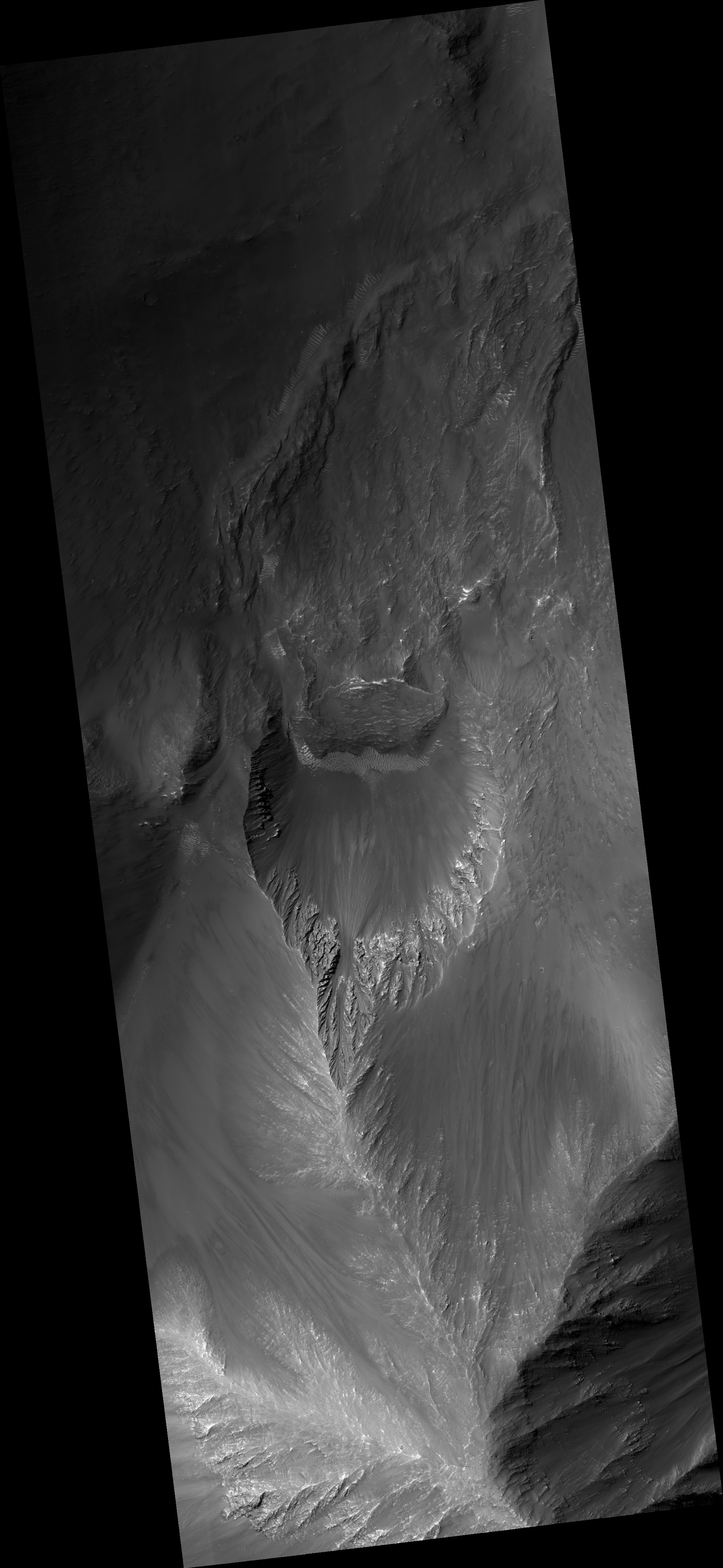
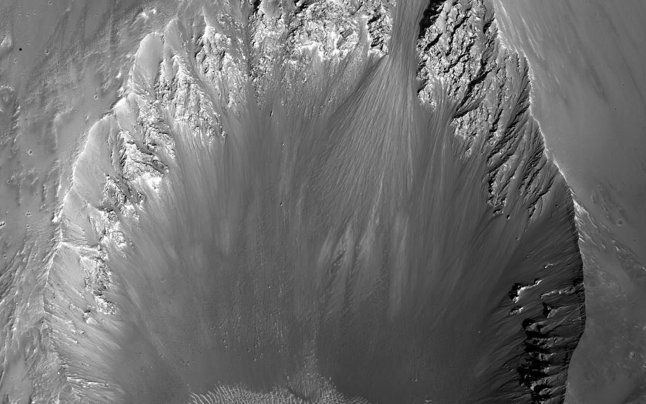
Map Projected Browse Image
Click on the image for larger version
The shape of a crater can depend on factors including the angle of impact and the pre-impact slope and topography.
This image shows a roughly 3-kilometer impact crater , formed on the sloping walls of Tithonium Chasma, part of the large Valles Marineris canyon system. We can see that this crater is non-circular, measuring about 3 by 4 kilometers. The ejecta -- the debris that is generated and thrown out by an impact -- will typically distribute itself evenly around the outside of the crater rim where the pre-impact surface is flat and the angle of impact is not too low. However, due to the highly inclined nature of the surface here, the ejecta deposited preferentially downslope, forming a tongue-like deposit .
Additionally, when examining the area around the crater, we see smooth, dark-toned flow-like features superimposed on the ejecta blanket and flowing downslope . These are believed to be composed of impact -- or the mixture of rock and other material that melted upon impact -- and flowed down the slope before hardening. These potential impact melt deposits also occur as smooth ponds, which pooled on the surface of a portion of the ejecta that did not escape the crater interior.
Background Info:
The University of Arizona, Tucson, operates HiRISE, which was built by Ball Aerospace & Technologies Corp., Boulder, Colo. NASA's Jet Propulsion Laboratory, a division of the California Institute of Technology in Pasadena, manages the Mars Reconnaissance Orbiter Project for NASA's Science Mission Directorate, Washington.
Cataloging Keywords:
| Name | Value | Additional Values |
|---|---|---|
| Target | Mars | |
| System | ||
| Target Type | Planet | |
| Mission | Mars Reconnaissance Orbiter (MRO) | Mariner |
| Instrument Host | Mars Reconnaissance Orbiter | |
| Host Type | Orbiter | Flyby Spacecraft |
| Instrument | High Resolution Imaging Science Experiment (HiRISE) | |
| Detector | ||
| Extra Keywords | Crater, Grayscale, Impact, Map | |
| Acquisition Date | ||
| Release Date | 2016-05-18 | |
| Date in Caption | ||
| Image Credit | NASA/JPL-Caltech/Univ. of Arizona | |
| Source | photojournal.jpl.nasa.gov/catalog/PIA20587 | |
| Identifier | PIA20587 | |