|
Scars of Erosion
- Click the image above for a larger view
- Full-Res JPEG (2880 x 1800) (489.1 kB)
- Full-Res TIFF (2880 x 1800) (12.9 MB)
Caption:

Map Projected Browse Image
Click on the image for larger version
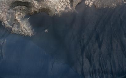
This large crescent dune in Kaiser Crater shows the scars of many types of seasonal erosional activities. Along its downwind slope are large gullies which are active during winter, when frost drives dune material downslope, carving out channels and creating fan-shaped aprons.
On the upwind slope (bottom), dust devil tracks are visible: dark lines and curliques created during the spring season by small wind vortices vacuuming up a thin layer of dust and exposing the dark dune sand.
This is a stereo pair with ESP_021720_1330 .
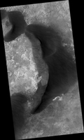
Note: Both the cutout and the above image are rotated so that North is to the right.
The map is projected here at a scale of 25 centimeters (9.8 inches) per pixel. [The original image scale is 25.3 centimeters (10 inches) per pixel (with 1 x 1 binning); objects on the order of 76 centimeters (30 inches) across are resolved.] North is up.
Background Info:
The University of Arizona, Tucson, operates HiRISE, which was built by Ball Aerospace & Technologies Corp., Boulder, Colo. NASA's Jet Propulsion Laboratory, a division of Caltech in Pasadena, California, manages the Mars Reconnaissance Orbiter Project for NASA's Science Mission Directorate, Washington.
Cataloging Keywords:
| Name | Value | Additional Values |
|---|---|---|
| Target | Mars | |
| System | ||
| Target Type | Planet | |
| Mission | Mars Reconnaissance Orbiter (MRO) | |
| Instrument Host | Mars Reconnaissance Orbiter | |
| Host Type | Orbiter | |
| Instrument | High Resolution Imaging Science Experiment (HiRISE) | |
| Detector | ||
| Extra Keywords | Color, Crater, Dune, Dust, Map, Rotation | |
| Acquisition Date | ||
| Release Date | 2017-02-16 | |
| Date in Caption | ||
| Image Credit | NASA/JPL-Caltech/Univ. of Arizona | |
| Source | photojournal.jpl.nasa.gov/catalog/PIA21458 | |
| Identifier | PIA21458 | |
