|
A Decade of Compiling the Sharpest Mars Map
- Click the image above for a larger view
- Full-Res JPEG (10000 x 5000) (8.2 MB)
- Full-Res TIFF (10000 x 5000) (48.7 MB)
Caption:

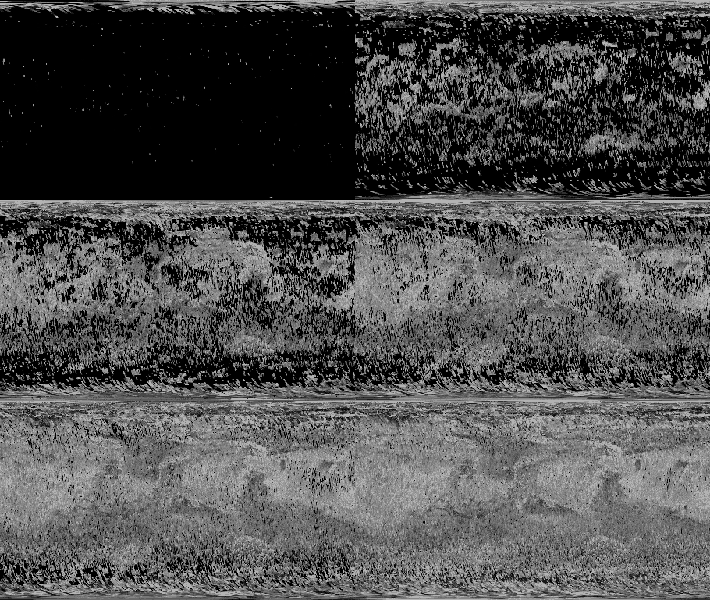
Click on the image for larger animation
View the full resolution animation
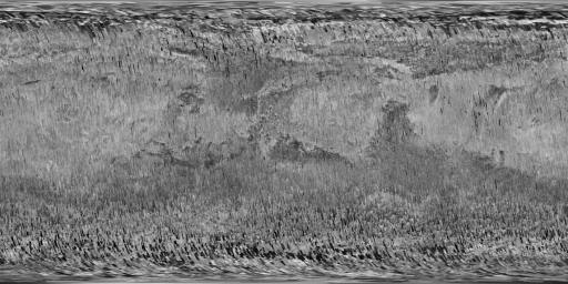
The Context Camera (CTX) on NASA's Mars Reconnaissance Orbiter (MRO) has been taking images of Mars for more than 10 years, sharp enough to show the shapes of features as small as a tennis court. The compiled images from CTX now cover more than 99 percent of Mars.
No other camera has ever shown us so much of Mars in such high resolution.
This animation tracks how the coverage accumulated over the period from late 2006 to early 2017 to form a nearly complete map of Mars. Each frame adds the locations of one month's worth of CTX observations.
This sequence of images is presented in reduced resolution to show the global coverage. From Mars orbit, each observation by CTX covers a swath of ground about 18.6 miles (30 kilometers) wide, at a resolution of about 20 feet (6 meters) per pixel. A still-image mosaic, PIA21488 , shows the final frame of this animation at greater resolution, though still far less than in individual CTX observations.
As of March 2017, the Context Camera has taken about 90,000 images since the spacecraft began examining Mars from orbit in late 2006. In addition to covering 99.1 percent of the surface of Mars at least once, this camera has observed more than 60 percent of Mars more than once, checking for changes over time and providing stereo pairs for 3-D modeling of the surface.
Background Info:
Malin Space Science Systems, San Diego, built and operates CTX, one of six instruments on the orbiter. NASA's Jet Propulsion Laboratory, a division of Caltech in Pasadena, California, manages the MRO Project for NASA's Science Mission Directorate, Washington. Lockheed Martin Space Systems, Denver, built the orbiter and collaborates with JPL to operate it.
Cataloging Keywords:
| Name | Value | Additional Values |
|---|---|---|
| Target | Mars | |
| System | ||
| Target Type | Planet | |
| Mission | Mars Reconnaissance Orbiter (MRO) | |
| Instrument Host | Mars Reconnaissance Orbiter | |
| Host Type | Orbiter | |
| Instrument | Context Camera (CTX) | |
| Detector | ||
| Extra Keywords | Grayscale, Map | |
| Acquisition Date | ||
| Release Date | 2017-03-29 | |
| Date in Caption | ||
| Image Credit | NASA/JPL-Caltech/MSSS | |
| Source | photojournal.jpl.nasa.gov/catalog/PIA21487 | |
| Identifier | PIA21487 | |
