|
Hexagons in Icy Terrain
- Click the image above for a larger view
- Full-Res JPEG (2880 x 1800) (1.4 MB)
- Full-Res TIFF (2880 x 1800) (15.6 MB)
Caption:
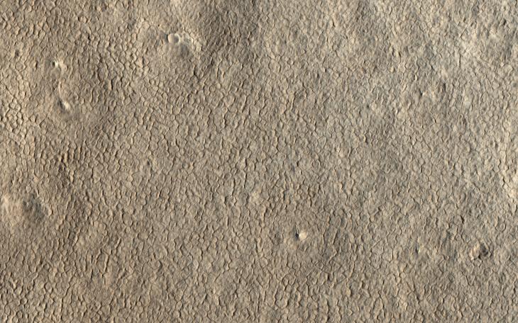
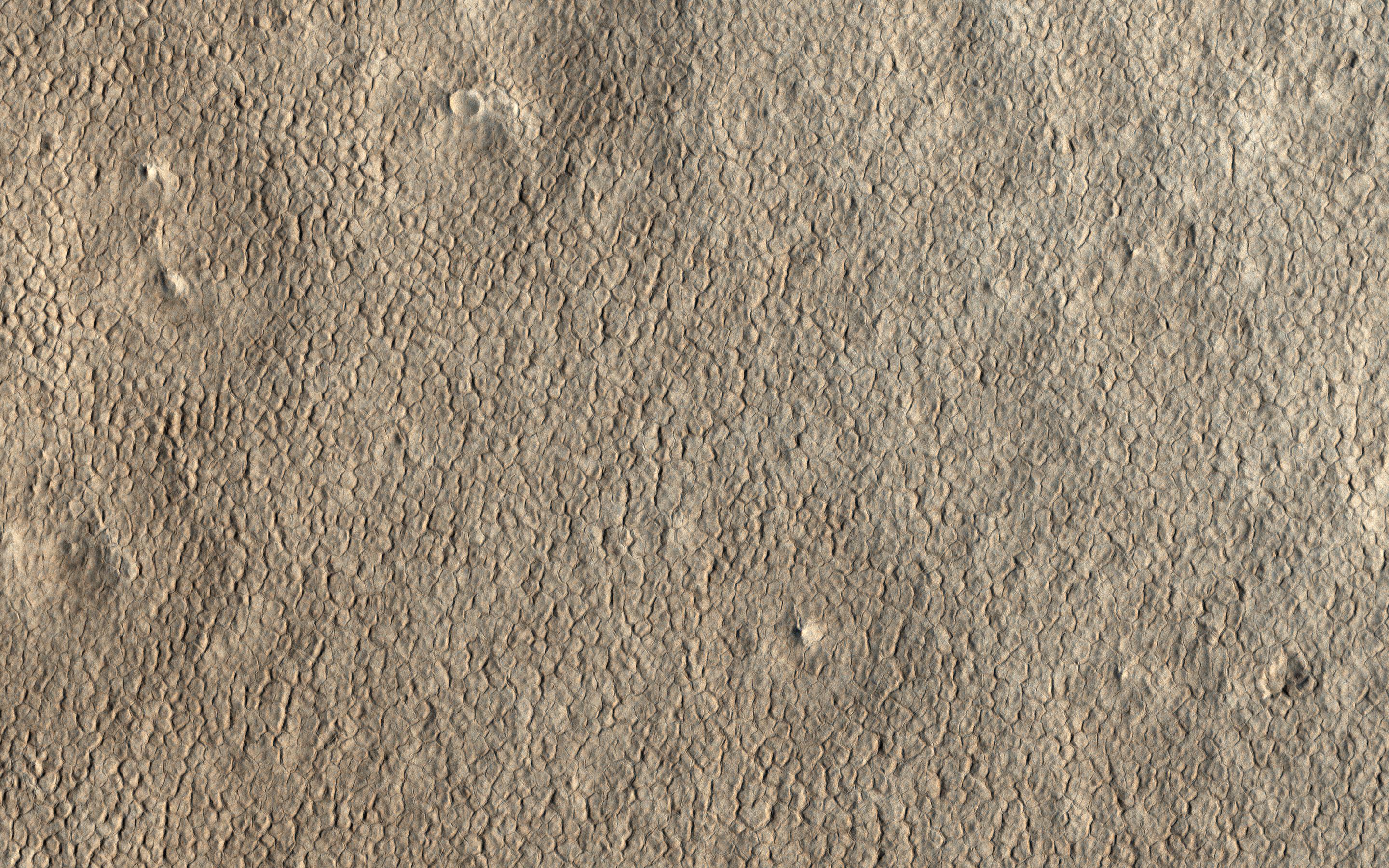
Map Projected Browse Image
Click on the image for larger version
Ground cemented by ice cover the high latitudes of Mars, much as they do on Earth's cold climates. A common landform that occurs in icy terrain are polygons as shown in this image from NASA's Mars Reconnaissance Orbiter (MRO).
Polygonal patterns form by winter cooling and contraction cracking of the frozen ground. Over time these thin cracks develop and coalesce into a honeycomb network, with a few meters spacing between neighboring cracks. Shallow troughs mark the locations of the underground cracks, which are clearly visible form orbit .
The map is projected here at a scale of 25 centimeters (9.8 inches) per pixel. [The original image scale is 30.2 centimeters (11.9 inches) per pixel (with 1 x 1 binning); objects on the order of 91 centimeters (35.8 inches) across are resolved.] North is up.
Background Info:
The University of Arizona, Tucson, operates HiRISE, which was built by Ball Aerospace & Technologies Corp., Boulder, Colorado. NASA's Jet Propulsion Laboratory, a division of Caltech in Pasadena, California, manages the Mars Reconnaissance Orbiter Project for NASA's Science Mission Directorate, Washington.
Cataloging Keywords:
| Name | Value | Additional Values |
|---|---|---|
| Target | Mars | |
| System | ||
| Target Type | Planet | |
| Mission | Mars Reconnaissance Orbiter (MRO) | |
| Instrument Host | Mars Reconnaissance Orbiter | |
| Host Type | Orbiter | |
| Instrument | High Resolution Imaging Science Experiment (HiRISE) | |
| Detector | ||
| Extra Keywords | Color, Map | |
| Acquisition Date | ||
| Release Date | 2018-01-23 | |
| Date in Caption | ||
| Image Credit | NASA/JPL-Caltech/Univ. of Arizona | |
| Source | photojournal.jpl.nasa.gov/catalog/PIA22180 | |
| Identifier | PIA22180 | |