|
Splitting Slope Streaks
- Click the image above for a larger view
- Full-Res JPEG (3199 x 2452) (822.8 kB)
- Full-Res TIFF (3199 x 2452) (20.8 MB)
Caption:
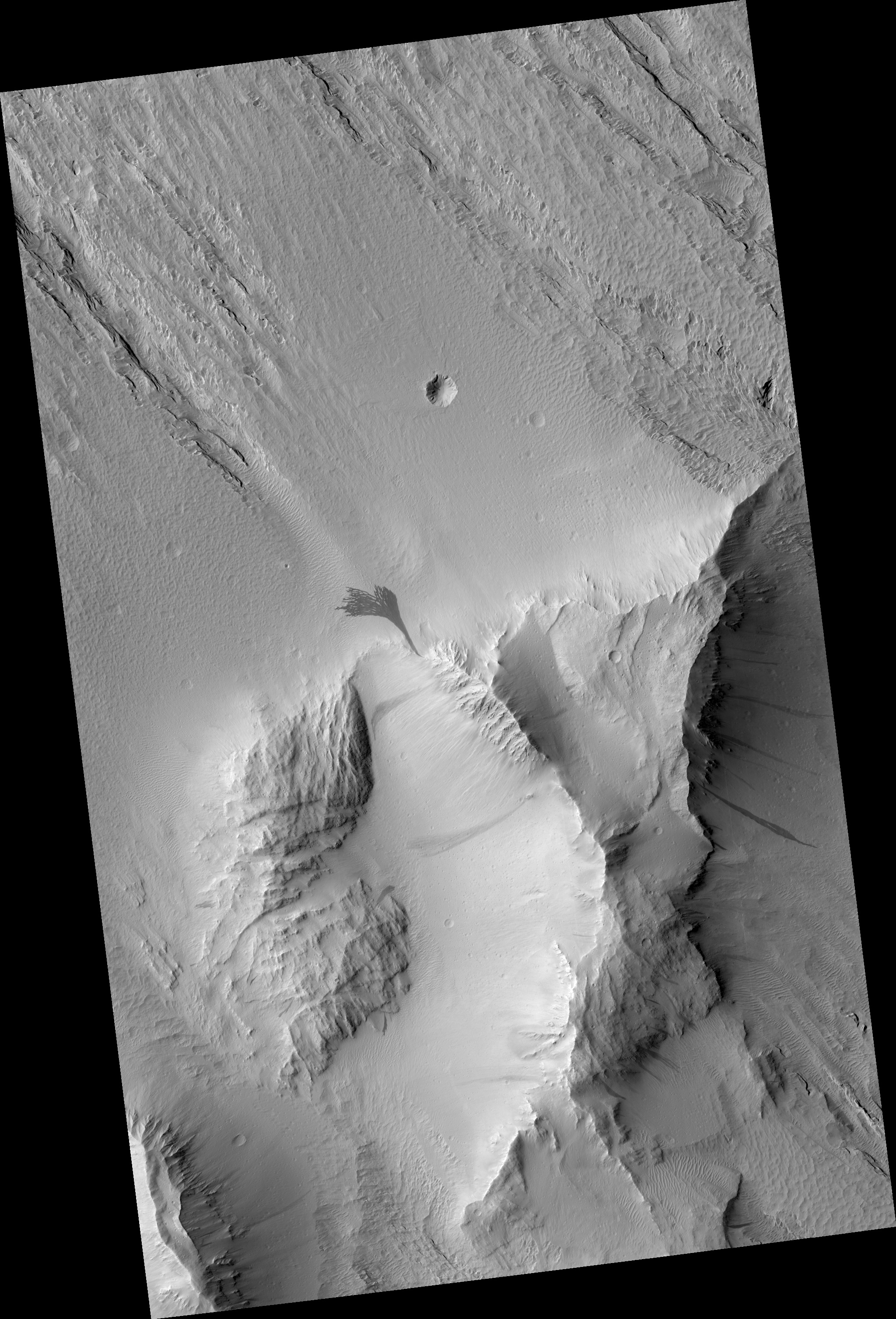
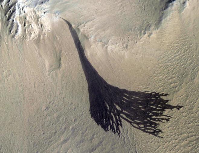
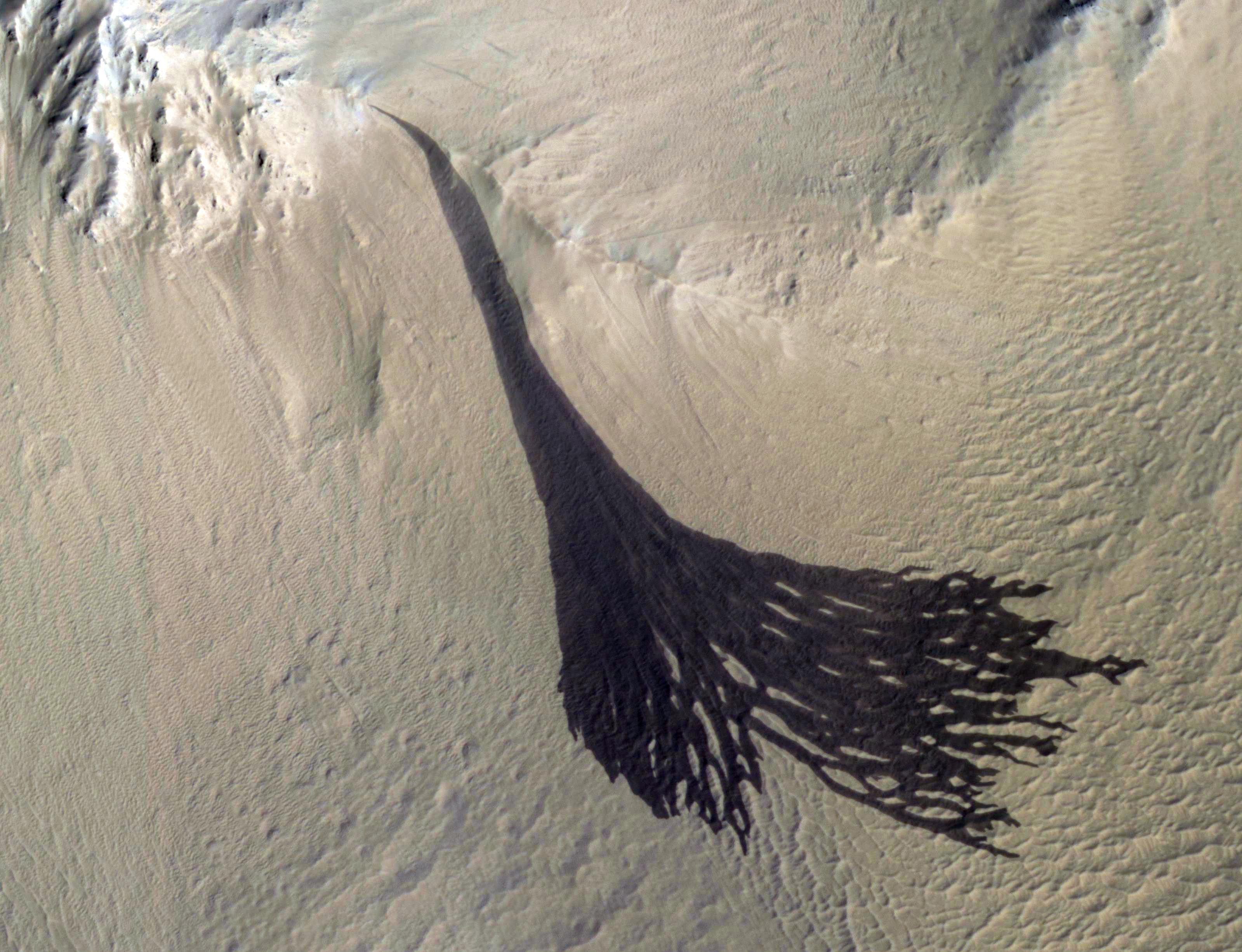
Map Projected Browse Image
Click on the image for larger version
This image from NASA's Mars Reconnaissance Orbiter (MRO) shows streaks forming on slopes when dust cascades downhill. The dark streak is an area of less dust compared to the brighter and reddish surroundings. What triggers these avalanches is not known, but might be related to sudden warming of the surface.
These streaks are often diverted by the terrain they flow down. This one has split into many smaller streaks where it encountered minor obstacles.
These streaks fade away over decades as more dust slowly settles out of the Martian sky.
The map is projected here at a scale of 25 centimeters (9.8 inches) per pixel. [The original image scale is 28.1 centimeters (11.1 inches) per pixel (with 1 x 1 binning); objects on the order of 84 centimeters (33.1 inches) across are resolved.] North is up.
Background Info:
The University of Arizona, Tucson, operates HiRISE, which was built by Ball Aerospace & Technologies Corp., Boulder, Colorado. NASA's Jet Propulsion Laboratory, a division of Caltech in Pasadena, California, manages the Mars Reconnaissance Orbiter Project for NASA's Science Mission Directorate, Washington.
Cataloging Keywords:
| Name | Value | Additional Values |
|---|---|---|
| Target | Mars | |
| System | ||
| Target Type | Planet | |
| Mission | Mars Reconnaissance Orbiter (MRO) | |
| Instrument Host | Mars Reconnaissance Orbiter | |
| Host Type | Orbiter | |
| Instrument | High Resolution Imaging Science Experiment (HiRISE) | |
| Detector | ||
| Extra Keywords | Color, Dust, Map | |
| Acquisition Date | ||
| Release Date | 2018-02-05 | |
| Date in Caption | ||
| Image Credit | NASA/JPL-Caltech/Univ. of Arizona | |
| Source | photojournal.jpl.nasa.gov/catalog/PIA22240 | |
| Identifier | PIA22240 | |