
|
Clays in the Eridania Basin
- Click the image above for a larger view
- Full-Res JPEG (2880 x 1800) (671.1 kB)
- Full-Res TIFF (2880 x 1800) (15.6 MB)
Caption:

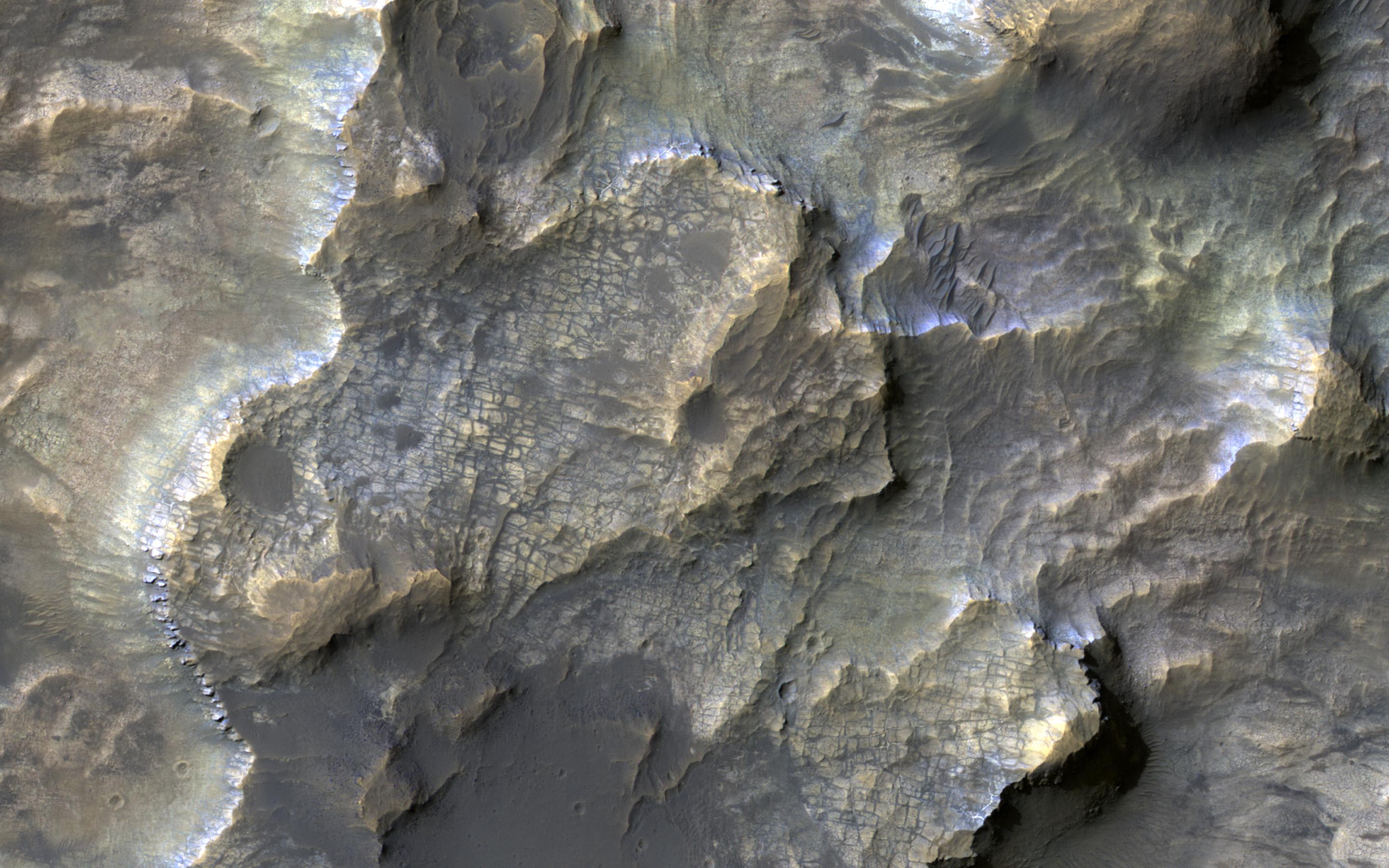
Map Projected Browse Image
Click on image for larger version
This colorful image, acquired on May 21, 2018 by NASA's Mars Reconnaissance Orbiter, shows clays within the Eridania basin region. Many scientists using orbital data have proposed that a large lake may have once existed here during the Late Noachian through Early Hesperian time periods, and then much of the water drained out to the north via Ma'adim Vallis.
Understanding where and what kind of clay exists within this region using CRISM data can help scientists learn more about how long the postulated lake existed and the water chemistry within the lake.
The map is projected here at a scale of 50 centimeters (19.7 inches) per pixel. [The original image scale is 55.3 centimeters (21.6 inches) per pixel (with 2 x 2 binning); objects on the order of 166 centimeters (65.4 inches) across are resolved.] North is up.
This is a stereo pair with PSP_010888_1510 .
Background Info:
The University of Arizona, Tucson, operates HiRISE, which was built by Ball Aerospace & Technologies Corp., Boulder, Colorado. NASA's Jet Propulsion Laboratory, a division of Caltech in Pasadena, California, manages the Mars Reconnaissance Orbiter Project for NASA's Science Mission Directorate, Washington.
Cataloging Keywords:
| Name | Value | Additional Values |
|---|---|---|
| Target | Mars | |
| System | ||
| Target Type | Planet | |
| Mission | Mars Reconnaissance Orbiter (MRO) | |
| Instrument Host | Mars Reconnaissance Orbiter | |
| Host Type | Orbiter | |
| Instrument | High Resolution Imaging Science Experiment (HiRISE) | Compact Reconnaissance Imaging Spectrometer for Mars (CRISM) |
| Detector | ||
| Extra Keywords | Color, Map, Water | |
| Acquisition Date | ||
| Release Date | 2018-07-09 | |
| Date in Caption | 2018-05-21 | |
| Image Credit | NASA/JPL-Caltech/Univ. of Arizona | |
| Source | photojournal.jpl.nasa.gov/catalog/PIA22588 | |
| Identifier | PIA22588 | |