|
Polar Ice
- Click the image above for a larger view
- Full-Res JPEG (986 x 2623) (440.3 kB)
- Full-Res TIFF (986 x 2623) (2.6 MB)
Caption:
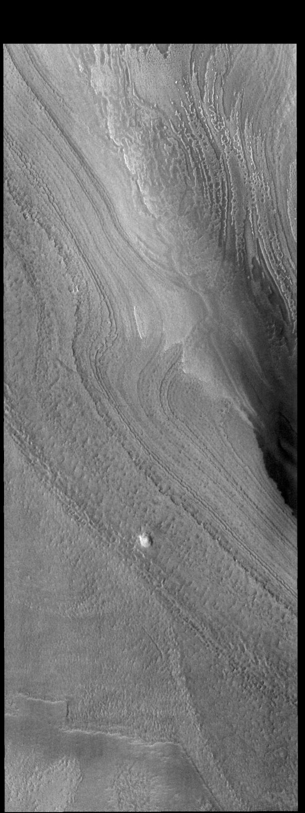
Context image
Today's VIS image shows a small part of the south polar cap. The layering of the cap is easy to see. The layers record the seasonal deposition of dust and ice over the course of 1000's of years. This image was taken during summer at the pole.
Orbit Number: 74904 Latitude: -85.4168 Longitude: 184.015 Instrument: VIS Captured: 2018-11-02 20:21
Background Info:
Please see the THEMIS Data Citation Note for details on crediting THEMIS images.
NASA's Jet Propulsion Laboratory manages the 2001 Mars Odyssey mission for NASA's Science Mission Directorate, Washington, D.C. The Thermal Emission Imaging System (THEMIS) was developed by Arizona State University, Tempe, in collaboration with Raytheon Santa Barbara Remote Sensing. The THEMIS investigation is led by Dr. Philip Christensen at Arizona State University. Lockheed Martin Astronautics, Denver, is the prime contractor for the Odyssey project, and developed and built the orbiter. Mission operations are conducted jointly from Lockheed Martin and from JPL, a division of the California Institute of Technology in Pasadena.
Cataloging Keywords:
| Name | Value | Additional Values |
|---|---|---|
| Target | Mars | |
| System | ||
| Target Type | Planet | |
| Mission | 2001 Mars Odyssey | |
| Instrument Host | Mars Odyssey | |
| Host Type | Orbiter | |
| Instrument | Thermal Emission Imaging System (THEMIS) | |
| Detector | ||
| Extra Keywords | Dust, Grayscale, Thermal | |
| Acquisition Date | ||
| Release Date | 2019-01-07 | |
| Date in Caption | 2018-11-02 | |
| Image Credit | NASA/JPL-Caltech/ASU | |
| Source | photojournal.jpl.nasa.gov/catalog/PIA22990 | |
| Identifier | PIA22990 | |