|
Multi-Elevation Gullies
- Click the image above for a larger view
- Full-Res JPEG (2880 x 1800) (1.3 MB)
- Full-Res TIFF (2880 x 1800) (15.6 MB)
Caption:

Map Projected Browse Image
Click on image for larger version
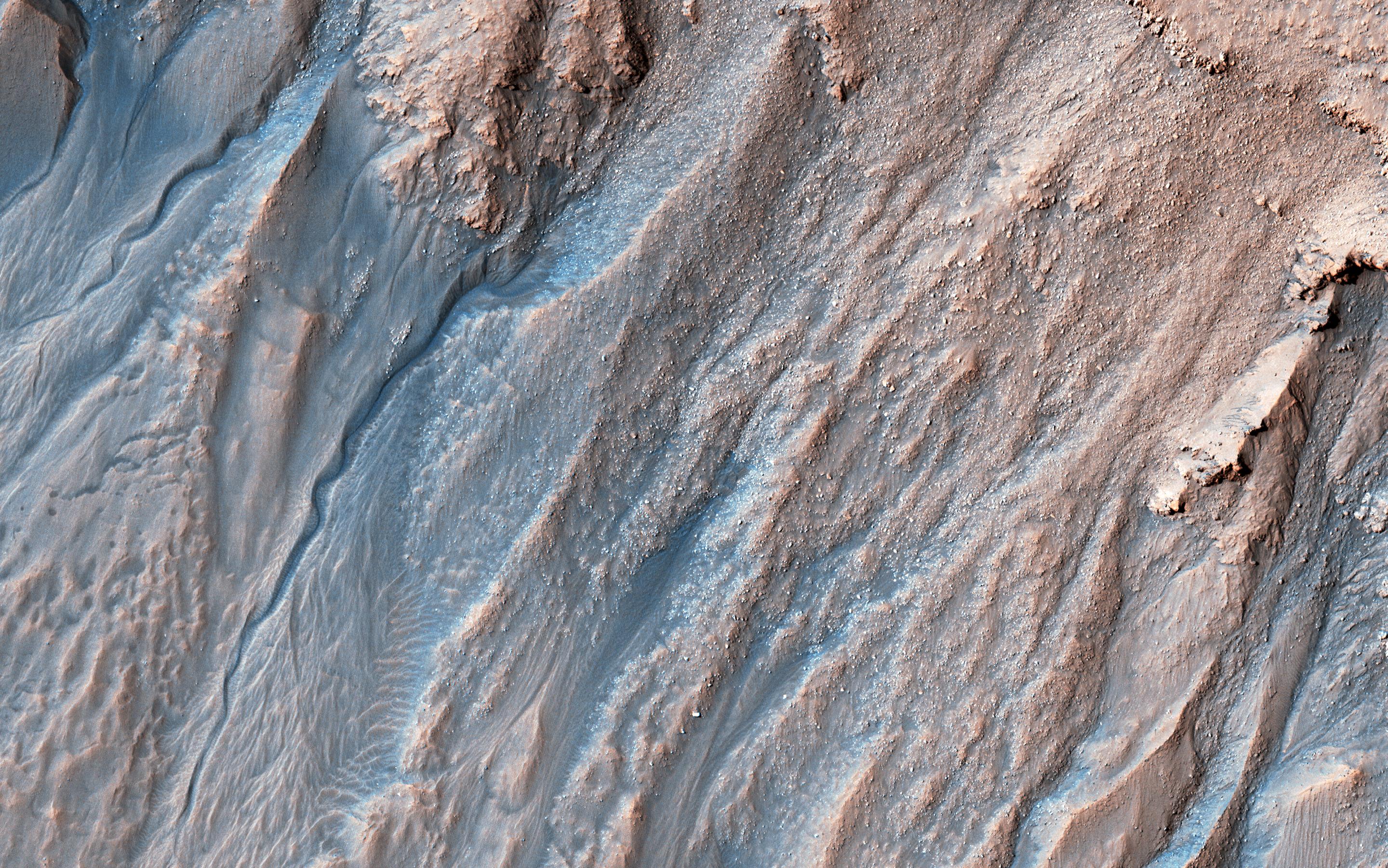
Gullies probably formed along the bouldery layers in the upper slopes of this unnamed crater within the last few million years. Gullies eroded these crater slopes and transported sediment downslope forming debris aprons multiple times.
These older apron surfaces were cut by numerous fractures running perpendicular to the slope. Subsequent episodes of gully activity eroded through these fractures and deposited new aprons.
On the floor of the crater are ridges with bouldery layers. These ridges may mark the furthest extent of glaciers that predate much of the original gully activity. Bright flows continue to form in these gullies seasonally.
In the upper gully regions, long shadows cast by jagged outcrops allow scientists to determine the heights and depths of landforms by measuring the length of the shadows cast by the ridges onto the gully floor.
The map is projected here at a scale of 25 centimeters (9.8 inches) per pixel. [The original image scale is 25.2 centimeters (9.9 inches) per pixel (with 1 x 1 binning); objects on the order of 75 centimeters (29.5 inches) across are resolved.] North is up.
Background Info:
The University of Arizona, Tucson, operates HiRISE, which was built by Ball Aerospace & Technologies Corp., Boulder, Colorado. NASA's Jet Propulsion Laboratory, a division of Caltech in Pasadena, California, manages the Mars Reconnaissance Orbiter Project for NASA's Science Mission Directorate, Washington.
Cataloging Keywords:
| Name | Value | Additional Values |
|---|---|---|
| Target | Mars | |
| System | ||
| Target Type | Planet | |
| Mission | Mars Reconnaissance Orbiter (MRO) | |
| Instrument Host | Mars Reconnaissance Orbiter | |
| Host Type | Orbiter | |
| Instrument | High Resolution Imaging Science Experiment (HiRISE) | |
| Detector | ||
| Extra Keywords | Color, Crater, Map, Shadow | |
| Acquisition Date | ||
| Release Date | 2019-01-23 | |
| Date in Caption | ||
| Image Credit | NASA/JPL-Caltech/University of Arizona | |
| Source | photojournal.jpl.nasa.gov/catalog/PIA23020 | |
| Identifier | PIA23020 | |
