
|
A First Look at Dunes
- Click the image above for a larger view
- Full-Res JPEG (2880 x 1800) (750.0 kB)
- Full-Res TIFF (2880 x 1800) (15.6 MB)
Caption:
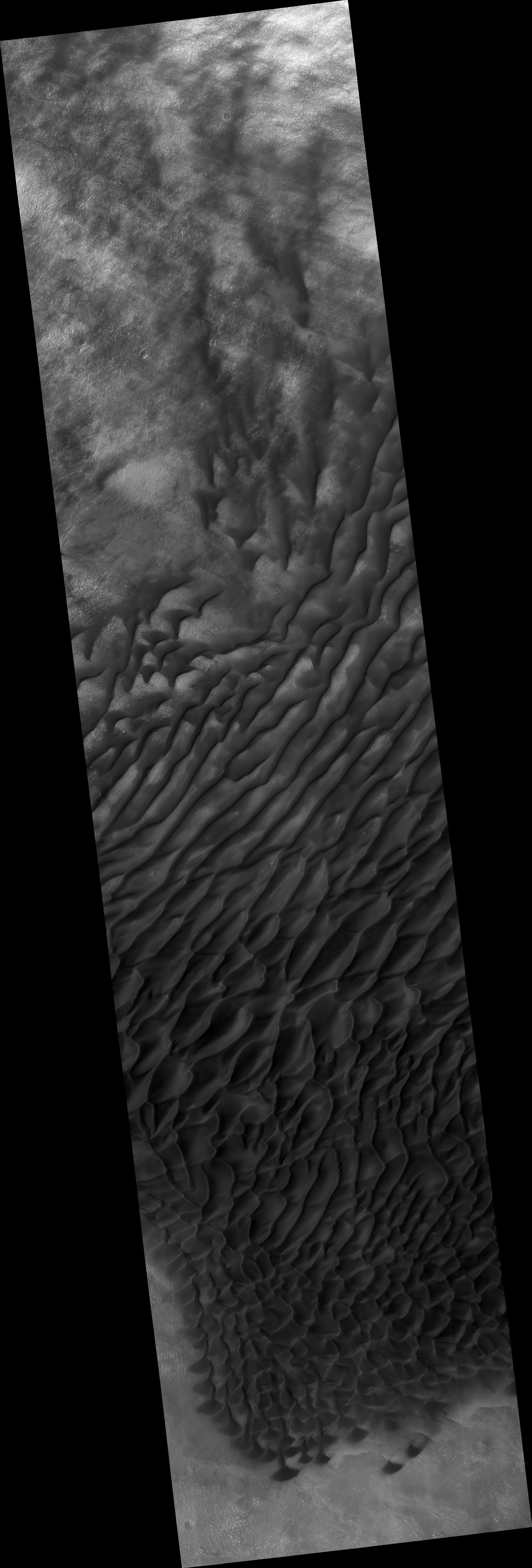
Map Projected Browse Image
Click on image for larger version
This image shows us a cross-section of a dune field. Dune shape depends on several factors, including the amount of sand present and the local wind directions. This dune field displays several distinct dune morphologies.
We see both individual barchan-like dunes and more complex dune shapes. The dunes are arranged in a linear fashion at the northern extent of the field, first in areas with lots of sand, and then with relatively sand-free patches in between dune crests. HiRISE has observed dune activity in other similar fields , but this is our first image over this group of dunes.
A second image is needed to determine if these dunes are also evolving and moving.
The map is projected here at a scale of 50 centimeters (19.7 inches) per pixel. [The original image scale is 51.2 centimeters (20.2 inches) per pixel (with 2 x 2 binning); objects on the order of 154 centimeters (60.6 inches) across are resolved.] North is up.
Background Info:
The University of Arizona, Tucson, operates HiRISE, which was built by Ball Aerospace & Technologies Corp., Boulder, Colorado. NASA's Jet Propulsion Laboratory, a division of Caltech in Pasadena, California, manages the Mars Reconnaissance Orbiter Project for NASA's Science Mission Directorate, Washington.
Cataloging Keywords:
| Name | Value | Additional Values |
|---|---|---|
| Target | Mars | |
| System | ||
| Target Type | Planet | |
| Mission | Mars Reconnaissance Orbiter (MRO) | |
| Instrument Host | Mars Reconnaissance Orbiter | |
| Host Type | Orbiter | |
| Instrument | High Resolution Imaging Science Experiment (HiRISE) | |
| Detector | ||
| Extra Keywords | Color, Dune, Map | |
| Acquisition Date | ||
| Release Date | 2019-01-23 | |
| Date in Caption | ||
| Image Credit | NASA/JPL-Caltech/University of Arizona | |
| Source | photojournal.jpl.nasa.gov/catalog/PIA23021 | |
| Identifier | PIA23021 | |