|
Everything is (Well) Illuminated
- Click the image above for a larger view
- Full-Res JPEG (2880 x 1800) (1.5 MB)
- Full-Res TIFF (2880 x 1800) (15.6 MB)
Caption:

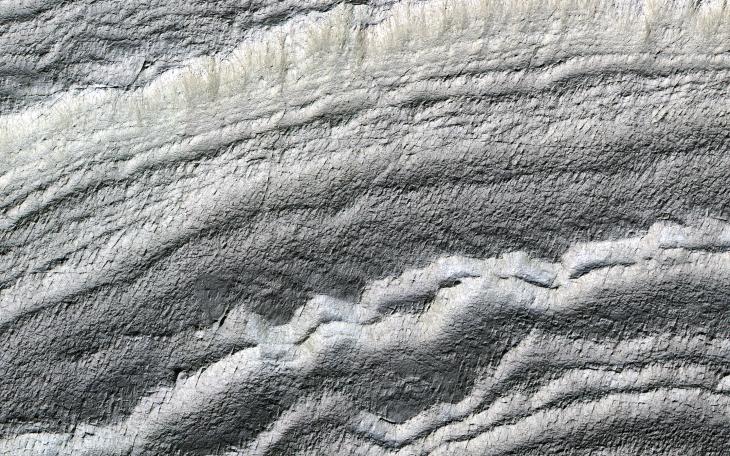
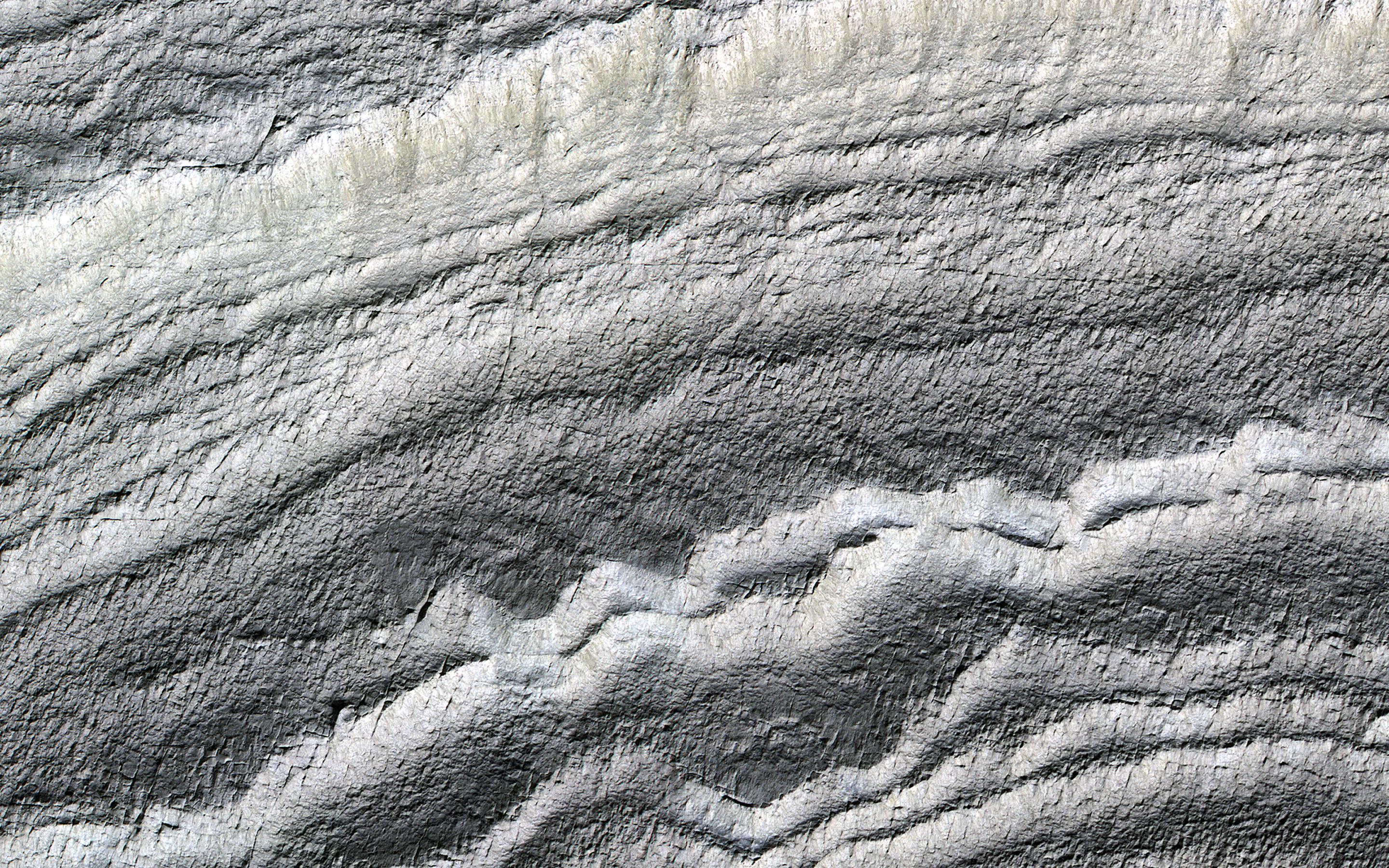
Map Projected Browse Image
Click on image for larger version
The south polar layered deposits are icy layers that have been deposited over millions of years, preserving a climate history of Mars. In this image the layers are well illuminated to accentuate the topography.
A prior image of this location was acquired with the layered slope facing away from the sun, placing the layers in shadow. (The top of the cutout image is at a higher elevation.)
The map is projected here at a scale of 50 centimeters (19.7 inches) per pixel. (The original image scale is 49.9 centimeters [19.6 inches] per pixel [with 2 x 2 binning]; objects on the order of 150 centimeters [59.1 inches] across are resolved.) North is up.
Background Info:
The University of Arizona, in Tucson, operates HiRISE, which was built by Ball Aerospace & Technologies Corp., in Boulder, Colorado. NASA's Jet Propulsion Laboratory, a division of Caltech in Pasadena, California, manages the Mars Reconnaissance Orbiter Project for NASA's Science Mission Directorate, Washington.
Cataloging Keywords:
| Name | Value | Additional Values |
|---|---|---|
| Target | Mars | |
| System | ||
| Target Type | Planet | |
| Mission | Mars Reconnaissance Orbiter (MRO) | |
| Instrument Host | Mars Reconnaissance Orbiter | |
| Host Type | Orbiter | |
| Instrument | High Resolution Imaging Science Experiment (HiRISE) | |
| Detector | ||
| Extra Keywords | Color, Map, Shadow | |
| Acquisition Date | ||
| Release Date | 2019-03-18 | |
| Date in Caption | ||
| Image Credit | NASA/JPL-Caltech/University of Arizona | |
| Source | photojournal.jpl.nasa.gov/catalog/PIA23098 | |
| Identifier | PIA23098 | |