
|
Landslides in Cerberus Fossae
- Click the image above for a larger view
- Full-Res JPEG (2880 x 1800) (1.1 MB)
- Full-Res TIFF (2880 x 1800) (15.6 MB)
Caption:
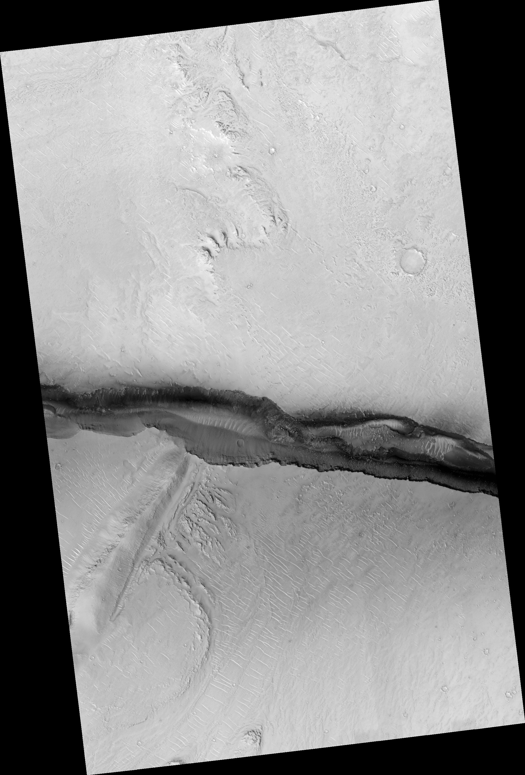
Map Projected Browse Image
Click on image for larger version
Cerberus Fossae is a steep-sided set of troughs cutting volcanic plains to the east of Elysium Mons. Steep slopes on Mars have active landslides (also called "mass wasting"), and here we see evidence for two types of activity.
First, the light bluish boulders on the slope appear to originate at a layer of bedrock (also light blue) near the top of the section. Second, the dark thin lines are recurring slope lineae, probably also due to mass wasting, but composed of finer-grained materials.
The map is projected here at a scale of 25 centimeters (9.8 inches) per pixel. (The original image scale is 28.1 centimeters [11.1 inches] per pixel [with 1 x 1 binning]; objects on the order of 84 centimeters [33.1 inches] across are resolved.) North is up.
Background Info:
The University of Arizona, in Tucson, operates HiRISE, which was built by Ball Aerospace & Technologies Corp., in Boulder, Colorado. NASA's Jet Propulsion Laboratory, a division of Caltech in Pasadena, California, manages the Mars Reconnaissance Orbiter Project for NASA's Science Mission Directorate, Washington.
Cataloging Keywords:
| Name | Value | Additional Values |
|---|---|---|
| Target | Mars | |
| System | ||
| Target Type | Planet | |
| Mission | Mars Reconnaissance Orbiter (MRO) | |
| Instrument Host | Mars Reconnaissance Orbiter | |
| Host Type | Orbiter | |
| Instrument | High Resolution Imaging Science Experiment (HiRISE) | |
| Detector | ||
| Extra Keywords | Color, Map, Mountain, Volcano | |
| Acquisition Date | ||
| Release Date | 2019-04-16 | |
| Date in Caption | ||
| Image Credit | NASA/JPL-Caltech/University of Arizona | |
| Source | photojournal.jpl.nasa.gov/catalog/PIA23182 | |
| Identifier | PIA23182 | |